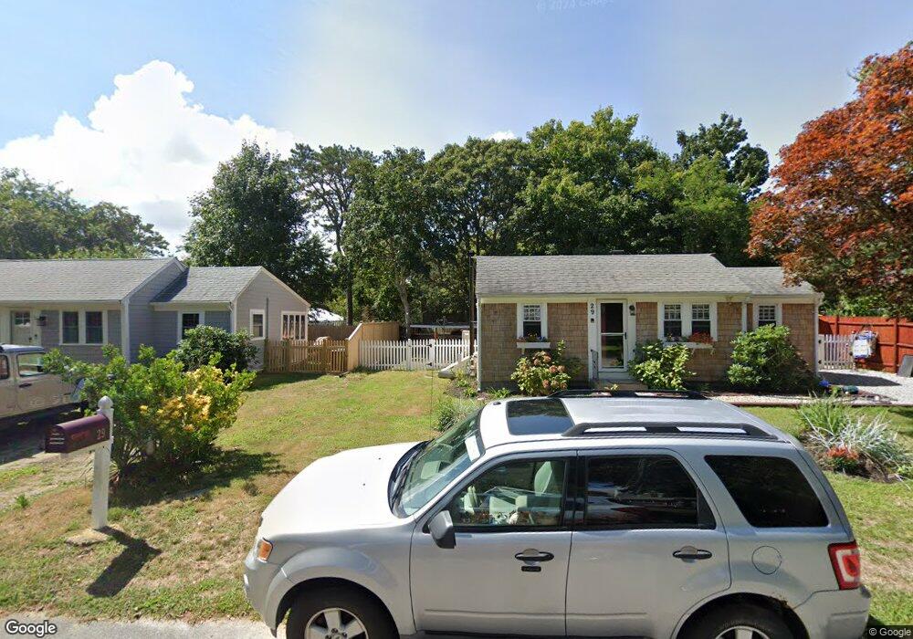
14 Driscoll Ln Dennis Port, MA 02639
Dennis Port NeighborhoodEstimated Value: $477,000 - $612,000
2
Beds
1
Bath
772
Sq Ft
$736/Sq Ft
Est. Value
About This Home
This home is located at 14 Driscoll Ln, Dennis Port, MA 02639 and is currently estimated at $568,532, approximately $736 per square foot. 14 Driscoll Ln is a home located in Barnstable County with nearby schools including Dennis-Yarmouth Regional High School and St. Pius X. School.
Ownership History
Date
Name
Owned For
Owner Type
Purchase Details
Closed on
May 18, 2023
Sold by
Judith A Legrand T A and Judith Legrand
Bought by
Kelly Ft and Kelly
Current Estimated Value
Home Financials for this Owner
Home Financials are based on the most recent Mortgage that was taken out on this home.
Original Mortgage
$150,000
Outstanding Balance
$145,416
Interest Rate
6.28%
Mortgage Type
Purchase Money Mortgage
Estimated Equity
$423,116
Purchase Details
Closed on
Sep 26, 2022
Sold by
Robinson Bonnie R Est and Kelly-Dias
Bought by
Kelly Ft and Kelly
Purchase Details
Closed on
Mar 4, 2020
Sold by
Kelly Edward N and Kelly Gabrielle C
Bought by
Kelly Ft and Kelly
Purchase Details
Closed on
Jan 29, 2014
Sold by
Harder Sandra J Est and Hartenstein
Bought by
Hartenstein Jill D and Harder Jeffrey C
Purchase Details
Closed on
Feb 24, 2004
Sold by
Legrand Judith A
Bought by
Judith A Legrand T A and Judith Legrand
Create a Home Valuation Report for This Property
The Home Valuation Report is an in-depth analysis detailing your home's value as well as a comparison with similar homes in the area
Home Values in the Area
Average Home Value in this Area
Purchase History
| Date | Buyer | Sale Price | Title Company |
|---|---|---|---|
| Kelly Ft | $168,000 | None Available | |
| Kelly Ft | $168,000 | None Available | |
| Kelly Ft | $67,200 | None Available | |
| Kelly Ft | $67,200 | None Available | |
| Kelly Ft | -- | None Available | |
| Kelly Ft | -- | None Available | |
| Hartenstein Jill D | -- | -- | |
| Hartenstein Jill D | -- | -- | |
| Judith A Legrand T A | -- | -- | |
| Judith A Legrand T A | -- | -- | |
| Judith A Legrand T A | -- | -- |
Source: Public Records
Mortgage History
| Date | Status | Borrower | Loan Amount |
|---|---|---|---|
| Open | Kelly Ft | $150,000 | |
| Closed | Kelly Ft | $150,000 |
Source: Public Records
Tax History Compared to Growth
Tax History
| Year | Tax Paid | Tax Assessment Tax Assessment Total Assessment is a certain percentage of the fair market value that is determined by local assessors to be the total taxable value of land and additions on the property. | Land | Improvement |
|---|---|---|---|---|
| 2025 | $2,248 | $519,200 | $283,900 | $235,300 |
| 2024 | $2,094 | $477,100 | $273,000 | $204,100 |
| 2023 | $2,026 | $433,800 | $248,200 | $185,600 |
| 2022 | $1,855 | $331,200 | $195,600 | $135,600 |
| 2021 | $1,819 | $301,600 | $191,800 | $109,800 |
| 2020 | $1,778 | $291,400 | $191,800 | $99,600 |
| 2019 | $1,805 | $292,500 | $204,200 | $88,300 |
| 2018 | $1,742 | $274,700 | $194,400 | $80,300 |
| 2017 | $1,578 | $256,600 | $179,000 | $77,600 |
| 2016 | $1,525 | $233,500 | $168,800 | $64,700 |
| 2015 | $1,494 | $233,500 | $168,800 | $64,700 |
| 2014 | $1,418 | $223,300 | $158,600 | $64,700 |
Source: Public Records
Map
Nearby Homes
- 402 Old Wharf Rd
- 102 Sea St
- 402 Old Wharf Rd
- 11 Ocean Park W
- 405 Old Wharf Rd Unit B204
- 405 Old Wharf Rd Unit B204
- 9 Chase Ave Unit 6
- 26 Manning Rd
- 22 Ferncliff Rd
- 12 Cross St
- 159 Center St Unit 22
- 37-A Beach Hills Rd
- 1 E Belmont Unit 630
- 37 Beach Hills Rd
- 1 Belmont Rd Unit 630
- 1 Belmont Rd Unit 513
- 262 Old Wharf Rd Unit 67
- 262 Old Wharf Rd Unit 5
- 262 Old Wharf Rd Unit 5
- 262 Old Wharf Rd Unit 20