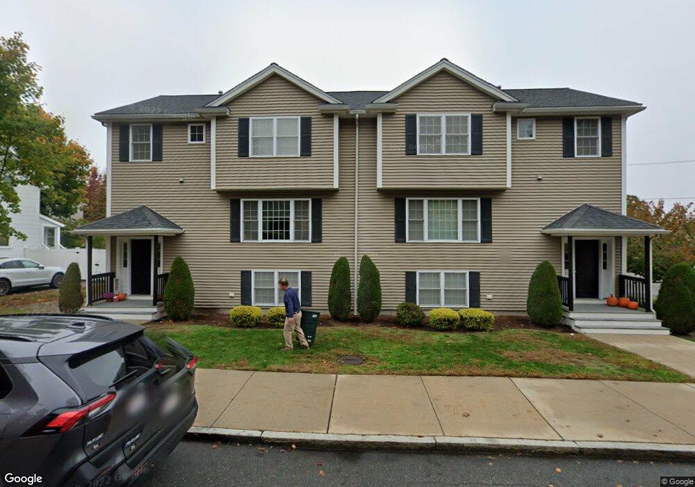
14 Elm St Wakefield, MA 01880
West Side NeighborhoodEstimated Value: $1,187,000 - $1,499,191
4
Beds
4
Baths
1,512
Sq Ft
$846/Sq Ft
Est. Value
About This Home
This home is located at 14 Elm St, Wakefield, MA 01880 and is currently estimated at $1,278,548, approximately $845 per square foot. 14 Elm St is a home located in Middlesex County with nearby schools including Wakefield Memorial High School and St Joseph School.
Ownership History
Date
Name
Owned For
Owner Type
Purchase Details
Closed on
Aug 10, 2020
Sold by
Sylvan Heights Llc
Bought by
Elm Wake Llc
Current Estimated Value
Purchase Details
Closed on
Dec 18, 2009
Sold by
Us Bk
Bought by
Sylvan Heights Llc
Purchase Details
Closed on
Dec 17, 2008
Sold by
Walsh Patrick M and Suntrust Mortgage Inc
Bought by
Suntrust Mortgage Inc
Purchase Details
Closed on
Mar 25, 1998
Sold by
Nob Rt and Ferris
Bought by
Elm T and Walsh
Home Financials for this Owner
Home Financials are based on the most recent Mortgage that was taken out on this home.
Original Mortgage
$15,000
Interest Rate
6.96%
Mortgage Type
Purchase Money Mortgage
Create a Home Valuation Report for This Property
The Home Valuation Report is an in-depth analysis detailing your home's value as well as a comparison with similar homes in the area
Home Values in the Area
Average Home Value in this Area
Purchase History
| Date | Buyer | Sale Price | Title Company |
|---|---|---|---|
| Elm Wake Llc | -- | None Available | |
| Sylvan Heights Llc | $171,000 | -- | |
| Us Bk | -- | -- | |
| Suntrust Mortgage Inc | $365,000 | -- | |
| Elm T | $190,000 | -- |
Source: Public Records
Mortgage History
| Date | Status | Borrower | Loan Amount |
|---|---|---|---|
| Previous Owner | Elm T | $84,036 | |
| Previous Owner | Elm T | $15,000 | |
| Previous Owner | Elm T | $135,000 | |
| Closed | Elm T | $36,250 |
Source: Public Records
Tax History Compared to Growth
Tax History
| Year | Tax Paid | Tax Assessment Tax Assessment Total Assessment is a certain percentage of the fair market value that is determined by local assessors to be the total taxable value of land and additions on the property. | Land | Improvement |
|---|---|---|---|---|
| 2025 | $14,967 | $1,318,700 | $395,400 | $923,300 |
| 2024 | $14,400 | $1,280,000 | $383,800 | $896,200 |
| 2023 | $13,902 | $1,185,200 | $355,400 | $829,800 |
| 2022 | $13,274 | $1,077,400 | $323,100 | $754,300 |
| 2021 | $12,192 | $957,700 | $300,200 | $657,500 |
| 2020 | $11,725 | $918,200 | $287,800 | $630,400 |
| 2019 | $11,373 | $886,400 | $277,800 | $608,600 |
| 2018 | $3,705 | $831,100 | $260,500 | $570,600 |
| 2017 | $10,313 | $791,500 | $248,100 | $543,400 |
| 2016 | $9,388 | $695,900 | $229,300 | $466,600 |
| 2015 | $8,767 | $650,400 | $214,300 | $436,100 |
| 2014 | $8,055 | $630,300 | $207,700 | $422,600 |
Source: Public Records
Map
Nearby Homes
- 26 Curve St
- 20 N Emerson St Unit 20
- 47 Emerson St
- 34 Cedar St
- 6 Avon Ct Unit 2
- 90 Prospect St
- 9 Avon St Unit 2
- 50 Albion St
- 40 Friend St
- 10 Wolcott St
- 4 Adams St
- 10 Converse St
- Unit 208 Plan at Wrenly
- Unit 310 Plan at Wrenly
- 4 Mcdonald Farm Rd
- 62 Foundry St Unit 310
- 62 Foundry St Unit 312
- 62 Foundry St Unit 506
- 62 Foundry St Unit 202
- 62 Foundry St Unit 208
- 14 Elm St Unit 2
- 18 Elm St
- 48 N Emerson St Unit 12
- 48 N Emerson St Unit 11
- 48 N Emerson St Unit 10
- 48 N Emerson St Unit 9
- 48 N Emerson St Unit 7
- 48 N Emerson St Unit 6
- 48 N Emerson St Unit 5
- 48 N Emerson St Unit 4
- 48 N Emerson St Unit 3
- 48 N Emerson St Unit 2
- 48 N Emerson St Unit 1
- 48 N Emerson St Unit 4
- 48 N Emerson St Unit 11
- 22 Elm St
- 45 N Emerson St Unit 4
- 45 N Emerson St Unit 4A
- 45 N Emerson St Unit 3
- 45 N Emerson St Unit 7