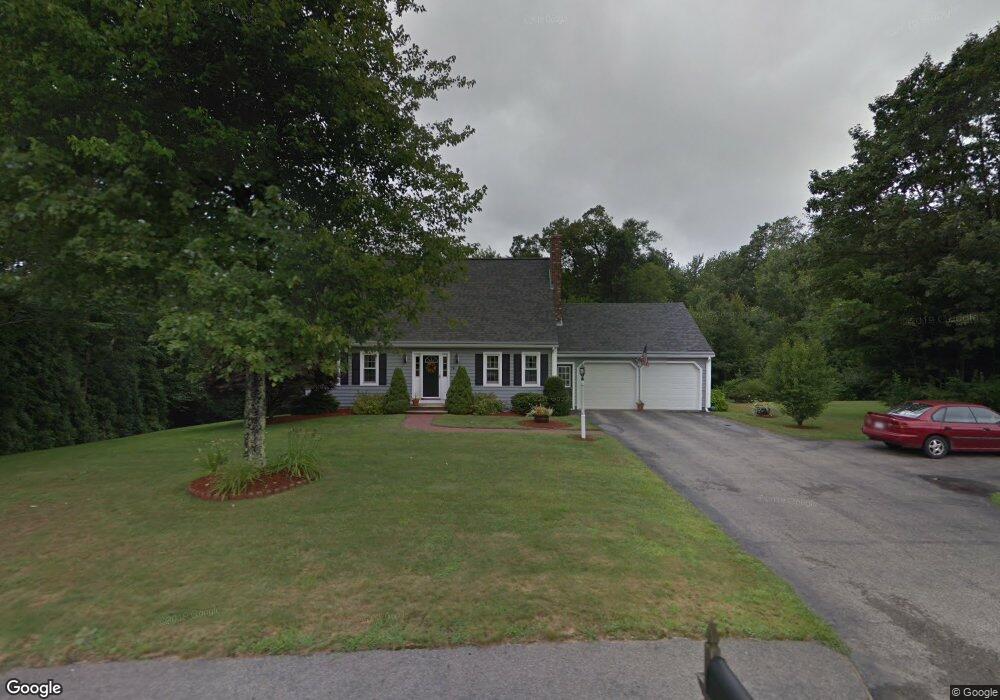
14 Forbes Rd Rutland, MA 01543
Estimated Value: $571,862 - $685,000
3
Beds
2
Baths
1,862
Sq Ft
$331/Sq Ft
Est. Value
About This Home
This home is located at 14 Forbes Rd, Rutland, MA 01543 and is currently estimated at $616,466, approximately $331 per square foot. 14 Forbes Rd is a home located in Worcester County with nearby schools including Wachusett Regional High School.
Ownership History
Date
Name
Owned For
Owner Type
Purchase Details
Closed on
Jul 22, 1993
Sold by
C B Blair Dev Corp
Bought by
Godin Gary B and Godin Kathleen
Current Estimated Value
Home Financials for this Owner
Home Financials are based on the most recent Mortgage that was taken out on this home.
Original Mortgage
$136,400
Interest Rate
7.43%
Mortgage Type
Purchase Money Mortgage
Create a Home Valuation Report for This Property
The Home Valuation Report is an in-depth analysis detailing your home's value as well as a comparison with similar homes in the area
Home Values in the Area
Average Home Value in this Area
Purchase History
| Date | Buyer | Sale Price | Title Company |
|---|---|---|---|
| Godin Gary B | $174,490 | -- |
Source: Public Records
Mortgage History
| Date | Status | Borrower | Loan Amount |
|---|---|---|---|
| Open | Godin Gary B | $119,355 | |
| Closed | Godin Gary B | $25,000 | |
| Closed | Godin Gary B | $136,400 |
Source: Public Records
Tax History Compared to Growth
Tax History
| Year | Tax Paid | Tax Assessment Tax Assessment Total Assessment is a certain percentage of the fair market value that is determined by local assessors to be the total taxable value of land and additions on the property. | Land | Improvement |
|---|---|---|---|---|
| 2025 | $7,220 | $507,000 | $118,800 | $388,200 |
| 2024 | $6,905 | $465,600 | $107,200 | $358,400 |
| 2023 | $6,259 | $456,200 | $101,000 | $355,200 |
| 2022 | $6,247 | $395,600 | $85,700 | $309,900 |
| 2021 | $6,114 | $366,100 | $85,700 | $280,400 |
| 2020 | $6,086 | $345,600 | $80,800 | $264,800 |
| 2019 | $6,140 | $343,200 | $74,000 | $269,200 |
| 2018 | $6,084 | $335,600 | $74,000 | $261,600 |
| 2017 | $5,600 | $305,700 | $74,000 | $231,700 |
| 2016 | $4,970 | $286,100 | $70,400 | $215,700 |
| 2015 | $4,603 | $260,800 | $70,400 | $190,400 |
| 2014 | $4,462 | $260,800 | $70,400 | $190,400 |
Source: Public Records
Map
Nearby Homes
- 35 Brintnal Dr
- 2 Simon Davis Dr
- 73 Brintnal Dr
- 101 Brintnal Dr
- 175 Glenwood Rd
- 40 Brunelle Dr
- 16 Richards Ave
- 81 Glenwood Place
- 271 Glenwood Rd
- 55 Pommogussett Rd
- 25 Watson Ln
- 5 Miles Rd
- 139 E County Rd Unit 139
- 147 E County Rd Unit 149
- 32 Pommogussett Rd Unit 1
- 47 Woodside Ave
- 51 Woodside Ave
- 10 Soucy Dr
- 28 Forest Hill Dr
- 11 Lewis St
- 18 Forbes Rd
- 13 Forbes Rd
- 10 Forbes Rd
- 9 Forbes Rd
- 22 Forbes Rd
- 6 Forbes Rd
- 74 Campbell St
- 7 Forbes Rd
- 76 Campbell St
- 21 Forbes Rd
- 84 Campbell St
- 68A Campbell St
- 14 Thurston Hill Rd
- 22 Thurston Hill Rd
- 26 Thurston Hill Rd
- 66 Campbell St Unit 1
- 3 Forbes Rd
- 30 Thurston Hill Rd
- 82 Campbell St
- 78 Campbell St