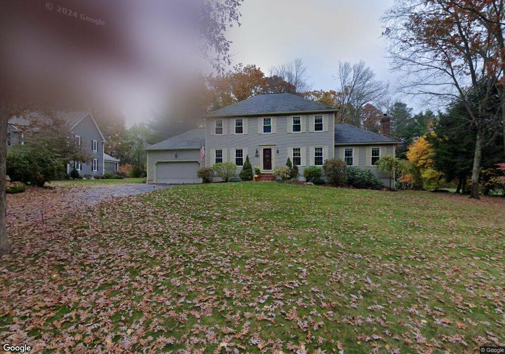
14 Forest Rd Medway, MA 02053
Estimated Value: $791,525 - $908,000
3
Beds
3
Baths
2,368
Sq Ft
$363/Sq Ft
Est. Value
About This Home
This home is located at 14 Forest Rd, Medway, MA 02053 and is currently estimated at $859,131, approximately $362 per square foot. 14 Forest Rd is a home located in Norfolk County with nearby schools including John D. McGovern Elementary School, Burke-Memorial Elementary, and Medway Middle School.
Ownership History
Date
Name
Owned For
Owner Type
Purchase Details
Closed on
Nov 30, 2005
Sold by
Bridle Jon W and Bridle Julianne
Bought by
Trufant Kristin L and Trufant Peter S
Current Estimated Value
Home Financials for this Owner
Home Financials are based on the most recent Mortgage that was taken out on this home.
Original Mortgage
$130,000
Outstanding Balance
$72,086
Interest Rate
6.14%
Mortgage Type
Purchase Money Mortgage
Estimated Equity
$787,045
Purchase Details
Closed on
Jun 15, 1994
Sold by
Heavner Constr Inc
Bought by
Biddle Jon Ws and Bridle Julianne
Home Financials for this Owner
Home Financials are based on the most recent Mortgage that was taken out on this home.
Original Mortgage
$175,000
Interest Rate
8.5%
Mortgage Type
Purchase Money Mortgage
Create a Home Valuation Report for This Property
The Home Valuation Report is an in-depth analysis detailing your home's value as well as a comparison with similar homes in the area
Home Values in the Area
Average Home Value in this Area
Purchase History
| Date | Buyer | Sale Price | Title Company |
|---|---|---|---|
| Trufant Kristin L | $548,900 | -- | |
| Biddle Jon Ws | $241,550 | -- |
Source: Public Records
Mortgage History
| Date | Status | Borrower | Loan Amount |
|---|---|---|---|
| Open | Trufant Kristin L | $130,000 | |
| Previous Owner | Biddle Jon Ws | $175,000 |
Source: Public Records
Tax History Compared to Growth
Tax History
| Year | Tax Paid | Tax Assessment Tax Assessment Total Assessment is a certain percentage of the fair market value that is determined by local assessors to be the total taxable value of land and additions on the property. | Land | Improvement |
|---|---|---|---|---|
| 2025 | $9,820 | $689,100 | $341,800 | $347,300 |
| 2024 | $9,923 | $689,100 | $341,800 | $347,300 |
| 2023 | $9,880 | $619,800 | $311,300 | $308,500 |
| 2022 | $8,814 | $520,600 | $230,700 | $289,900 |
| 2021 | $8,756 | $501,500 | $215,400 | $286,100 |
| 2020 | $8,587 | $490,700 | $215,400 | $275,300 |
| 2019 | $8,105 | $477,600 | $206,700 | $270,900 |
| 2018 | $8,166 | $462,400 | $198,000 | $264,400 |
| 2017 | $8,130 | $453,700 | $193,700 | $260,000 |
| 2016 | $7,939 | $438,400 | $178,400 | $260,000 |
| 2015 | $7,878 | $431,900 | $176,200 | $255,700 |
| 2014 | $7,911 | $419,900 | $178,300 | $241,600 |
Source: Public Records
Map
Nearby Homes
- 5 Richardson St
- 280 Village St Unit D2
- 4 Shaw St
- 22 Sunset Dr
- 28 Wellington St
- 176 Main St Unit 3
- 14 Heritage Dr
- 3 Meryl St
- 12 Lovering St
- 36 Lovering St
- 106 Holliston St
- 21 Riverside Rd
- 50 Main St
- 220 Main St Unit 220
- 20 Broad St Unit 6
- 20 Broad St Unit A
- 20 Broad St Unit 4
- 5 Fales St
- 14 Sanford St Unit 15
- 9 Sanford St