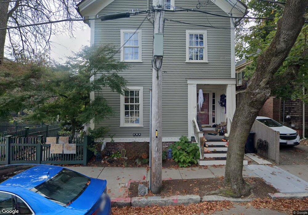
14 Foster St Cambridge, MA 02138
West Cambridge NeighborhoodEstimated Value: $2,369,000 - $3,201,000
6
Beds
5
Baths
2,954
Sq Ft
$962/Sq Ft
Est. Value
About This Home
This home is located at 14 Foster St, Cambridge, MA 02138 and is currently estimated at $2,840,667, approximately $961 per square foot. 14 Foster St is a home located in Middlesex County with nearby schools including St Peter School, Cambridge Montessori School, and Shady Hill School.
Ownership History
Date
Name
Owned For
Owner Type
Purchase Details
Closed on
Sep 9, 2021
Sold by
Wilbert Joanne E
Bought by
Joanne Wilbert Weed Ret
Current Estimated Value
Purchase Details
Closed on
Dec 7, 1990
Sold by
Heard Florence J
Bought by
Wilbert Joanne E
Home Financials for this Owner
Home Financials are based on the most recent Mortgage that was taken out on this home.
Original Mortgage
$320,000
Interest Rate
10.1%
Mortgage Type
Purchase Money Mortgage
Create a Home Valuation Report for This Property
The Home Valuation Report is an in-depth analysis detailing your home's value as well as a comparison with similar homes in the area
Home Values in the Area
Average Home Value in this Area
Purchase History
| Date | Buyer | Sale Price | Title Company |
|---|---|---|---|
| Joanne Wilbert Weed Ret | -- | None Available | |
| Wilbert Joanne E | $400,000 | -- |
Source: Public Records
Mortgage History
| Date | Status | Borrower | Loan Amount |
|---|---|---|---|
| Previous Owner | Wilbert Joanne E | $320,000 | |
| Previous Owner | Wilbert Joanne E | $5,600 |
Source: Public Records
Tax History Compared to Growth
Tax History
| Year | Tax Paid | Tax Assessment Tax Assessment Total Assessment is a certain percentage of the fair market value that is determined by local assessors to be the total taxable value of land and additions on the property. | Land | Improvement |
|---|---|---|---|---|
| 2025 | $18,198 | $2,865,900 | $1,493,400 | $1,372,500 |
| 2024 | $16,484 | $2,784,400 | $1,462,100 | $1,322,300 |
| 2023 | $16,226 | $2,769,000 | $1,430,900 | $1,338,100 |
| 2022 | $15,580 | $2,631,700 | $1,422,100 | $1,209,600 |
| 2021 | $14,968 | $2,558,700 | $1,394,500 | $1,164,200 |
| 2020 | $14,204 | $2,470,200 | $1,346,100 | $1,124,100 |
| 2019 | $13,304 | $2,239,800 | $1,180,500 | $1,059,300 |
| 2018 | $13,407 | $2,131,500 | $1,173,600 | $957,900 |
| 2017 | $13,432 | $2,069,700 | $1,173,600 | $896,100 |
| 2016 | $12,997 | $1,859,300 | $1,032,000 | $827,300 |
| 2015 | $13,066 | $1,670,800 | $949,200 | $721,600 |
| 2014 | $12,780 | $1,525,100 | $862,900 | $662,200 |
Source: Public Records
Map
Nearby Homes
- 32 Hawthorn St
- 20 Maynard Place
- 15 Hubbard Park Rd
- 3 Berkeley Place
- 12 Berkeley St
- 1010 Memorial Dr Unit 6G
- 48 Hubbard Park Rd
- 988 Memorial Dr Unit 386
- 153 Brattle St
- 986 Memorial Dr Unit 404
- 22 Concord Ave Unit 10
- 983 Memorial Dr Unit 502
- 984 Memorial Dr Unit 984-503
- 158 Brattle St
- 130 Mount Auburn St Unit 108
- 44 Garden St
- 52 Garden St Unit B2
- 172 Brattle St
- 975 Memorial Dr Unit 209
- 975 Memorial Dr Unit 211