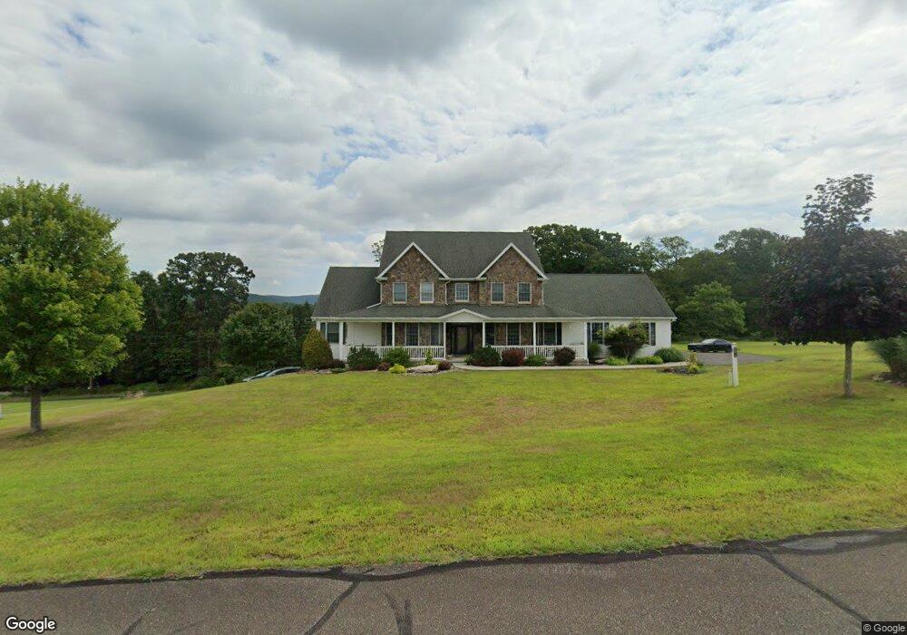
14 Foxtail Dr Zion Grove, PA 17985
Estimated Value: $588,000 - $616,008
5
Beds
4
Baths
3,688
Sq Ft
$163/Sq Ft
Est. Value
About This Home
This home is located at 14 Foxtail Dr, Zion Grove, PA 17985 and is currently estimated at $600,003, approximately $162 per square foot. 14 Foxtail Dr is a home located in Schuylkill County with nearby schools including Hazleton Area High School.
Ownership History
Date
Name
Owned For
Owner Type
Purchase Details
Closed on
May 5, 2022
Sold by
Valente Renato D and Valente Debra D
Bought by
Uplinger Brian T and Uplinger Danielle S
Current Estimated Value
Home Financials for this Owner
Home Financials are based on the most recent Mortgage that was taken out on this home.
Original Mortgage
$427,350
Outstanding Balance
$406,046
Interest Rate
5.27%
Mortgage Type
FHA
Estimated Equity
$193,957
Create a Home Valuation Report for This Property
The Home Valuation Report is an in-depth analysis detailing your home's value as well as a comparison with similar homes in the area
Home Values in the Area
Average Home Value in this Area
Purchase History
| Date | Buyer | Sale Price | Title Company |
|---|---|---|---|
| Uplinger Brian T | $475,000 | None Listed On Document |
Source: Public Records
Mortgage History
| Date | Status | Borrower | Loan Amount |
|---|---|---|---|
| Open | Uplinger Brian T | $427,350 |
Source: Public Records
Tax History Compared to Growth
Tax History
| Year | Tax Paid | Tax Assessment Tax Assessment Total Assessment is a certain percentage of the fair market value that is determined by local assessors to be the total taxable value of land and additions on the property. | Land | Improvement |
|---|---|---|---|---|
| 2025 | $7,110 | $112,880 | $8,425 | $104,455 |
| 2024 | $6,543 | $112,880 | $8,425 | $104,455 |
| 2023 | $6,412 | $112,880 | $8,425 | $104,455 |
| 2022 | $6,536 | $112,880 | $8,425 | $104,455 |
| 2021 | $6,248 | $112,880 | $8,425 | $104,455 |
| 2020 | $6,207 | $112,880 | $8,425 | $104,455 |
| 2018 | $6,343 | $112,880 | $8,425 | $104,455 |
| 2017 | $6,184 | $112,880 | $8,425 | $104,455 |
| 2015 | -- | $112,880 | $8,425 | $104,455 |
| 2011 | -- | $8,425 | $0 | $0 |
Source: Public Records
Map
Nearby Homes
- AWS-19 Sayre Dr
- 003 Okwes Ln
- AV2 030 Sisilia Ln
- 118 Arapahoe Ln
- AW 012 Arapahoe Ln
- AW Lot 114 Arapahoe Ln
- 130 Spring Mountain Dr
- 123 Spring Mountain Dr
- 117 Spring Mountain Dr
- 116 Spring Mountain Dr
- 124 Spring Mountain Dr
- 556-557 Hay Stack Dr
- 357 White Face Cir
- EA Lot 247 Algonquin Dr
- 0 Algonquin Dr Unit PASK2022426
- 0 Algonquin Dr Unit 24-281
- 580 Chamonix Ln
- 114 Summit Rd
- 50 Alpine Dr
- 24 Foxtail Dr
- 21 Foxtail Dr
- 4 Honeysuckle Dr
- 7 Foxtail Dr
- 16 Foxtail Dr
- 512 Millers Rd
- 7 & 8 Honeysuckle Dr
- 2 Foxtail Dr
- 506 Millers Rd
- 1 Foxtail Dr
- 1 Foxtail Dr
- 518 Millers Rd
- 10 Honeysuckle Dr
- 10 Honeysuckle Dr
- 479 Millers Rd
- 511 Millers Rd
- 515 Millers Rd
- 476 Millers Rd
- 582 Mountain Rd
- 523 Millers Rd