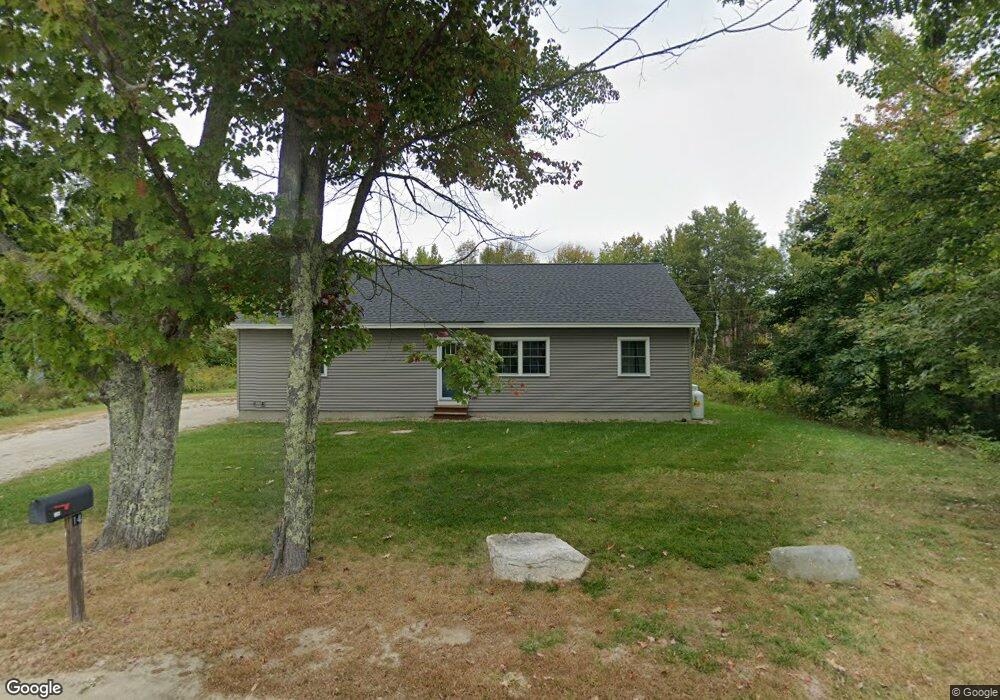
14 Gilmore Rd New Gloucester, ME 04260
Estimated Value: $377,000 - $537,000
--
Bed
--
Bath
1,300
Sq Ft
$326/Sq Ft
Est. Value
About This Home
This home is located at 14 Gilmore Rd, New Gloucester, ME 04260 and is currently estimated at $424,159, approximately $326 per square foot. 14 Gilmore Rd is a home located in Cumberland County with nearby schools including Gray-New Gloucester High School and Spurwink School - Auburn.
Ownership History
Date
Name
Owned For
Owner Type
Purchase Details
Closed on
Oct 1, 2025
Sold by
Pauley Jason L and Pauley Kimberly A
Bought by
Menard Joseph M and Menard Stacey M
Current Estimated Value
Home Financials for this Owner
Home Financials are based on the most recent Mortgage that was taken out on this home.
Original Mortgage
$290,000
Outstanding Balance
$289,742
Interest Rate
6.58%
Mortgage Type
New Conventional
Estimated Equity
$134,417
Purchase Details
Closed on
Aug 31, 2018
Sold by
Lee David R
Bought by
Pauley Kimberly A and Pauley Jason L
Home Financials for this Owner
Home Financials are based on the most recent Mortgage that was taken out on this home.
Original Mortgage
$190,000
Interest Rate
4.5%
Mortgage Type
New Conventional
Create a Home Valuation Report for This Property
The Home Valuation Report is an in-depth analysis detailing your home's value as well as a comparison with similar homes in the area
Home Values in the Area
Average Home Value in this Area
Purchase History
| Date | Buyer | Sale Price | Title Company |
|---|---|---|---|
| Menard Joseph M | $375,000 | -- | |
| Pauley Kimberly A | -- | -- |
Source: Public Records
Mortgage History
| Date | Status | Borrower | Loan Amount |
|---|---|---|---|
| Open | Menard Joseph M | $290,000 | |
| Previous Owner | Pauley Kimberly A | $190,000 |
Source: Public Records
Tax History Compared to Growth
Tax History
| Year | Tax Paid | Tax Assessment Tax Assessment Total Assessment is a certain percentage of the fair market value that is determined by local assessors to be the total taxable value of land and additions on the property. | Land | Improvement |
|---|---|---|---|---|
| 2025 | $3,565 | $230,421 | $65,280 | $165,141 |
| 2024 | $3,431 | $230,421 | $65,280 | $165,141 |
| 2023 | $3,293 | $230,421 | $65,280 | $165,141 |
| 2022 | $3,180 | $230,421 | $65,280 | $165,141 |
| 2021 | $3,180 | $230,421 | $65,280 | $165,141 |
| 2020 | $3,145 | $230,421 | $65,280 | $165,141 |
| 2019 | $960 | $56,800 | $56,800 | $0 |
| 2018 | $897 | $56,800 | $56,800 | $0 |
| 2017 | $886 | $56,800 | $56,800 | $0 |
| 2016 | $992 | $67,500 | $56,800 | $10,700 |
| 2015 | $1,361 | $92,900 | $56,800 | $36,100 |
| 2014 | $1,347 | $92,900 | $56,800 | $36,100 |
| 2013 | $1,250 | $92,900 | $56,800 | $36,100 |
Source: Public Records
Map
Nearby Homes
- 12 Country Charm Ln
- 10-56 C&E Bowdoin Way
- 164 Intervale Rd
- 10 Spring Valley Ln
- 10 Cobbs Bridge Rd
- 161 Beaver Dam Dr
- 24 Swamp Rd
- 832 Old Danville Rd
- 200 Woodman Rd
- 160 Gloucester Hill Rd
- 22 Shaw Rd
- 271 Bennett Rd
- 155 & 151 Gloucester Hill Rd
- 0018-C Gloucester Hill Rd
- 114 Garden Cir
- 16 Harvest Hill Ln Unit 2
- 22 Lantern Way Unit 23
- 14 Harvest Hill Ln Unit 1
- 14 Golden Way
- 15 Country Club Dr
- 1101 Lewiston Rd
- 6 Gilmore Rd
- 80 Peacock Hill Rd
- 1095 Lewiston Rd
- 1119 Lewiston Rd
- 1100 Lewiston Rd
- 79 Peacock Hill Rd
- 1108 Lewiston Rd
- 52 Peacock Hill Rd
- 52 Peacock Hill
- 1120 Lewiston Rd
- 87 Peacock Hill Rd
- 1127 Lewiston Rd
- 1126 Lewiston Rd
- 1094 Lewiston Rd
- 1128 Lewiston Rd
- 1137 Lewiston Rd
- 1084 Lewiston Rd
- 1134 Lewiston Rd
- 11 Donnas Ln