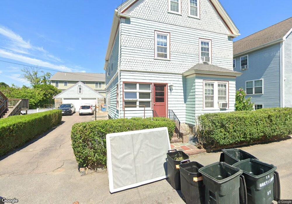
14 Greystone St Quincy, MA 02169
South Quincy NeighborhoodEstimated Value: $897,000 - $958,000
2
Beds
1
Bath
825
Sq Ft
$1,118/Sq Ft
Est. Value
About This Home
This home is located at 14 Greystone St, Quincy, MA 02169 and is currently estimated at $921,965, approximately $1,117 per square foot. 14 Greystone St is a home located in Norfolk County with nearby schools including South West Middle School, Lincoln-Hancock Community School, and Quincy High School.
Ownership History
Date
Name
Owned For
Owner Type
Purchase Details
Closed on
Sep 13, 1995
Sold by
Fontana Marion T
Bought by
Clifford Desmond P and Clifford Deirdre M
Current Estimated Value
Home Financials for this Owner
Home Financials are based on the most recent Mortgage that was taken out on this home.
Original Mortgage
$135,000
Interest Rate
7.81%
Mortgage Type
Purchase Money Mortgage
Create a Home Valuation Report for This Property
The Home Valuation Report is an in-depth analysis detailing your home's value as well as a comparison with similar homes in the area
Home Values in the Area
Average Home Value in this Area
Purchase History
| Date | Buyer | Sale Price | Title Company |
|---|---|---|---|
| Clifford Desmond P | $150,000 | -- |
Source: Public Records
Mortgage History
| Date | Status | Borrower | Loan Amount |
|---|---|---|---|
| Open | Clifford Desmond P | $170,000 | |
| Closed | Clifford Desmond P | $135,000 |
Source: Public Records
Tax History Compared to Growth
Tax History
| Year | Tax Paid | Tax Assessment Tax Assessment Total Assessment is a certain percentage of the fair market value that is determined by local assessors to be the total taxable value of land and additions on the property. | Land | Improvement |
|---|---|---|---|---|
| 2025 | $9,619 | $834,300 | $279,000 | $555,300 |
| 2024 | $9,033 | $801,500 | $265,700 | $535,800 |
| 2023 | $8,533 | $766,700 | $241,600 | $525,100 |
| 2022 | $8,490 | $708,700 | $201,300 | $507,400 |
| 2021 | $7,802 | $642,700 | $201,300 | $441,400 |
| 2020 | $7,990 | $642,800 | $201,300 | $441,500 |
| 2019 | $7,485 | $596,400 | $189,900 | $406,500 |
| 2018 | $7,576 | $567,900 | $175,800 | $392,100 |
| 2017 | $5,787 | $408,400 | $167,400 | $241,000 |
| 2016 | $5,279 | $367,600 | $145,600 | $222,000 |
| 2015 | $5,344 | $366,000 | $145,600 | $220,400 |
| 2014 | $4,760 | $320,300 | $145,600 | $174,700 |
Source: Public Records
Map
Nearby Homes
- 42 West St
- 211 West St Unit 12B
- 57 Buckley St
- 510 Willard St
- 46-48 Buckley St
- 211 Copeland St
- 14 Arthur Ave
- 21 Arthur St
- 12 Arthur Ave
- 91 Garfield St
- 46 Suomi Rd
- 46 Suomi Rd Unit 46
- 63 Adele Rd
- 64 Garfield St Unit B
- 52 Bunker Hill Ln
- 21 Totman St Unit 202
- 21 Totman St Unit 309
- 21 Totman St Unit Model-1
- 21 Totman St Unit 209
- 21 Totman St Unit 203
- 14 Greystone St Unit 2
- 14 Greystone St Unit 1
- 18 Greystone St
- 8 Greystone St
- 56 Station St Unit 5
- 56 Station St Unit A
- 56 Station St Unit B
- 11 Greystone St
- 20 Greystone St
- 15 Greystone St
- 58 Station St
- 54 Station St
- 17 Greystone St
- 17 Greystone St Unit 1
- 24 Greystone St
- 11 Westford St
- 72 Station St
- 5 Westford St
- 24 Greystone St
- 24 Greystone St Unit 1