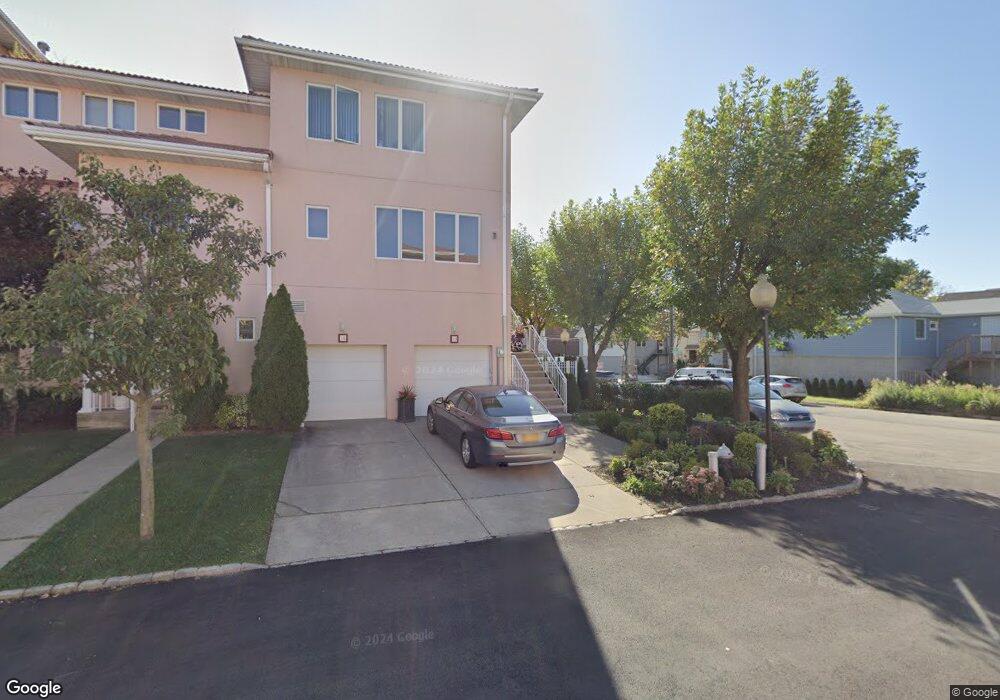
14 Harbour Ct Unit 55 Staten Island, NY 10308
Great Kills NeighborhoodEstimated Value: $499,000 - $766,000
--
Bed
--
Bath
1,724
Sq Ft
$385/Sq Ft
Est. Value
About This Home
This home is located at 14 Harbour Ct Unit 55, Staten Island, NY 10308 and is currently estimated at $663,913, approximately $385 per square foot. 14 Harbour Ct Unit 55 is a home located in Richmond County with nearby schools including P.S. 8 Shirlee Solomon, Myra S. Barnes Intermediate School 24, and New Dorp High School.
Ownership History
Date
Name
Owned For
Owner Type
Purchase Details
Closed on
Nov 11, 2019
Sold by
Spina Lydia
Bought by
Spina Lydia and The Lydia Spina Revocable Livi
Current Estimated Value
Purchase Details
Closed on
Dec 14, 2001
Sold by
Port Regalle Ii Development Corp
Bought by
Spina Lydia
Home Financials for this Owner
Home Financials are based on the most recent Mortgage that was taken out on this home.
Original Mortgage
$75,000
Interest Rate
6.85%
Create a Home Valuation Report for This Property
The Home Valuation Report is an in-depth analysis detailing your home's value as well as a comparison with similar homes in the area
Home Values in the Area
Average Home Value in this Area
Purchase History
| Date | Buyer | Sale Price | Title Company |
|---|---|---|---|
| Spina Lydia | -- | Express Abstract Svcs Inc | |
| Spina Lydia | $150,000 | Fidelity National Title Ins | |
| Port Regalle Ii Development Corp | -- | Fidelity National Title Ins |
Source: Public Records
Mortgage History
| Date | Status | Borrower | Loan Amount |
|---|---|---|---|
| Previous Owner | Port Regalle Ii Development Corp | $75,000 |
Source: Public Records
Tax History Compared to Growth
Tax History
| Year | Tax Paid | Tax Assessment Tax Assessment Total Assessment is a certain percentage of the fair market value that is determined by local assessors to be the total taxable value of land and additions on the property. | Land | Improvement |
|---|---|---|---|---|
| 2025 | $6,320 | $42,593 | $4,678 | $37,915 |
| 2024 | $6,320 | $37,935 | $4,956 | $32,979 |
| 2023 | $6,029 | $29,687 | $5,017 | $24,670 |
| 2022 | $4,932 | $28,007 | $5,974 | $22,033 |
| 2021 | $5,184 | $28,012 | $5,974 | $22,038 |
| 2020 | $5,805 | $30,539 | $5,974 | $24,565 |
| 2019 | $5,448 | $29,192 | $5,974 | $23,218 |
| 2018 | $5,013 | $27,824 | $5,973 | $21,851 |
| 2017 | $5,027 | $27,831 | $5,974 | $21,857 |
| 2016 | $5,163 | $28,934 | $5,974 | $22,960 |
| 2015 | $4,948 | $30,342 | $5,325 | $25,017 |
| 2014 | $4,948 | $28,625 | $5,049 | $23,576 |
Source: Public Records
Map
Nearby Homes
- 22 Harbour Ct Unit 30
- 23 Harbour Ct Unit 23
- 77 Harbour Ct Unit 77
- 46 Harbour Ct Unit 46
- 60 Harbour Ct Unit 60
- 111 Goodall St
- 224 Wiman Ave
- 198 Wiman Ave
- 72 Goodall St
- 98 Glover St
- 61 Heinz Ave
- 292 Tennyson Dr
- 4028 Hylan Blvd
- 346 Cleveland Ave
- 9 Russell St
- 11 Russell St
- 79 Robinson Ave
- 268 Nelson Ave
- 309 Cleveland Ave
- 69 Littlefield Ave
- 16 Harbour Ct Unit 19
- 18 Harbour Ct Unit 141
- 20 Harbour Ct Unit 139
- 22 Harbour Ct Unit A
- 24 Harbour Ct Unit 32
- 247 Wiman Ave
- 5 Harbour Ct Unit 5
- 15 Harbour Ct Unit 15
- 17 Harbour Ct Unit 1
- 21 Harbour Ct Unit 21
- 245 Wiman Ave
- 30 Harbour Ct Unit 30
- 30 Harbour Ct Unit 41
- 32 Harbour Ct Unit 32
- 32 Harbour Ct Unit A
- 34 Harbour Ct Unit 34
- 170 Wiman Ave
- 243 Wiman Ave
- 250 Wiman Ave
- 54 Harbour Ct Unit 54