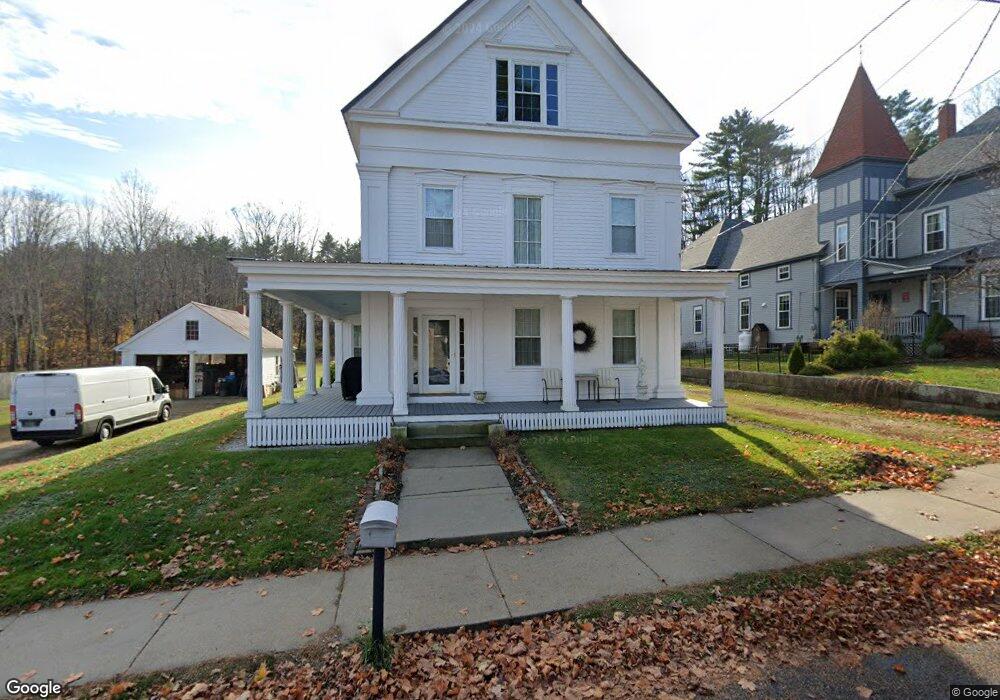
14 High Rd Cornish, ME 04020
Estimated Value: $387,000 - $447,000
3
Beds
1
Bath
2,523
Sq Ft
$163/Sq Ft
Est. Value
About This Home
This home is located at 14 High Rd, Cornish, ME 04020 and is currently estimated at $410,099, approximately $162 per square foot. 14 High Rd is a home located in York County.
Ownership History
Date
Name
Owned For
Owner Type
Purchase Details
Closed on
Aug 17, 2009
Sold by
Donnell Kenneth L and Donnell Susan B
Bought by
Fulginiti Michael S and Fulginiti Lisa L
Current Estimated Value
Home Financials for this Owner
Home Financials are based on the most recent Mortgage that was taken out on this home.
Original Mortgage
$108,000
Outstanding Balance
$70,379
Interest Rate
5.36%
Mortgage Type
Unknown
Estimated Equity
$339,720
Create a Home Valuation Report for This Property
The Home Valuation Report is an in-depth analysis detailing your home's value as well as a comparison with similar homes in the area
Home Values in the Area
Average Home Value in this Area
Purchase History
| Date | Buyer | Sale Price | Title Company |
|---|---|---|---|
| Fulginiti Michael S | -- | -- |
Source: Public Records
Mortgage History
| Date | Status | Borrower | Loan Amount |
|---|---|---|---|
| Open | Fulginiti Michael S | $108,000 |
Source: Public Records
Tax History
| Year | Tax Paid | Tax Assessment Tax Assessment Total Assessment is a certain percentage of the fair market value that is determined by local assessors to be the total taxable value of land and additions on the property. | Land | Improvement |
|---|---|---|---|---|
| 2025 | $4,256 | $450,400 | $87,600 | $362,800 |
| 2024 | $3,012 | $327,400 | $66,200 | $261,200 |
| 2023 | $3,509 | $245,400 | $47,800 | $197,600 |
| 2022 | $3,387 | $245,400 | $47,800 | $197,600 |
| 2021 | $3,313 | $245,400 | $47,800 | $197,600 |
| 2020 | $4,081 | $239,900 | $47,800 | $192,100 |
| 2019 | $3,215 | $239,900 | $47,800 | $192,100 |
| 2018 | $3,409 | $239,900 | $47,800 | $192,100 |
| 2016 | $3,092 | $239,900 | $47,800 | $192,100 |
| 2015 | $3,095 | $239,900 | $47,800 | $192,100 |
| 2014 | $3,059 | $237,100 | $47,800 | $189,300 |
Source: Public Records
Map
Nearby Homes
- 20 Main St
- 4 Bridge St
- 96 Maple St
- 6-13 Main St
- Lot #3 Jordan Heights Rd
- Lot #2 Jordan Heights Rd
- Lot #8 Jordan Heights Rd
- Lot #4 Jordan Heights Rd
- 490 S Hiram Rd
- 0 Durgintown Rd
- 992 Pequawket Trail
- 198 Senator Black Rd
- TBD Sokokis Trail N
- 174 Marston Rd
- 5 Kimball Hill Rd
- 12 Main St
- 8 Graffam Rd
- 8 - A Graffam Rd
- 482 Ossipee Trail
- 50AC Sawyer Mountain Rd
Your Personal Tour Guide
Ask me questions while you tour the home.