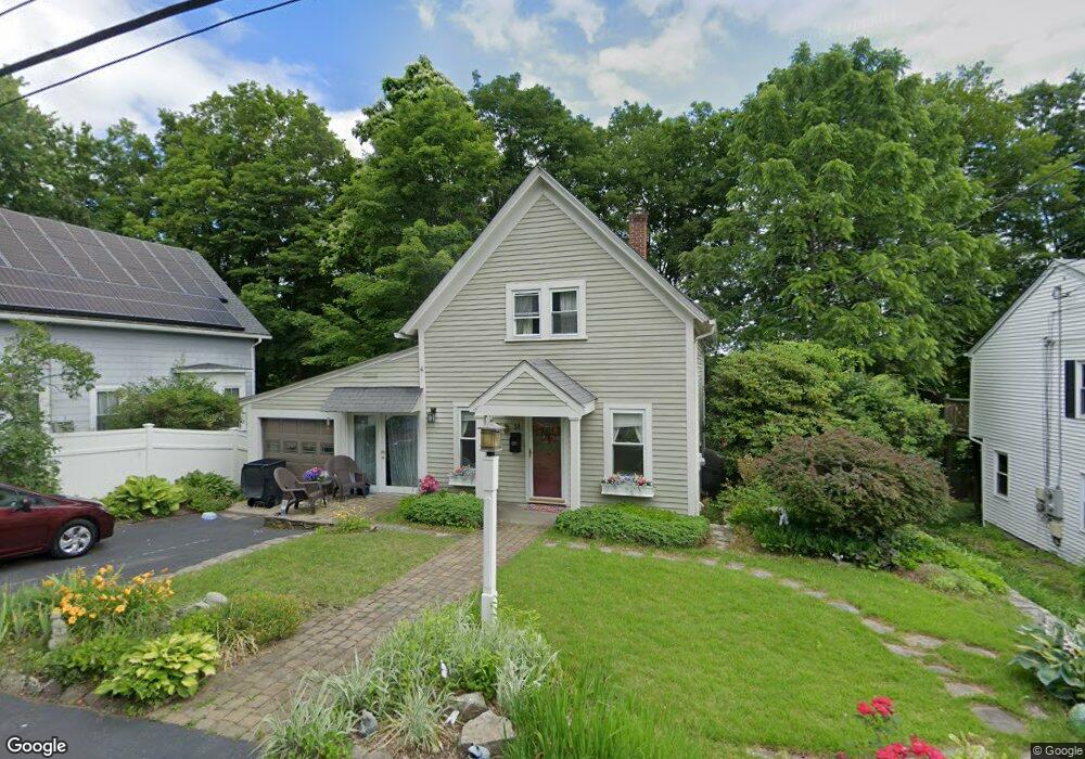
14 High St North Grafton, MA 01536
Estimated Value: $355,000 - $429,000
2
Beds
2
Baths
868
Sq Ft
$454/Sq Ft
Est. Value
About This Home
This home is located at 14 High St, North Grafton, MA 01536 and is currently estimated at $393,886, approximately $453 per square foot. 14 High St is a home located in Worcester County with nearby schools including Grafton High School, Silver Spruce Montessori School, and Al-Hamra Academy.
Ownership History
Date
Name
Owned For
Owner Type
Purchase Details
Closed on
Dec 31, 2002
Sold by
Lupo Nicholas and Terry Jean
Bought by
Mcauliffe Lois K
Current Estimated Value
Home Financials for this Owner
Home Financials are based on the most recent Mortgage that was taken out on this home.
Original Mortgage
$162,400
Outstanding Balance
$69,282
Interest Rate
6.02%
Mortgage Type
Purchase Money Mortgage
Estimated Equity
$324,604
Purchase Details
Closed on
Jul 18, 1997
Sold by
Cote Florence A
Bought by
Lupo Nicholas and Terry Jean E
Create a Home Valuation Report for This Property
The Home Valuation Report is an in-depth analysis detailing your home's value as well as a comparison with similar homes in the area
Home Values in the Area
Average Home Value in this Area
Purchase History
| Date | Buyer | Sale Price | Title Company |
|---|---|---|---|
| Mcauliffe Lois K | $203,000 | -- | |
| Mcauliffe Lois K | $203,000 | -- | |
| Lupo Nicholas | $96,900 | -- | |
| Lupo Nicholas | $96,900 | -- |
Source: Public Records
Mortgage History
| Date | Status | Borrower | Loan Amount |
|---|---|---|---|
| Open | Lupo Nicholas | $162,400 | |
| Closed | Lupo Nicholas | $162,400 | |
| Previous Owner | Lupo Nicholas | $49,400 |
Source: Public Records
Tax History Compared to Growth
Tax History
| Year | Tax Paid | Tax Assessment Tax Assessment Total Assessment is a certain percentage of the fair market value that is determined by local assessors to be the total taxable value of land and additions on the property. | Land | Improvement |
|---|---|---|---|---|
| 2025 | $4,289 | $307,700 | $126,500 | $181,200 |
| 2024 | $4,194 | $293,100 | $120,500 | $172,600 |
| 2023 | $4,011 | $255,300 | $120,500 | $134,800 |
| 2022 | $4,004 | $237,200 | $103,400 | $133,800 |
| 2021 | $3,857 | $224,500 | $94,000 | $130,500 |
| 2020 | $3,722 | $225,600 | $94,000 | $131,600 |
| 2019 | $3,512 | $210,800 | $91,300 | $119,500 |
| 2018 | $3,275 | $197,400 | $91,000 | $106,400 |
| 2017 | $2,963 | $180,700 | $69,000 | $111,700 |
| 2016 | $2,936 | $175,300 | $72,200 | $103,100 |
| 2015 | $2,911 | $176,400 | $72,200 | $104,200 |
| 2014 | $2,715 | $177,900 | $80,000 | $97,900 |
Source: Public Records
Map
Nearby Homes
- 17 Hingham Rd
- 11 Hovey Pond Dr Unit 11
- 7 Hovey Pond Dr Unit 7
- 194 Worcester St
- 4 Westboro Rd
- 22 Beverly Rd
- 14 Northgate Ct Unit 14
- 0 East St
- 30 Falmouth Dr
- 4 Winslow Ln Unit 1410
- 15 Windle Ave
- 44 Meadow Ln
- 3 Abby Rd
- 2 Winslow Ln Unit 2302
- 2 Winslow Ln Unit 406
- Ivywood Plan at Winslow Point - The Building 1 Series
- Hayden Plan at Winslow Point - The Building 1 Series
- 51 Cortland Grove Dr Unit 51
- 34 Clews St
- 1 Purinton St
- 12 High St Unit 2
- 12 High St Unit 1
- 12 Perry St Unit 18
- 12 Perry St Unit 11
- 12 High St Unit A
- 12 Perry St Unit 17
- 12 Perry St Unit 3
- 12 Perry St Unit 13
- 12 Perry St Unit 16
- 12 Perry St
- 12 High St Unit B
- 4 High St Unit AFF
- 4 High St Unit AFF
- 16 High St
- 47 N Main St
- 13 High Street B
- 13 High St
- 13 High St Unit B
- 13A High St
- 13B High St