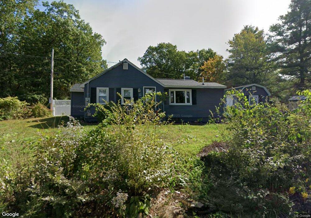
14 Holiday Ln Lancaster, MA 01523
Estimated Value: $347,000 - $400,000
1
Bed
1
Bath
798
Sq Ft
$474/Sq Ft
Est. Value
About This Home
This home is located at 14 Holiday Ln, Lancaster, MA 01523 and is currently estimated at $378,575, approximately $474 per square foot. 14 Holiday Ln is a home with nearby schools including Mary Rowlandson Elementary School, Luther Burbank Middle School, and Nashoba Regional High School.
Ownership History
Date
Name
Owned For
Owner Type
Purchase Details
Closed on
Jun 30, 2023
Sold by
Wallace Kimberly A
Bought by
Riley Brendan and Riley Elizabeth
Current Estimated Value
Purchase Details
Closed on
Nov 15, 2021
Sold by
Simard Lisa L and Simard David
Bought by
Wallace Kimberly A
Purchase Details
Closed on
Jun 6, 2014
Sold by
Drouin Allan A
Bought by
Simard Lisa L
Purchase Details
Closed on
Dec 18, 2013
Sold by
Drouin Allan A and Drouin Melina M
Bought by
Drouin Allan A
Purchase Details
Closed on
May 25, 1965
Bought by
Drouin Allan A
Create a Home Valuation Report for This Property
The Home Valuation Report is an in-depth analysis detailing your home's value as well as a comparison with similar homes in the area
Home Values in the Area
Average Home Value in this Area
Purchase History
| Date | Buyer | Sale Price | Title Company |
|---|---|---|---|
| Riley Brendan | $357,500 | None Available | |
| Riley Brendan | $357,500 | None Available | |
| Wallace Kimberly A | $244,000 | None Available | |
| Wallace Kimberly A | $244,000 | None Available | |
| Simard Lisa L | -- | -- | |
| Simard Lisa L | -- | -- | |
| Drouin Allan A | -- | -- | |
| Drouin Allan A | -- | -- | |
| Drouin Allan A | -- | -- |
Source: Public Records
Tax History
| Year | Tax Paid | Tax Assessment Tax Assessment Total Assessment is a certain percentage of the fair market value that is determined by local assessors to be the total taxable value of land and additions on the property. | Land | Improvement |
|---|---|---|---|---|
| 2025 | $4,438 | $274,600 | $100,600 | $174,000 |
| 2024 | $4,066 | $232,900 | $93,600 | $139,300 |
| 2023 | $0 | $216,300 | $85,100 | $131,200 |
| 2022 | $3,398 | $174,700 | $88,500 | $86,200 |
| 2021 | $3,365 | $168,400 | $88,500 | $79,900 |
| 2020 | $3,136 | $158,000 | $88,500 | $69,500 |
| 2019 | $2,961 | $149,900 | $88,500 | $61,400 |
| 2018 | $2,819 | $141,100 | $88,500 | $52,600 |
| 2016 | $2,635 | $134,800 | $87,700 | $47,100 |
| 2015 | $2,506 | $133,600 | $87,700 | $45,900 |
| 2014 | $2,534 | $134,000 | $87,700 | $46,300 |
Source: Public Records
Map
Nearby Homes
- 207 White Pond Rd
- 437 Johnny Appleseed Ln
- 35 Mcgovern Blvd
- 93 Pennacook Dr
- 99 Cortland Cir
- 851 Lancaster St
- 60 Howard St
- 26 Mahogany Run
- 1497 Lunenburg Rd
- 6 Longwood Ave
- 193 Bayberry Hill Ln
- 17 Vinton St
- 124 11th St
- 36 Sunrise Ave
- 7 Lawson Ave
- 65 Farm Hill Rd
- 14 Viscoloid Ave
- 257 Spruce St
- 0 Johnson St
- 0 Wheeler St
- 14 Holiday Ln
- 9 Holiday Ln
- 270 White Pond Rd
- 270 White Pond Rd Unit 270
- 270 White Pond Rd
- 1 Holiday Ln
- 35 Holiday Ln
- 290 White Pond Rd
- 285 White Pond Rd
- 35 Holiday Ln
- 325 White Pond Rd
- 325 White Pond Rd Unit A
- 493 White Pond Rd
- 238 White Pond Rd
- 45 Holiday Ln
- 479 White Pond Rd
- 329 White Pond Rd
- 270 White Pond Rd
- 53 Holiday Ln
- 304 White Pond Rd
Your Personal Tour Guide
Ask me questions while you tour the home.