Estimated Value: $1,014,000 - $1,089,000
5
Beds
5
Baths
4,280
Sq Ft
$244/Sq Ft
Est. Value
About This Home
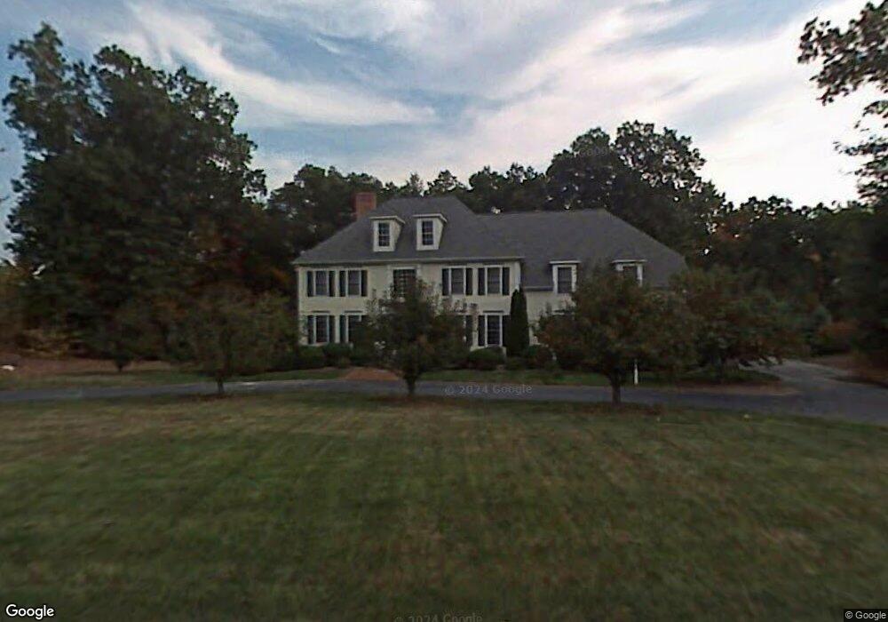
This home is located at 14 James Ct, Avon, CT 06001 and is currently estimated at $1,046,020, approximately $244 per square foot. 14 James Ct is a home located in Hartford County with nearby schools including Roaring Brook School, Thompson Brook School, and Avon Middle School.
Ownership History
Date
Name
Owned For
Owner Type
Purchase Details
Closed on
Jul 9, 1998
Sold by
Depadua Antonio Z and Depadua James E
Bought by
Bombard Paul M and Bombard Marsha A
Current Estimated Value
Home Financials for this Owner
Home Financials are based on the most recent Mortgage that was taken out on this home.
Original Mortgage
$350,000
Outstanding Balance
$71,750
Interest Rate
7.02%
Mortgage Type
Unknown
Estimated Equity
$974,270
Purchase Details
Closed on
Dec 20, 1996
Sold by
Avon Res Prop
Bought by
Depadua Antonio and Depadua Joan
Home Financials for this Owner
Home Financials are based on the most recent Mortgage that was taken out on this home.
Original Mortgage
$261,700
Interest Rate
7.62%
Mortgage Type
Unknown
Create a Home Valuation Report for This Property
The Home Valuation Report is an in-depth analysis detailing your home's value as well as a comparison with similar homes in the area
Home Values in the Area
Average Home Value in this Area
Purchase History
| Date | Buyer | Sale Price | Title Company |
|---|---|---|---|
| Bombard Paul M | $535,000 | -- | |
| Bombard Paul M | $535,000 | -- | |
| Depadua Antonio | $506,000 | -- | |
| Depadua Antonio | $506,000 | -- |
Source: Public Records
Mortgage History
| Date | Status | Borrower | Loan Amount |
|---|---|---|---|
| Open | Depadua Antonio | $350,000 | |
| Closed | Depadua Antonio | $350,000 | |
| Previous Owner | Depadua Antonio | $261,700 |
Source: Public Records
Tax History
| Year | Tax Paid | Tax Assessment Tax Assessment Total Assessment is a certain percentage of the fair market value that is determined by local assessors to be the total taxable value of land and additions on the property. | Land | Improvement |
|---|---|---|---|---|
| 2025 | $16,968 | $551,820 | $123,450 | $428,370 |
| 2024 | $16,367 | $551,820 | $123,450 | $428,370 |
| 2023 | $16,469 | $465,350 | $123,450 | $341,900 |
| 2022 | $16,106 | $465,350 | $123,450 | $341,900 |
| 2021 | $15,920 | $465,350 | $123,450 | $341,900 |
| 2020 | $15,310 | $465,350 | $123,450 | $341,900 |
| 2019 | $15,310 | $465,350 | $123,450 | $341,900 |
| 2018 | $15,340 | $489,310 | $140,950 | $348,360 |
| 2017 | $14,968 | $489,310 | $140,950 | $348,360 |
| 2016 | $14,444 | $489,310 | $140,950 | $348,360 |
| 2015 | $14,092 | $489,310 | $140,950 | $348,360 |
| 2014 | $13,857 | $489,310 | $140,950 | $348,360 |
Source: Public Records
Map
Nearby Homes
- 15 Greenwich Ln Unit 15
- 9 Putnam Ln
- 373 Collinsville Rd
- 4 Strathmore Ln Unit 4
- 40 Homestead Ln
- 28 Cottonwood Dr
- 39 High Ridge Hollow
- 14 Walnut Ln
- 7 Maple Ln
- 7 Chestnut Dr
- 39 Heritage Dr Unit 39
- 29 Crocus Ln
- 7 Hadley Dr
- 8919 Taine Mountain Rd
- 145 Hollister Dr
- 23 Keyes St
- 32 Canterbury Ln
- 51 Westland Rd
- 55 Depot Place
- 2 Ventres Way
- 6 James Ct
- 18 James Ct
- 25 Nottingham Ridge
- 21 James Ct
- 655 Lovely St
- 5 James Ct
- 11 James Ct
- 661 Lovely St
- 645 Lovely St
- 5 King Richards Ct
- 17 James Ct
- 45 Nottingham Ridge
- 675 Lovely St
- 637 Lovely St
- 42 Nottingham Ridge
- 9 King Richards Ct
- 58 Grant Dr
- 61 Grant Dr
- 48 Nottingham Ridge
- 5 Nottingham Ridge
Your Personal Tour Guide
Ask me questions while you tour the home.