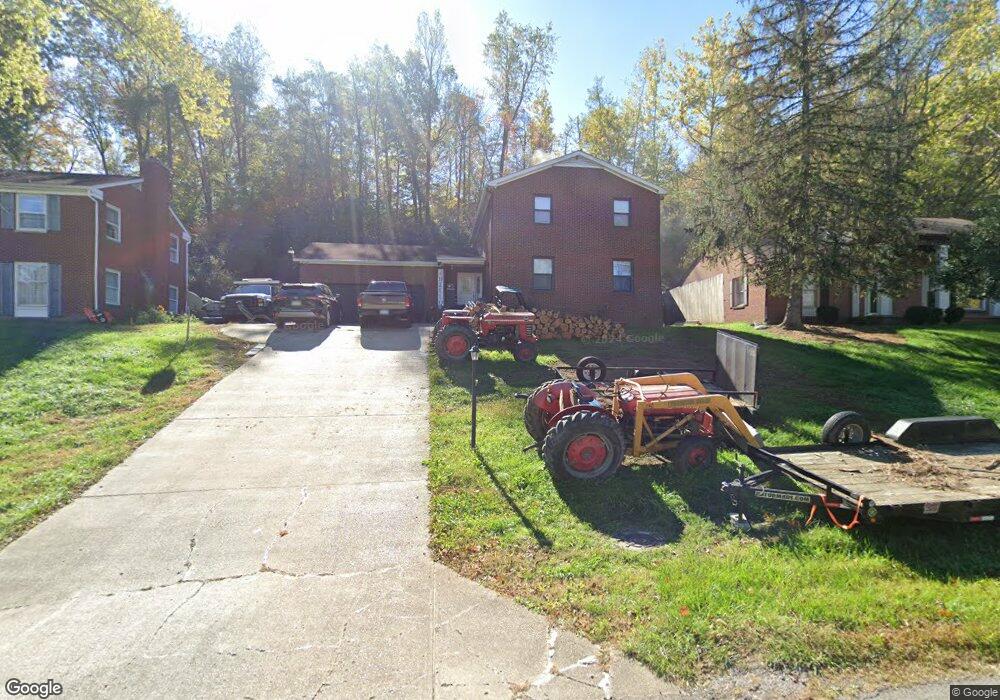
14 Kay Crest Dr Huntington, WV 25705
Southeast Hills NeighborhoodEstimated Value: $258,000 - $299,000
4
Beds
3
Baths
2,359
Sq Ft
$118/Sq Ft
Est. Value
About This Home
This home is located at 14 Kay Crest Dr, Huntington, WV 25705 and is currently estimated at $277,219, approximately $117 per square foot. 14 Kay Crest Dr is a home located in Cabell County with nearby schools including Explorer Academy, Huntington East Middle School, and Huntington High School.
Ownership History
Date
Name
Owned For
Owner Type
Purchase Details
Closed on
Sep 11, 2012
Sold by
Minnix Bobby R
Bought by
Minnix Bobby R and Minnix Jessica Dawn
Current Estimated Value
Home Financials for this Owner
Home Financials are based on the most recent Mortgage that was taken out on this home.
Original Mortgage
$110,000
Interest Rate
3.39%
Mortgage Type
New Conventional
Purchase Details
Closed on
Jul 23, 2010
Sold by
Clements Bradford
Bought by
Minix Bobby R
Home Financials for this Owner
Home Financials are based on the most recent Mortgage that was taken out on this home.
Original Mortgage
$115,542
Interest Rate
4.87%
Mortgage Type
FHA
Create a Home Valuation Report for This Property
The Home Valuation Report is an in-depth analysis detailing your home's value as well as a comparison with similar homes in the area
Home Values in the Area
Average Home Value in this Area
Purchase History
| Date | Buyer | Sale Price | Title Company |
|---|---|---|---|
| Minnix Bobby R | -- | -- | |
| Minix Bobby R | $138,000 | -- |
Source: Public Records
Mortgage History
| Date | Status | Borrower | Loan Amount |
|---|---|---|---|
| Previous Owner | Minnix Bobby R | $110,000 | |
| Previous Owner | Minix Bobby R | $115,542 |
Source: Public Records
Tax History Compared to Growth
Tax History
| Year | Tax Paid | Tax Assessment Tax Assessment Total Assessment is a certain percentage of the fair market value that is determined by local assessors to be the total taxable value of land and additions on the property. | Land | Improvement |
|---|---|---|---|---|
| 2024 | $1,523 | $104,100 | $19,380 | $84,720 |
| 2023 | $1,426 | $104,100 | $19,380 | $84,720 |
| 2022 | $1,539 | $111,300 | $19,380 | $91,920 |
| 2021 | $1,525 | $109,620 | $19,380 | $90,240 |
| 2020 | $1,460 | $109,620 | $19,380 | $90,240 |
| 2019 | $1,576 | $114,900 | $19,380 | $95,520 |
| 2018 | $1,579 | $114,900 | $19,380 | $95,520 |
| 2017 | $1,580 | $114,900 | $19,380 | $95,520 |
| 2016 | $1,566 | $114,000 | $16,320 | $97,680 |
| 2015 | $1,562 | $114,000 | $16,320 | $97,680 |
| 2014 | -- | $114,000 | $16,320 | $97,680 |
Source: Public Records
Map
Nearby Homes
- 157 Bryn Myrr Dr Unit 3356 Bryn Myrr Dr
- 89 Belmont Dr
- 55 Endicott Ln
- 983 Turner Rd
- 44 Carriage Ln
- Lot 31 Seneca Rd
- 887 Norway Ave
- 0 Kensington Ln
- 58 Holley Ave
- 12 Romar Ct
- 334 Cherokee Trail
- 929 Norway Ave
- 347 Navajo Trail
- 3105 Brereton Ct
- 3119 Brereton Ct
- 12 Marquis Dr
- 1778 Woodward Terrace
- 1770 Woodward Terrace
- 1771 Woodward Terrace
- 5 Highland Dr Unit PT LOT 5 Rankin Sub
- 12 Kay Crest Dr
- 16 Kay Crest Dr
- 10 Kay Crest Dr
- 3419 Norwood Rd
- 1 Rujon Dr
- 3401 Allen Ct
- 2 Rujon Dr Unit 2
- 4 Rujon Dr
- 791 Norwood Rd
- 3431 Norwood Rd
- 3421 Norwood Rd Unit R
- 3421 Norwood Rd Unit R
- 3421 Norwood Rd Unit A
- 3421 Norwood Rd
- 851 Norwood Rd
- 3403 Allen Ct
- 3425 Norwood Rd
- 3402 Allen Ct
- 10 Rujon Dr
- 3405 Allen Ct