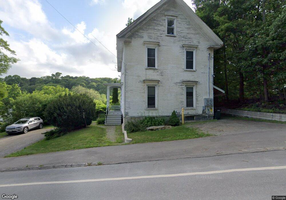
14 Kenduskeag Ave Bangor, ME 04401
Little City NeighborhoodEstimated Value: $283,000 - $377,000
3
Beds
3
Baths
2,214
Sq Ft
$154/Sq Ft
Est. Value
About This Home
This home is located at 14 Kenduskeag Ave, Bangor, ME 04401 and is currently estimated at $341,000, approximately $154 per square foot. 14 Kenduskeag Ave is a home with nearby schools including Abraham Lincoln School, Mary Snow School, and William S. Cohen School.
Create a Home Valuation Report for This Property
The Home Valuation Report is an in-depth analysis detailing your home's value as well as a comparison with similar homes in the area
Home Values in the Area
Average Home Value in this Area
Tax History Compared to Growth
Tax History
| Year | Tax Paid | Tax Assessment Tax Assessment Total Assessment is a certain percentage of the fair market value that is determined by local assessors to be the total taxable value of land and additions on the property. | Land | Improvement |
|---|---|---|---|---|
| 2024 | $3,762 | $202,800 | $17,600 | $185,200 |
| 2023 | $3,575 | $186,700 | $17,600 | $169,100 |
| 2022 | $3,286 | $161,100 | $17,600 | $143,500 |
| 2021 | $3,296 | $147,800 | $16,300 | $131,500 |
| 2020 | $3,267 | $140,800 | $16,300 | $124,500 |
| 2019 | $1,941 | $135,100 | $16,300 | $118,800 |
| 2018 | $1,941 | $128,200 | $16,300 | $111,900 |
| 2017 | $2,889 | $128,100 | $16,300 | $111,800 |
| 2016 | $2,828 | $125,700 | $16,300 | $109,400 |
| 2015 | $2,759 | $125,700 | $16,300 | $109,400 |
| 2014 | $2,705 | $124,100 | $16,300 | $107,800 |
| 2013 | $2,581 | $124,100 | $16,300 | $107,800 |
Source: Public Records
Map
Nearby Homes
- 26 Kenduskeag Ave
- 30 Kenduskeag Ave
- 15 Kenduskeag Ave
- 349 Harlow St
- 408 Harlow St
- 36 Kenduskeag Ave
- 347 Harlow St
- 31 Kenduskeag Ave
- 42 Kenduskeag Ave
- 315 Harlow St
- 455 Harlow St
- 44 Kenduskeag Ave
- 11 Division St
- 49 Kenduskeag Ave
- 52 Kenduskeag Ave
- 26/67 Curve Market
- 17 Division St
- 2 Mill St
- 54 Kenduskeag Ave
- 21 Division St