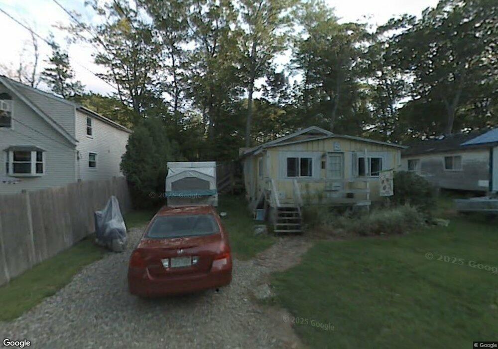
14 Kosta Ave Rutland, MA 01543
Estimated Value: $179,000 - $246,000
2
Beds
1
Bath
660
Sq Ft
$340/Sq Ft
Est. Value
About This Home
This home is located at 14 Kosta Ave, Rutland, MA 01543 and is currently estimated at $224,460, approximately $340 per square foot. 14 Kosta Ave is a home located in Worcester County with nearby schools including Wachusett Regional High School.
Create a Home Valuation Report for This Property
The Home Valuation Report is an in-depth analysis detailing your home's value as well as a comparison with similar homes in the area
Home Values in the Area
Average Home Value in this Area
Tax History Compared to Growth
Tax History
| Year | Tax Paid | Tax Assessment Tax Assessment Total Assessment is a certain percentage of the fair market value that is determined by local assessors to be the total taxable value of land and additions on the property. | Land | Improvement |
|---|---|---|---|---|
| 2025 | $2,506 | $176,000 | $73,000 | $103,000 |
| 2024 | $2,095 | $141,300 | $64,800 | $76,500 |
| 2023 | $1,814 | $132,200 | $61,100 | $71,100 |
| 2022 | $1,810 | $114,600 | $52,000 | $62,600 |
| 2021 | $1,740 | $104,200 | $51,400 | $52,800 |
| 2020 | $1,710 | $97,100 | $41,600 | $55,500 |
| 2019 | $1,673 | $93,500 | $35,400 | $58,100 |
| 2018 | $1,514 | $83,500 | $35,400 | $48,100 |
| 2017 | $1,530 | $83,500 | $35,400 | $48,100 |
| 2016 | $1,529 | $88,000 | $36,200 | $51,800 |
| 2015 | $1,433 | $81,200 | $36,200 | $45,000 |
| 2014 | $1,389 | $81,200 | $36,200 | $45,000 |
Source: Public Records
Map
Nearby Homes
- 2 Kosta Ave
- 7 Victoria Ave
- 4 Wilson Way
- 14 Welch Ave Unit A
- 7 Emerald Rd
- 289 Richards Ave
- 236 Turkey Hill Rd
- LOT 8 Pierre Cir
- 11 Brigham Rd
- 189 Maple Ave
- 176 Maple Ave Unit 1-38
- 176 Maple Ave Unit 3-25
- 176 Maple Ave Unit 2-26
- 43 Irish Ln
- 37 Irish Ln
- 39 Irish Ln
- 217 Grove St
- 7 Prescott St
- 132 Fidelity Dr Unit 61
- 12 Fidelity Dr Unit 6