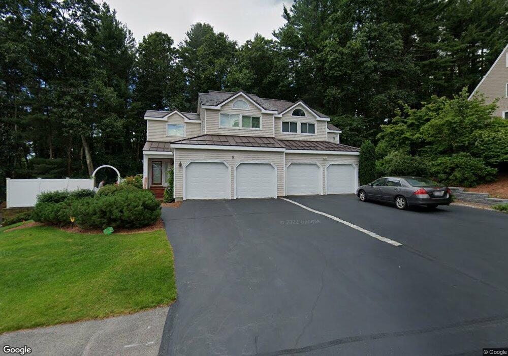
14 Lanes End Natick, MA 01760
Estimated Value: $396,000 - $789,000
2
Beds
3
Baths
1,206
Sq Ft
$527/Sq Ft
Est. Value
About This Home
This home is located at 14 Lanes End, Natick, MA 01760 and is currently estimated at $635,933, approximately $527 per square foot. 14 Lanes End is a home located in Middlesex County with nearby schools including Natick High School, J F Kennedy Middle School, and Johnson Elementary School.
Ownership History
Date
Name
Owned For
Owner Type
Purchase Details
Closed on
May 17, 2019
Sold by
Evans Allison R
Bought by
Allison R Evans Lt
Current Estimated Value
Purchase Details
Closed on
May 23, 1989
Sold by
No Essex Rlty Co
Bought by
Evans Richard L
Home Financials for this Owner
Home Financials are based on the most recent Mortgage that was taken out on this home.
Original Mortgage
$122,500
Interest Rate
10.97%
Mortgage Type
Purchase Money Mortgage
Create a Home Valuation Report for This Property
The Home Valuation Report is an in-depth analysis detailing your home's value as well as a comparison with similar homes in the area
Home Values in the Area
Average Home Value in this Area
Purchase History
| Date | Buyer | Sale Price | Title Company |
|---|---|---|---|
| Allison R Evans Lt | -- | -- | |
| Evans Richard L | $175,000 | -- |
Source: Public Records
Mortgage History
| Date | Status | Borrower | Loan Amount |
|---|---|---|---|
| Previous Owner | Evans Richard L | $122,500 |
Source: Public Records
Tax History
| Year | Tax Paid | Tax Assessment Tax Assessment Total Assessment is a certain percentage of the fair market value that is determined by local assessors to be the total taxable value of land and additions on the property. | Land | Improvement |
|---|---|---|---|---|
| 2025 | $7,662 | $640,600 | $0 | $640,600 |
| 2024 | $7,450 | $607,700 | $0 | $607,700 |
| 2023 | $7,244 | $573,100 | $0 | $573,100 |
| 2022 | $7,128 | $534,300 | $0 | $534,300 |
| 2021 | $6,755 | $496,300 | $0 | $496,300 |
| 2020 | $6,417 | $471,500 | $0 | $471,500 |
| 2019 | $5,993 | $471,500 | $0 | $471,500 |
| 2018 | $5,903 | $452,300 | $0 | $452,300 |
| 2017 | $5,615 | $416,200 | $0 | $416,200 |
| 2016 | $5,526 | $407,200 | $0 | $407,200 |
| 2015 | $5,283 | $382,300 | $0 | $382,300 |
Source: Public Records
Map
Nearby Homes
- 5 Lanes End
- 34 Walden Dr Unit 5
- 30 Walden Dr Unit 7
- 8 Walden Dr Unit 13
- 1 Post Oak Ln Unit 19
- 46 Silver Hill Ln Unit 1
- 3 Silver Hill Ln Unit 6
- 36 Silver Hill Ln Unit 21
- 27 Stillman St
- 52 Village Brook Ln Unit 14
- 28 Sylvester Rd
- 26 Wellesley Ave Unit B
- 57 Village Brook Ln Unit 5
- 79 Speen St
- 8 Village Way Unit 11
- 44 Village Hill Ln
- 29 Village Rock Ln Unit 6
- 4 Village Rock Ln Unit 9
- 15 Village Way Unit 8
- 21 Village Rock Ln Unit 4
- 16 Lanes End
- 16 Lanes End Unit 16
- 12 Lanes End
- 18 Lanes End
- 13 Lanes End
- 11 Lanes End
- 11 Lanes End Unit 11
- 11 Lanes End Unit 11-B,11
- 15 Lanes End
- 20 Lanes End
- 22 Lanes End
- 22 Lanes End Unit 22
- 17 Lanes End
- 9 Lanes End
- 7 Lanes End
- 7 Lanes End Unit 7
- 7 Lanes End Unit B,1
- 10 Lanes End
- 8 Lanes End
- 10 Lanes End Unit 10,10
Your Personal Tour Guide
Ask me questions while you tour the home.