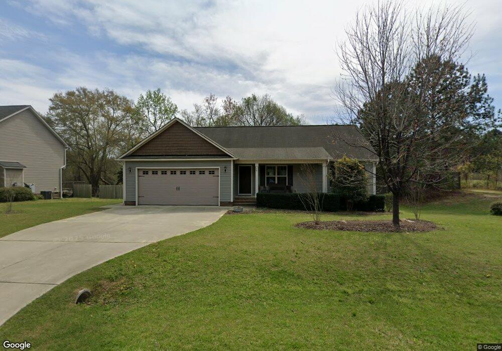
14 Langston Ridge Dr Angier, NC 27501
Pleasant Grove NeighborhoodEstimated Value: $311,000 - $346,000
3
Beds
2
Baths
1,488
Sq Ft
$221/Sq Ft
Est. Value
About This Home
This home is located at 14 Langston Ridge Dr, Angier, NC 27501 and is currently estimated at $329,012, approximately $221 per square foot. 14 Langston Ridge Dr is a home located in Johnston County with nearby schools including McGee's Crossroads Elementary School, McGee's Crossroads Middle School, and West Johnston High School.
Ownership History
Date
Name
Owned For
Owner Type
Purchase Details
Closed on
Jun 24, 2015
Sold by
On Top Buildings Company Llc
Bought by
Mckee Patricia S
Current Estimated Value
Home Financials for this Owner
Home Financials are based on the most recent Mortgage that was taken out on this home.
Original Mortgage
$119,920
Outstanding Balance
$93,441
Interest Rate
3.92%
Mortgage Type
New Conventional
Estimated Equity
$235,571
Purchase Details
Closed on
Jan 22, 2015
Sold by
R L Properties Llc
Bought by
On Top Building Company Llc
Home Financials for this Owner
Home Financials are based on the most recent Mortgage that was taken out on this home.
Original Mortgage
$115,900
Interest Rate
3.94%
Mortgage Type
Future Advance Clause Open End Mortgage
Create a Home Valuation Report for This Property
The Home Valuation Report is an in-depth analysis detailing your home's value as well as a comparison with similar homes in the area
Home Values in the Area
Average Home Value in this Area
Purchase History
| Date | Buyer | Sale Price | Title Company |
|---|---|---|---|
| Mckee Patricia S | $150,000 | None Available | |
| On Top Building Company Llc | $44,000 | None Available |
Source: Public Records
Mortgage History
| Date | Status | Borrower | Loan Amount |
|---|---|---|---|
| Open | Mckee Patricia S | $119,920 | |
| Previous Owner | On Top Building Company Llc | $115,900 |
Source: Public Records
Tax History
| Year | Tax Paid | Tax Assessment Tax Assessment Total Assessment is a certain percentage of the fair market value that is determined by local assessors to be the total taxable value of land and additions on the property. | Land | Improvement |
|---|---|---|---|---|
| 2025 | $2,020 | $318,150 | $77,000 | $241,150 |
| 2024 | $1,470 | $181,530 | $39,600 | $141,930 |
| 2023 | $1,416 | $181,530 | $39,600 | $141,930 |
| 2022 | $1,489 | $181,530 | $39,600 | $141,930 |
| 2021 | $1,452 | $181,530 | $39,600 | $141,930 |
| 2020 | $1,507 | $181,530 | $39,600 | $141,930 |
| 2019 | $1,507 | $181,530 | $39,600 | $141,930 |
| 2018 | $1,368 | $160,990 | $33,000 | $127,990 |
| 2017 | $1,368 | $160,990 | $33,000 | $127,990 |
| 2016 | $1,368 | $160,990 | $33,000 | $127,990 |
| 2015 | $281 | $33,000 | $33,000 | $0 |
| 2014 | $281 | $33,000 | $33,000 | $0 |
Source: Public Records
Map
Nearby Homes
- 57 Andorra Place
- 216 Cedar Ridge Trail
- 216 Country Haven Ct
- 139 Bounty Cir
- 3645 Old Fairground Rd
- 97 Carrousel Ct
- 336 Cedar Ridge Trail
- 264 Harbor Cove Dr
- 226 Marshview Cir
- 506 Harbor Cove Dr
- 24 Sue Dr
- 111 Old Mill Dr
- 105 Pinecrest Dr
- 81 Pinon Dr
- 206 West Rd
- 810 | 850 Wiggins Rd
- 197 Silverside Dr
- 179 Camden Dr
- 205 Teresa Ct
- 299 Greenleaf Rd
- 28 Langston Ridge Dr
- 28 Langston Ridge Dr
- 4006 Old Fairground Rd
- 4014 Old Fairground Rd
- 120 Savannah Ridge Ct
- 42 Langston Ridge Dr
- 4004 Old Fairground Rd
- 102 Savannah Ridge Ct
- 123 Savannah Ridge Ct
- 56 Langston Ridge Dr
- 3938 Old Fairground Rd
- 70 Langston Ridge Dr
- 89 Savannah Ridge Ct
- 119 Savannah Ridge Ct
- 107 Savannah Ridge Ct
- 76 Savannah Ridge Ct
- 6900 Old Fairground Rd
- 73 Savannah Ridge Ct
- 84 Langston Ridge Dr
- 48 Savannah Ridge Ct
Your Personal Tour Guide
Ask me questions while you tour the home.