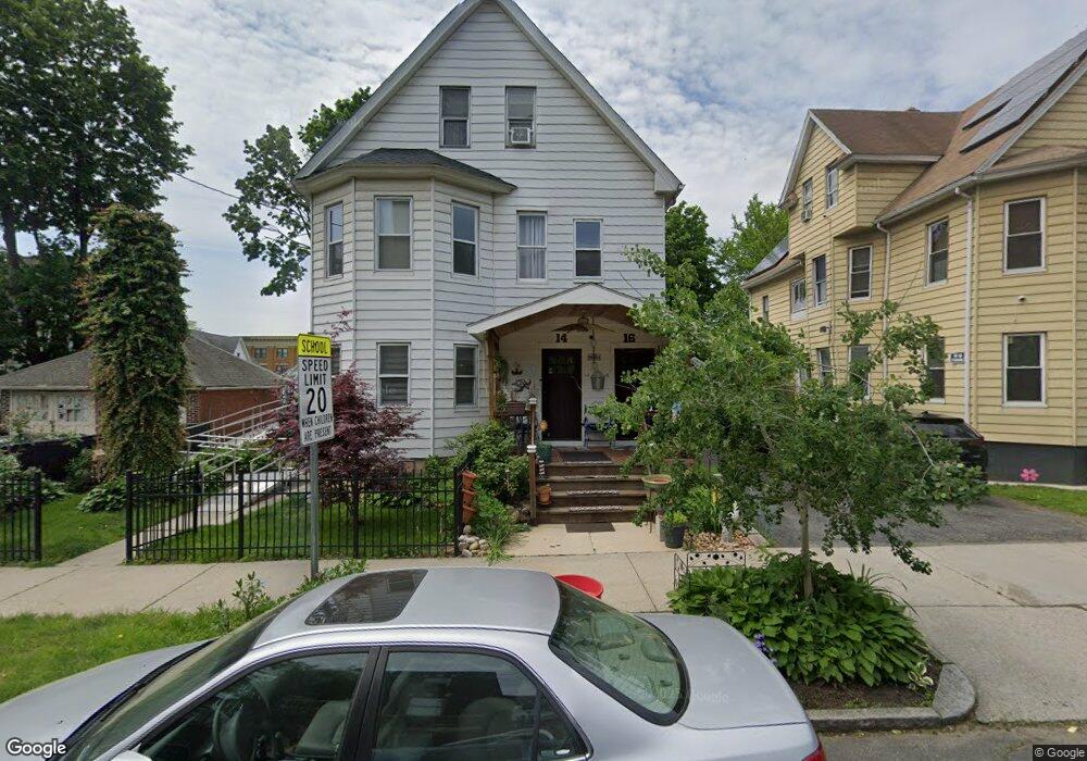
14 Leonard St Unit 16 Springfield, MA 01104
Liberty Heights NeighborhoodEstimated Value: $265,000 - $363,000
4
Beds
3
Baths
3,086
Sq Ft
$96/Sq Ft
Est. Value
About This Home
This home is located at 14 Leonard St Unit 16, Springfield, MA 01104 and is currently estimated at $297,681, approximately $96 per square foot. 14 Leonard St Unit 16 is a home located in Hampden County with nearby schools including Mary M. Walsh Elementary School, High School Of Commerce, and Springfield High School of Science and Technology.
Ownership History
Date
Name
Owned For
Owner Type
Purchase Details
Closed on
Oct 30, 2009
Sold by
Leonard T and Wiatrowski Richard J
Bought by
Arias Sol A
Current Estimated Value
Home Financials for this Owner
Home Financials are based on the most recent Mortgage that was taken out on this home.
Original Mortgage
$112,818
Outstanding Balance
$73,891
Interest Rate
5.06%
Mortgage Type
Purchase Money Mortgage
Estimated Equity
$223,790
Create a Home Valuation Report for This Property
The Home Valuation Report is an in-depth analysis detailing your home's value as well as a comparison with similar homes in the area
Home Values in the Area
Average Home Value in this Area
Purchase History
| Date | Buyer | Sale Price | Title Company |
|---|---|---|---|
| Arias Sol A | $115,000 | -- |
Source: Public Records
Mortgage History
| Date | Status | Borrower | Loan Amount |
|---|---|---|---|
| Open | Arias Sol A | $112,818 |
Source: Public Records
Tax History
| Year | Tax Paid | Tax Assessment Tax Assessment Total Assessment is a certain percentage of the fair market value that is determined by local assessors to be the total taxable value of land and additions on the property. | Land | Improvement |
|---|---|---|---|---|
| 2025 | $3,109 | $198,300 | $30,500 | $167,800 |
| 2024 | $3,217 | $200,300 | $30,500 | $169,800 |
| 2023 | $3,060 | $179,500 | $27,700 | $151,800 |
| 2022 | $3,421 | $181,800 | $25,900 | $155,900 |
| 2021 | $2,871 | $151,900 | $23,500 | $128,400 |
| 2020 | $2,722 | $139,400 | $23,500 | $115,900 |
| 2019 | $2,606 | $132,400 | $23,500 | $108,900 |
| 2018 | $2,591 | $138,700 | $23,500 | $115,200 |
| 2017 | $2,591 | $131,800 | $17,100 | $114,700 |
| 2016 | $2,363 | $120,200 | $17,100 | $103,100 |
| 2015 | $2,266 | $115,200 | $17,100 | $98,100 |
Source: Public Records
Map
Nearby Homes
- 148-150 Stafford St
- 78 Prospect St
- 60 Ringgold St
- 69 Winter St
- 24 Melha Ave
- 13 Ringgold St
- 571-573 Carew St
- 57 Narragansett St
- 26 Hebron St
- 140 Chestnut St Unit 706
- 140 Chestnut St Unit 702
- 140 Chestnut St Unit 204
- 140 Chestnut St Unit 819
- 140 Chestnut St Unit 619
- 140 Chestnut St Unit 816
- 140 Chestnut St Unit 604
- 211-213 Chapin Terrace
- 52 Osgood St
- 40 Byers St
- 138 Magazine St
- 18 Leonard St Unit 20
- 18-20 Leonard St
- 318 Franklin St Unit 320
- 318-320 Franklin St
- 312 Franklin St Unit 314
- 24 Leonard St Unit 26
- 24-26 Leonard St
- 75 Cass St
- 71 Cass St
- 73 Cass St
- 85 Cass St
- 67 Cass St
- 58 Vinton St Unit 60
- 0 Franklin St
- 295 Franklin St
- 54-56 Vinton St
- 61 Cass St
- 292 Franklin St Unit 298
- 57 Cass St
- 52 Vinton St
Your Personal Tour Guide
Ask me questions while you tour the home.