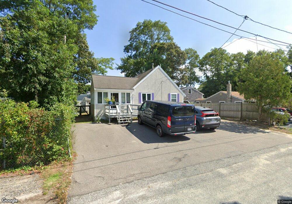
14 Lone Tree Rd Dennis Port, MA 02639
Dennis Port NeighborhoodEstimated Value: $406,000 - $505,000
1
Bed
1
Bath
686
Sq Ft
$689/Sq Ft
Est. Value
About This Home
This home is located at 14 Lone Tree Rd, Dennis Port, MA 02639 and is currently estimated at $472,766, approximately $689 per square foot. 14 Lone Tree Rd is a home located in Barnstable County with nearby schools including Dennis-Yarmouth Regional High School and St. Pius X. School.
Ownership History
Date
Name
Owned For
Owner Type
Purchase Details
Closed on
Dec 26, 2007
Sold by
Arena Anthonino A and Arena Lorraine S
Bought by
Arena Alan A
Current Estimated Value
Home Financials for this Owner
Home Financials are based on the most recent Mortgage that was taken out on this home.
Original Mortgage
$120,000
Outstanding Balance
$76,180
Interest Rate
6.27%
Mortgage Type
Purchase Money Mortgage
Estimated Equity
$396,586
Create a Home Valuation Report for This Property
The Home Valuation Report is an in-depth analysis detailing your home's value as well as a comparison with similar homes in the area
Home Values in the Area
Average Home Value in this Area
Purchase History
| Date | Buyer | Sale Price | Title Company |
|---|---|---|---|
| Arena Alan A | $150,000 | -- |
Source: Public Records
Mortgage History
| Date | Status | Borrower | Loan Amount |
|---|---|---|---|
| Open | Arena Alan A | $120,000 |
Source: Public Records
Tax History Compared to Growth
Tax History
| Year | Tax Paid | Tax Assessment Tax Assessment Total Assessment is a certain percentage of the fair market value that is determined by local assessors to be the total taxable value of land and additions on the property. | Land | Improvement |
|---|---|---|---|---|
| 2025 | $1,745 | $403,100 | $174,200 | $228,900 |
| 2024 | $1,613 | $367,500 | $167,500 | $200,000 |
| 2023 | $1,562 | $334,400 | $152,300 | $182,100 |
| 2022 | $1,612 | $287,800 | $137,200 | $150,600 |
| 2021 | $1,667 | $276,500 | $153,700 | $122,800 |
| 2020 | $1,510 | $247,500 | $134,500 | $113,000 |
| 2019 | $1,443 | $233,800 | $131,800 | $102,000 |
| 2018 | $1,392 | $219,600 | $125,500 | $94,100 |
| 2017 | $1,278 | $207,800 | $116,600 | $91,200 |
| 2016 | $1,330 | $203,600 | $125,500 | $78,100 |
| 2015 | $1,303 | $203,600 | $125,500 | $78,100 |
| 2014 | $1,005 | $158,300 | $107,600 | $50,700 |
Source: Public Records
Map
Nearby Homes
- 71 Main St
- 4 Coffey Ln
- 19 Standish Way
- 125 Main St Unit 3
- 12 Spoonbill Rd
- 22 Wixon Rd
- 80 Michaels Ave
- 72 Bassett Ln
- 268 Main St
- 95 Center St
- 15 Woodside Park Rd
- 31 Easy St
- 26 Center St
- 3 Pinefield Ln
- 20 Aunt Debbys Rd
- 78 Upper County Rd Unit A&B
- 78 Upper County Rd
- 61 Trotters Ln
- 24 Indian Trail
- 37 Ocean Dr Unit 2
- 18 Lone Tree Rd
- 8 Lone Tree Rd
- 17 Shad Hole Rd
- 15 Lone Tree Rd
- 9 Shad Hole Rd
- 26 Lone Tree Rd
- 26 Lone Tree Rd Unit B
- 26 Lone Tree Rd Unit A
- 26 Lone Tree Rd Unit 1&2
- 49 Main St
- 11 Shad Hole Rd
- 17 Lone Tree Rd
- 31 Massachusetts 28 Unit 1
- 31 Massachusetts 28
- 31 Main St
- 19 Main St
- 21 Lone Tree Rd
- 10 Shad Hole Rd
- 5 Colony Rd
- 9 Colony Rd