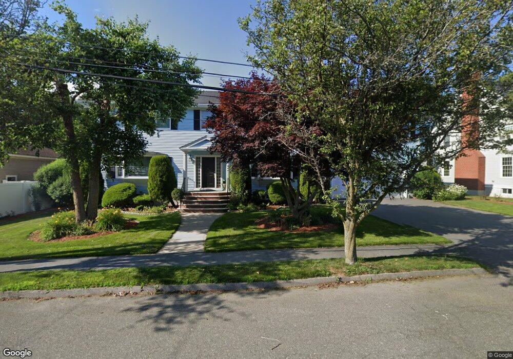
14 Longwood Dr Swampscott, MA 01907
Estimated Value: $1,012,000 - $1,306,000
4
Beds
3
Baths
3,828
Sq Ft
$315/Sq Ft
Est. Value
About This Home
This home is located at 14 Longwood Dr, Swampscott, MA 01907 and is currently estimated at $1,204,029, approximately $314 per square foot. 14 Longwood Dr is a home located in Essex County with nearby schools including Swampscott Middle School and Swampscott High School.
Ownership History
Date
Name
Owned For
Owner Type
Purchase Details
Closed on
May 9, 1997
Sold by
Eisener George W
Bought by
Perez Clifford A
Current Estimated Value
Home Financials for this Owner
Home Financials are based on the most recent Mortgage that was taken out on this home.
Original Mortgage
$350,800
Outstanding Balance
$43,069
Interest Rate
7.88%
Mortgage Type
Purchase Money Mortgage
Estimated Equity
$1,160,960
Purchase Details
Closed on
Dec 24, 1992
Sold by
Andover Bank
Bought by
Ford Joseph E
Purchase Details
Closed on
May 7, 1991
Sold by
Kelley James W
Bought by
Blanchette James R
Home Financials for this Owner
Home Financials are based on the most recent Mortgage that was taken out on this home.
Original Mortgage
$112,100
Interest Rate
9.55%
Mortgage Type
Purchase Money Mortgage
Create a Home Valuation Report for This Property
The Home Valuation Report is an in-depth analysis detailing your home's value as well as a comparison with similar homes in the area
Home Values in the Area
Average Home Value in this Area
Purchase History
| Date | Buyer | Sale Price | Title Company |
|---|---|---|---|
| Perez Clifford A | $120,000 | -- | |
| Perez Clifford A | $120,000 | -- | |
| Ford Joseph E | $60,000 | -- | |
| Blanchette James R | $137,000 | -- | |
| Blanchette James R | $137,000 | -- |
Source: Public Records
Mortgage History
| Date | Status | Borrower | Loan Amount |
|---|---|---|---|
| Open | Perez Clifford A | $350,800 | |
| Closed | Blanchette James R | $350,800 | |
| Previous Owner | Blanchette James R | $112,100 |
Source: Public Records
Tax History Compared to Growth
Tax History
| Year | Tax Paid | Tax Assessment Tax Assessment Total Assessment is a certain percentage of the fair market value that is determined by local assessors to be the total taxable value of land and additions on the property. | Land | Improvement |
|---|---|---|---|---|
| 2025 | $11,238 | $979,800 | $335,100 | $644,700 |
| 2024 | $11,580 | $1,007,800 | $320,100 | $687,700 |
| 2023 | $10,626 | $905,100 | $300,100 | $605,000 |
| 2022 | $10,410 | $811,400 | $250,100 | $561,300 |
| 2021 | $10,118 | $733,200 | $225,100 | $508,100 |
| 2020 | $10,363 | $724,700 | $225,100 | $499,600 |
| 2019 | $10,711 | $704,700 | $205,100 | $499,600 |
| 2018 | $10,947 | $684,200 | $205,100 | $479,100 |
| 2017 | $11,102 | $636,200 | $180,100 | $456,100 |
| 2016 | $10,765 | $621,200 | $165,100 | $456,100 |
| 2015 | $10,654 | $621,200 | $165,100 | $456,100 |
| 2014 | $10,833 | $579,300 | $140,000 | $439,300 |
Source: Public Records
Map
Nearby Homes
- 10-12 Fairview Ave
- 2 Gracie Ln Unit 4
- 445 Essex St Unit 304
- 8 Ryan Place
- 306 Paradise Rd
- 309 Paradise Rd
- 51 Barnstable St
- 76 Stetson Ave
- 1004 Paradise Rd Unit PHJ
- 27 Weatherly Dr Unit 27
- 1002 Paradise Rd Unit PHE
- 1006 Paradise Rd Unit 3R
- 71 Walnut Rd
- 86 Freedom Hollow
- 106 Norfolk Ave
- 98 Paradise Rd
- 6 Loring Hills Ave Unit D3
- 80 Norfolk Ave Unit 1
- 100 Burpee Rd
- 71 Greenwood Ave Unit 207
- 12 Longwood Dr
- 16 Longwood Dr
- 61 Prospect St
- 63 Prospect St
- 59 Prospect St
- 13 Longwood Dr
- 57 Prospect St
- 15 Longwood Dr
- 18 Longwood Dr
- 55 Prospect St
- 11 Longwood Dr
- 67 Prospect St
- 10 Longwood Dr
- 12 Summit View Dr
- 17 Longwood Dr
- 51 Prospect St
- 14 Summit View Dr
- 71 Prospect St
- 54 Prospect St
- 56 Prospect St