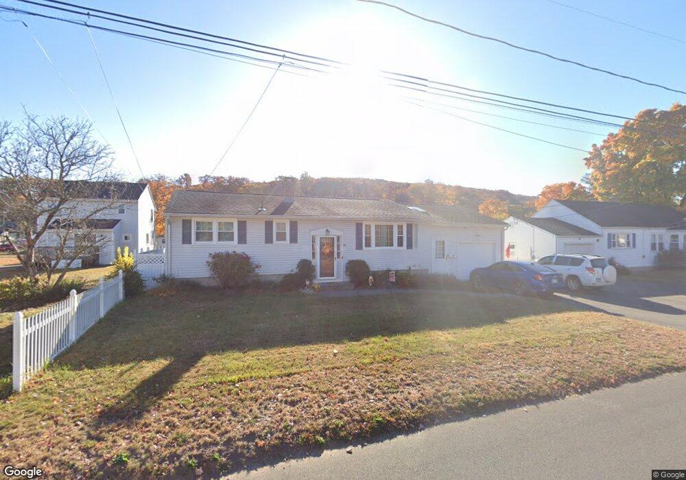
14 Loomis Ave Plainville, CT 06062
Estimated Value: $306,000 - $378,000
3
Beds
3
Baths
986
Sq Ft
$336/Sq Ft
Est. Value
About This Home
This home is located at 14 Loomis Ave, Plainville, CT 06062 and is currently estimated at $331,585, approximately $336 per square foot. 14 Loomis Ave is a home located in Hartford County with nearby schools including Middle School Of Plainville, Plainville High School, and Great Beginnings.
Ownership History
Date
Name
Owned For
Owner Type
Purchase Details
Closed on
Apr 23, 2021
Sold by
Brown Joyce K and Brown Donald R
Bought by
Torres Eneida
Current Estimated Value
Home Financials for this Owner
Home Financials are based on the most recent Mortgage that was taken out on this home.
Original Mortgage
$228,288
Outstanding Balance
$206,281
Interest Rate
3.05%
Mortgage Type
FHA
Estimated Equity
$125,304
Purchase Details
Closed on
Jun 10, 1998
Sold by
Gravelle Dorothy A
Bought by
Brown Joyce K and Brown Donald R
Home Financials for this Owner
Home Financials are based on the most recent Mortgage that was taken out on this home.
Original Mortgage
$99,900
Interest Rate
7.11%
Mortgage Type
Unknown
Purchase Details
Closed on
Aug 19, 1996
Sold by
Arshalouss Abrahemian
Bought by
Gravelle Ronald
Create a Home Valuation Report for This Property
The Home Valuation Report is an in-depth analysis detailing your home's value as well as a comparison with similar homes in the area
Home Values in the Area
Average Home Value in this Area
Purchase History
| Date | Buyer | Sale Price | Title Company |
|---|---|---|---|
| Torres Eneida | $232,500 | None Available | |
| Torres Eneida | $232,500 | None Available | |
| Brown Joyce K | $111,000 | -- | |
| Brown Joyce K | $111,000 | -- | |
| Gravelle Ronald | $51,000 | -- | |
| Gravelle Ronald | $51,000 | -- |
Source: Public Records
Mortgage History
| Date | Status | Borrower | Loan Amount |
|---|---|---|---|
| Open | Torres Eneida | $228,288 | |
| Closed | Torres Eneida | $228,288 | |
| Previous Owner | Gravelle Ronald | $71,000 | |
| Previous Owner | Gravelle Ronald | $99,900 |
Source: Public Records
Tax History
| Year | Tax Paid | Tax Assessment Tax Assessment Total Assessment is a certain percentage of the fair market value that is determined by local assessors to be the total taxable value of land and additions on the property. | Land | Improvement |
|---|---|---|---|---|
| 2025 | $5,337 | $155,330 | $52,920 | $102,410 |
| 2024 | $5,070 | $155,330 | $52,920 | $102,410 |
| 2023 | $4,880 | $155,330 | $52,920 | $102,410 |
| 2022 | $4,759 | $155,330 | $52,920 | $102,410 |
| 2021 | $4,410 | $127,610 | $46,060 | $81,550 |
| 2020 | $4,418 | $127,610 | $46,060 | $81,550 |
| 2019 | $4,418 | $127,610 | $46,060 | $81,550 |
| 2018 | $4,318 | $127,610 | $46,060 | $81,550 |
| 2017 | $4,170 | $127,610 | $46,060 | $81,550 |
| 2016 | $3,784 | $118,300 | $41,720 | $76,580 |
| 2015 | $3,765 | $118,300 | $41,720 | $76,580 |
| 2014 | $4,033 | $128,520 | $42,770 | $85,750 |
Source: Public Records
Map
Nearby Homes
- 36 View St
- 248 Woodford Ave Unit 9
- 71 White Oak Ave Unit B6
- 19 Maple St
- 12 Rockwell Ave
- 270 East St
- 270R East St
- 29 Mountain View Dr
- 962 Shuttle Meadow Rd
- 50 Pierce St Unit 24
- 98 Cooke St
- 67 Shuttlemeadow Rd
- 12 Oakland St
- 180 S Washington St Unit 7
- 48 Plum Tree Rd
- 119 Pattonwood Dr
- 253 Cooke St Unit D
- 33 Colt St
- 62 Northampton Ln
- 45 Quail Hollow Dr
Your Personal Tour Guide
Ask me questions while you tour the home.