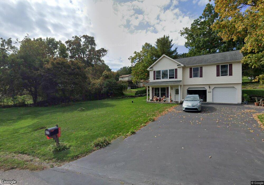
14 Mandys Ln Hunlock Creek, PA 18621
Estimated Value: $147,000 - $216,000
2
Beds
1
Bath
1,080
Sq Ft
$169/Sq Ft
Est. Value
About This Home
This home is located at 14 Mandys Ln, Hunlock Creek, PA 18621 and is currently estimated at $182,226, approximately $168 per square foot. 14 Mandys Ln is a home located in Luzerne County.
Ownership History
Date
Name
Owned For
Owner Type
Purchase Details
Closed on
Apr 17, 2020
Sold by
Sheruda Joseph H
Bought by
Lee Joann
Current Estimated Value
Home Financials for this Owner
Home Financials are based on the most recent Mortgage that was taken out on this home.
Original Mortgage
$59,200
Outstanding Balance
$52,344
Interest Rate
3.3%
Mortgage Type
New Conventional
Estimated Equity
$129,882
Purchase Details
Closed on
Nov 17, 2006
Sold by
Urganus Michael
Bought by
Jp Morgan Chase Bank
Create a Home Valuation Report for This Property
The Home Valuation Report is an in-depth analysis detailing your home's value as well as a comparison with similar homes in the area
Home Values in the Area
Average Home Value in this Area
Purchase History
| Date | Buyer | Sale Price | Title Company |
|---|---|---|---|
| Lee Joann | $72,000 | United One Resources Inc | |
| Jp Morgan Chase Bank | $2,326 | None Available |
Source: Public Records
Mortgage History
| Date | Status | Borrower | Loan Amount |
|---|---|---|---|
| Open | Lee Joann | $59,200 |
Source: Public Records
Tax History Compared to Growth
Tax History
| Year | Tax Paid | Tax Assessment Tax Assessment Total Assessment is a certain percentage of the fair market value that is determined by local assessors to be the total taxable value of land and additions on the property. | Land | Improvement |
|---|---|---|---|---|
| 2025 | $1,779 | $80,500 | $20,400 | $60,100 |
| 2024 | $1,769 | $80,500 | $20,400 | $60,100 |
| 2023 | $1,760 | $80,500 | $20,400 | $60,100 |
| 2022 | $1,665 | $80,500 | $20,400 | $60,100 |
| 2021 | $1,598 | $80,500 | $20,400 | $60,100 |
| 2020 | $1,598 | $80,500 | $20,400 | $60,100 |
| 2019 | $1,538 | $80,500 | $20,400 | $60,100 |
| 2018 | $1,476 | $80,500 | $20,400 | $60,100 |
| 2017 | $1,449 | $80,500 | $20,400 | $60,100 |
| 2016 | -- | $80,500 | $20,400 | $60,100 |
| 2015 | -- | $80,500 | $20,400 | $60,100 |
| 2014 | -- | $80,500 | $20,400 | $60,100 |
Source: Public Records
Map
Nearby Homes
- 15 Pearl St
- 32 Lake Ave
- 46 Country Crest Ln
- 983 Swamp Rd
- 641 Sorbertown Hill Rd
- 0 Moon Lake Rd
- 127 White Oak Dr
- 107 White Oak Dr
- 73 Adams Dr
- 0 Hunlock-Harveyville Rd
- 85 Sorbertown Hill Rd
- 0 Sweet Valley Rd
- 4B, C, & D Hayfield Rd
- 1B & C Hayfield Rd
- 1842 Pennsylvania 118
- 205 Post Office Rd
- 609 Main Rd
- 198 Indian Cave Rd
- Lot 54 Garden Dr
- 1011 Mill St
- 21 Eleanor Dr
- 1917 State Route 29 Hwy
- 11 Eleanor Dr
- 37 Jones Rd
- 22 Eleanor Dr
- 1925 State Route 29 Hwy
- 24 Eleanor Dr
- 18 Eleanor Dr
- 10 Eleanor Dr
- 1913 State Route 29 Hwy
- 23 Jones Rd
- 1929 State Route 29 Hwy
- 7 Jones Rd
- 1929 Pennsylvania 29
- 1931 State Route 29 Hwy
- 1916 State Route 29 Hwy
- 8 Cook St
- 1935 State Route 29 Hwy
- 1912 State Route 29 Hwy
- 2 Sando St