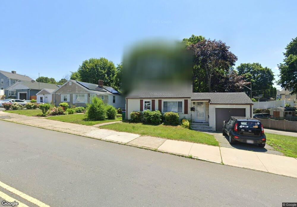
14 Maple St Lynn, MA 01904
Chatham Street NeighborhoodEstimated Value: $502,000 - $628,000
2
Beds
1
Bath
972
Sq Ft
$576/Sq Ft
Est. Value
About This Home
This home is located at 14 Maple St, Lynn, MA 01904 and is currently estimated at $559,494, approximately $575 per square foot. 14 Maple St is a home located in Essex County with nearby schools including Hood Elementary School, William R. Fallon School, and Pickering Middle School.
Ownership History
Date
Name
Owned For
Owner Type
Purchase Details
Closed on
May 20, 2008
Sold by
Thibedeau Carol Est
Bought by
Garry Beth
Current Estimated Value
Home Financials for this Owner
Home Financials are based on the most recent Mortgage that was taken out on this home.
Original Mortgage
$160,000
Interest Rate
5.91%
Mortgage Type
Purchase Money Mortgage
Create a Home Valuation Report for This Property
The Home Valuation Report is an in-depth analysis detailing your home's value as well as a comparison with similar homes in the area
Home Values in the Area
Average Home Value in this Area
Purchase History
| Date | Buyer | Sale Price | Title Company |
|---|---|---|---|
| Garry Beth | $209,000 | -- | |
| Garry Beth | $209,000 | -- |
Source: Public Records
Mortgage History
| Date | Status | Borrower | Loan Amount |
|---|---|---|---|
| Open | Garry Beth | $153,700 | |
| Closed | Garry Beth | $165,000 | |
| Closed | Garry Beth | $160,000 |
Source: Public Records
Tax History
| Year | Tax Paid | Tax Assessment Tax Assessment Total Assessment is a certain percentage of the fair market value that is determined by local assessors to be the total taxable value of land and additions on the property. | Land | Improvement |
|---|---|---|---|---|
| 2025 | $5,708 | $551,000 | $193,000 | $358,000 |
| 2024 | $5,455 | $518,000 | $188,600 | $329,400 |
| 2023 | $5,200 | $466,400 | $177,300 | $289,100 |
| 2022 | $5,053 | $406,500 | $139,400 | $267,100 |
| 2021 | $4,829 | $370,600 | $141,100 | $229,500 |
| 2020 | $4,600 | $343,300 | $127,200 | $216,100 |
| 2019 | $4,650 | $325,200 | $119,800 | $205,400 |
| 2018 | $4,353 | $287,300 | $111,500 | $175,800 |
| 2017 | $3,822 | $245,000 | $98,400 | $146,600 |
| 2016 | $3,704 | $228,900 | $91,000 | $137,900 |
| 2015 | $3,655 | $218,200 | $96,700 | $121,500 |
Source: Public Records
Map
Nearby Homes
- 12 Maple St
- 22 Maple St
- 11 Hatzis Way
- 8 Maple St
- 23 Maple St
- 30 Stanwood St
- 29 Brooklawn Terrace
- 15 Maple St Unit 17
- 15 Maple St Unit 1
- 17 Maple St Unit 1
- 28 Maple St
- 23 Brooklawn Terrace
- 35 Brooklawn Terrace
- 67 Western Ave
- 61 Western Ave
- 69 Western Ave Unit 69A
- 9 Maple St
- 26 Stanwood St
- 41 Brooklawn Terrace
- 19 Brooklawn Terrace
Your Personal Tour Guide
Ask me questions while you tour the home.