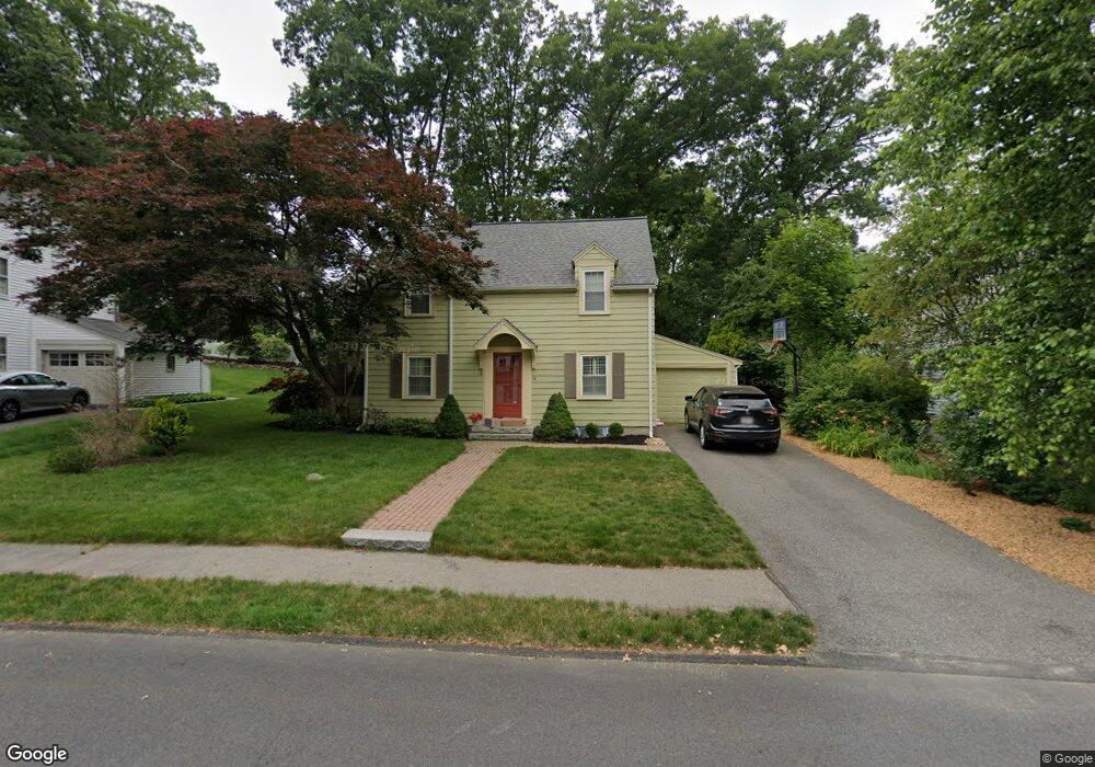
14 Martin Rd Wellesley Hills, MA 02481
Estimated Value: $993,000 - $1,163,000
3
Beds
2
Baths
1,440
Sq Ft
$760/Sq Ft
Est. Value
About This Home
This home is located at 14 Martin Rd, Wellesley Hills, MA 02481 and is currently estimated at $1,094,521, approximately $760 per square foot. 14 Martin Rd is a home located in Norfolk County with nearby schools including Katharine Lee Bates Elementary School, Wellesley Middle School, and Wellesley Sr High School.
Ownership History
Date
Name
Owned For
Owner Type
Purchase Details
Closed on
Jul 21, 2006
Sold by
Garvey John P and Garvey Juliet P
Bought by
Harju Andrew T and Harju Joy B
Current Estimated Value
Home Financials for this Owner
Home Financials are based on the most recent Mortgage that was taken out on this home.
Original Mortgage
$492,000
Outstanding Balance
$292,411
Interest Rate
6.67%
Mortgage Type
Purchase Money Mortgage
Estimated Equity
$802,110
Purchase Details
Closed on
Jun 25, 1998
Sold by
Dibiase Anthony D and Dibiase Mary D
Bought by
Garvey John P and Garvey Juliet P
Home Financials for this Owner
Home Financials are based on the most recent Mortgage that was taken out on this home.
Original Mortgage
$272,000
Interest Rate
7.09%
Mortgage Type
Purchase Money Mortgage
Purchase Details
Closed on
May 15, 1992
Sold by
Holownia Michael E and Holownia Linda A
Bought by
Dibiase Anthony D and Dibiase Mary D
Home Financials for this Owner
Home Financials are based on the most recent Mortgage that was taken out on this home.
Original Mortgage
$185,600
Interest Rate
8.89%
Mortgage Type
Purchase Money Mortgage
Create a Home Valuation Report for This Property
The Home Valuation Report is an in-depth analysis detailing your home's value as well as a comparison with similar homes in the area
Home Values in the Area
Average Home Value in this Area
Purchase History
| Date | Buyer | Sale Price | Title Company |
|---|---|---|---|
| Harju Andrew T | $615,000 | -- | |
| Garvey John P | $340,000 | -- | |
| Dibiase Anthony D | $238,000 | -- |
Source: Public Records
Mortgage History
| Date | Status | Borrower | Loan Amount |
|---|---|---|---|
| Open | Harju Andrew T | $492,000 | |
| Closed | Harju Andrew T | $61,500 | |
| Previous Owner | Dibiase Anthony D | $272,000 | |
| Previous Owner | Dibiase Anthony D | $186,000 | |
| Previous Owner | Dibiase Anthony D | $185,600 |
Source: Public Records
Tax History Compared to Growth
Tax History
| Year | Tax Paid | Tax Assessment Tax Assessment Total Assessment is a certain percentage of the fair market value that is determined by local assessors to be the total taxable value of land and additions on the property. | Land | Improvement |
|---|---|---|---|---|
| 2025 | $10,763 | $1,047,000 | $912,000 | $135,000 |
| 2024 | $9,619 | $924,000 | $793,000 | $131,000 |
| 2023 | $9,091 | $794,000 | $674,000 | $120,000 |
| 2022 | $8,842 | $757,000 | $577,000 | $180,000 |
| 2021 | $8,895 | $757,000 | $577,000 | $180,000 |
| 2020 | $8,751 | $757,000 | $577,000 | $180,000 |
| 2019 | $8,758 | $757,000 | $577,000 | $180,000 |
| 2018 | $8,102 | $678,000 | $552,000 | $126,000 |
| 2017 | $7,994 | $678,000 | $552,000 | $126,000 |
| 2016 | $7,867 | $665,000 | $543,000 | $122,000 |
| 2015 | $7,410 | $641,000 | $523,000 | $118,000 |
Source: Public Records
Map
Nearby Homes
- 6 Wilde Rd
- 23 Pilgrim Rd
- 12 Russell Rd Unit 405
- 365 Weston Rd
- 13 Cavanaugh Rd
- 6 Norwich Rd
- 18 Patton Rd
- 51 Boulder Brook Rd
- 428 Weston Rd
- 209 Bristol Rd
- 36 Oakridge Rd
- 19 Louis Dr
- 63 Oak St Unit B
- 45 Mayo Rd
- 50 Upson Rd
- 6 Nantucket Rd
- 16 Stearns Rd Unit 101
- 16 Stearns Rd Unit 302
- 16 Stearns Rd Unit 207
- 16 Stearns Rd Unit 301