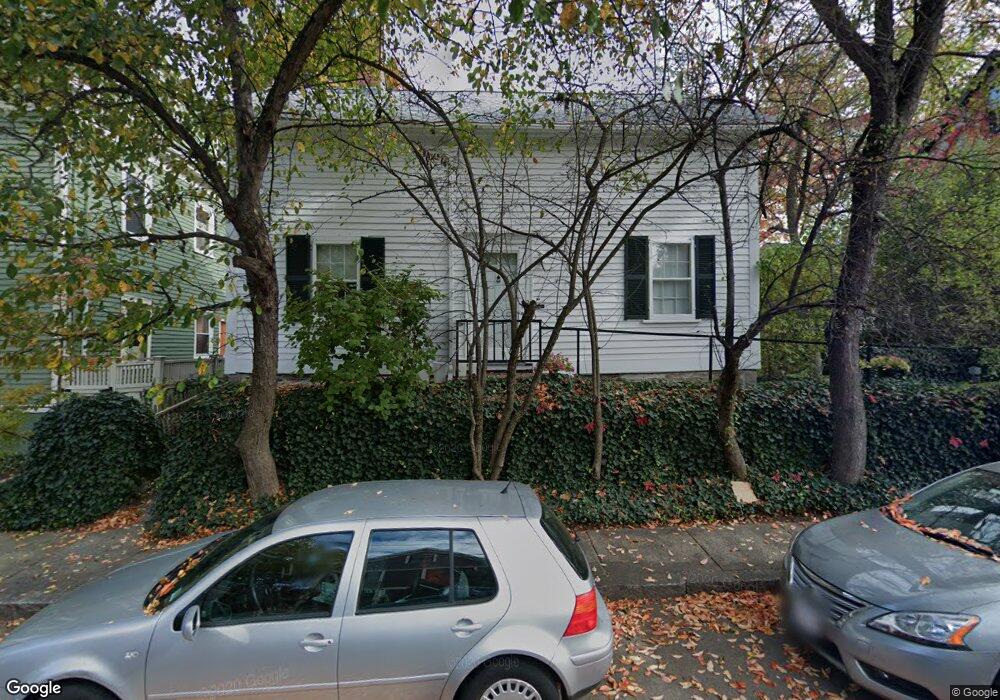
14 Maynard Place Cambridge, MA 02138
West Cambridge NeighborhoodEstimated Value: $1,460,000 - $2,504,202
4
Beds
2
Baths
2,502
Sq Ft
$843/Sq Ft
Est. Value
About This Home
This home is located at 14 Maynard Place, Cambridge, MA 02138 and is currently estimated at $2,109,551, approximately $843 per square foot. 14 Maynard Place is a home located in Middlesex County with nearby schools including St Peter School, Shady Hill School, and Buckingham Browne & Nichols School.
Ownership History
Date
Name
Owned For
Owner Type
Purchase Details
Closed on
Mar 17, 1994
Sold by
Davidson Harold
Bought by
Nemser Paul E and Nemser Rebecca M
Current Estimated Value
Home Financials for this Owner
Home Financials are based on the most recent Mortgage that was taken out on this home.
Original Mortgage
$320,000
Interest Rate
6.9%
Mortgage Type
Purchase Money Mortgage
Purchase Details
Closed on
Jun 2, 1989
Sold by
Gordon William J J
Bought by
Davidson Harold
Home Financials for this Owner
Home Financials are based on the most recent Mortgage that was taken out on this home.
Original Mortgage
$50,000
Interest Rate
10.07%
Create a Home Valuation Report for This Property
The Home Valuation Report is an in-depth analysis detailing your home's value as well as a comparison with similar homes in the area
Home Values in the Area
Average Home Value in this Area
Purchase History
| Date | Buyer | Sale Price | Title Company |
|---|---|---|---|
| Nemser Paul E | $400,000 | -- | |
| Davidson Harold | $475,000 | -- |
Source: Public Records
Mortgage History
| Date | Status | Borrower | Loan Amount |
|---|---|---|---|
| Closed | Davidson Harold | $320,000 | |
| Previous Owner | Davidson Harold | $282,000 | |
| Previous Owner | Davidson Harold | $50,000 | |
| Previous Owner | Davidson Harold | $250,000 |
Source: Public Records
Tax History Compared to Growth
Tax History
| Year | Tax Paid | Tax Assessment Tax Assessment Total Assessment is a certain percentage of the fair market value that is determined by local assessors to be the total taxable value of land and additions on the property. | Land | Improvement |
|---|---|---|---|---|
| 2025 | $12,536 | $1,974,100 | $0 | $1,974,100 |
| 2024 | $11,945 | $2,017,800 | $0 | $2,017,800 |
| 2023 | $10,668 | $1,820,400 | $0 | $1,820,400 |
| 2022 | $10,445 | $1,764,300 | $0 | $1,764,300 |
| 2021 | $9,970 | $1,704,200 | $0 | $1,704,200 |
| 2020 | $9,407 | $1,636,000 | $0 | $1,636,000 |
| 2019 | $9,001 | $1,515,400 | $0 | $1,515,400 |
| 2018 | $8,753 | $1,391,600 | $0 | $1,391,600 |
| 2017 | $8,681 | $1,337,600 | $0 | $1,337,600 |
| 2016 | $8,573 | $1,226,400 | $0 | $1,226,400 |
| 2015 | $8,500 | $1,087,000 | $0 | $1,087,000 |
| 2014 | $8,376 | $999,500 | $0 | $999,500 |
Source: Public Records
Map
Nearby Homes
- 20 Maynard Place
- 1010 Memorial Dr Unit 6G
- 15 Hubbard Park Rd
- 48 Hubbard Park Rd
- 158 Brattle St
- 153 Brattle St
- 172 Brattle St
- 32 Hawthorn St
- 3 Berkeley Place
- 988 Memorial Dr Unit 386
- 5 Brewer St Unit 5
- 986 Memorial Dr Unit 404
- 984 Memorial Dr Unit 984-503
- 983 Memorial Dr Unit 502
- 12 Berkeley St
- 234 Huron Ave
- 130 Mount Auburn St Unit 108
- 22 Concord Ave Unit 10
- 44 Garden St
- 52 Garden St Unit B2
- 12 Maynard Place
- 18 Maynard Place
- 13 Maynard Place Unit 1
- 17 Maynard Place
- 9 Maynard Place
- 4 Kenway St
- 6 Kenway St
- 2 Kenway St
- 27 Gibson St Unit 38 - 5D
- 27 Gibson St Unit 5
- 27 Gibson St Unit 5D
- 27 Gibson St Unit 6D
- 27 Gibson St
- 8 Kenway St
- 25 Gibson St
- 21 Gibson St
- 21 Gibson St Unit 3
- 15 Gibson St
- 10 Kenway St
- 7 Gibson St