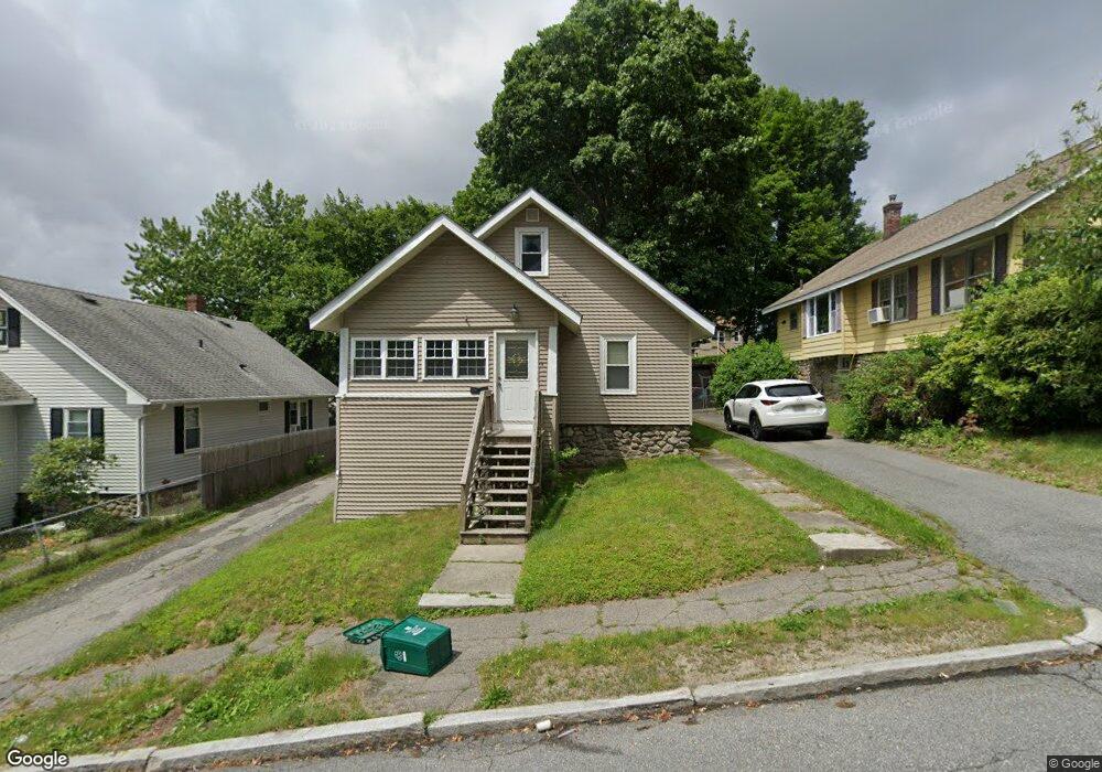
14 Merton Rd Worcester, MA 01605
North Lincoln Street NeighborhoodEstimated Value: $379,000 - $413,000
2
Beds
2
Baths
1,290
Sq Ft
$309/Sq Ft
Est. Value
About This Home
This home is located at 14 Merton Rd, Worcester, MA 01605 and is currently estimated at $399,168, approximately $309 per square foot. 14 Merton Rd is a home located in Worcester County with nearby schools including Jacob Hiatt Magnet School, Chandler Magnet, and Wawecus Road School.
Ownership History
Date
Name
Owned For
Owner Type
Purchase Details
Closed on
May 30, 2019
Sold by
Butt Arthur O
Bought by
Assabet Realty Llc
Current Estimated Value
Purchase Details
Closed on
Aug 17, 2005
Sold by
Nye Jacqueline M
Bought by
Butt Arthur O
Home Financials for this Owner
Home Financials are based on the most recent Mortgage that was taken out on this home.
Original Mortgage
$144,000
Interest Rate
5.66%
Mortgage Type
Purchase Money Mortgage
Create a Home Valuation Report for This Property
The Home Valuation Report is an in-depth analysis detailing your home's value as well as a comparison with similar homes in the area
Home Values in the Area
Average Home Value in this Area
Purchase History
| Date | Buyer | Sale Price | Title Company |
|---|---|---|---|
| Assabet Realty Llc | -- | -- | |
| Butt Arthur O | $160,000 | -- |
Source: Public Records
Mortgage History
| Date | Status | Borrower | Loan Amount |
|---|---|---|---|
| Previous Owner | Butt Arthur O | $144,000 |
Source: Public Records
Tax History Compared to Growth
Tax History
| Year | Tax Paid | Tax Assessment Tax Assessment Total Assessment is a certain percentage of the fair market value that is determined by local assessors to be the total taxable value of land and additions on the property. | Land | Improvement |
|---|---|---|---|---|
| 2025 | $4,543 | $344,400 | $107,100 | $237,300 |
| 2024 | $4,439 | $322,800 | $107,100 | $215,700 |
| 2023 | $4,265 | $297,400 | $93,100 | $204,300 |
| 2022 | $3,892 | $255,900 | $74,500 | $181,400 |
| 2021 | $3,766 | $231,300 | $59,600 | $171,700 |
| 2020 | $3,679 | $216,400 | $59,600 | $156,800 |
| 2019 | $3,382 | $187,900 | $53,600 | $134,300 |
| 2018 | $3,362 | $177,800 | $53,600 | $124,200 |
| 2017 | $3,246 | $168,900 | $53,600 | $115,300 |
| 2016 | $3,248 | $157,600 | $40,600 | $117,000 |
| 2015 | $3,163 | $157,600 | $40,600 | $117,000 |
| 2014 | $3,080 | $157,600 | $40,600 | $117,000 |
Source: Public Records
Map
Nearby Homes
- 37 Kenwood Ave
- 36 Melrose St
- 3 Selden St
- 23 Ashton St
- 2 Selden St
- 19 Mckinley Rd
- 33 Denmark St
- 73 Paine St
- 14 Mary Ann Dr
- 93 W Boylston St
- 87 W Boylston St
- 89 W Boylston St Unit 4
- 10 Hemans St Unit 9
- 30 Boardman St
- 15 Boardman St
- 26 Tower St
- 44 Boardman St
- 23 Dryden St
- 10 Dryden St Unit 7
- 11 Gifford Dr
- 16 Merton Rd
- 12 Merton Rd
- 8 Merton Rd
- 18 Merton Rd
- 45 Burncoat Terrace
- 153 Millbrook St
- 157 Millbrook St
- 43 Burncoat Terrace
- 15 Merton Rd
- 49 Burncoat Terrace
- 41 Burncoat Terrace
- 159 Millbrook St
- 151 Millbrook St
- 51 Burncoat Terrace
- 161 Millbrook St
- 54 Burncoat Terrace
- 37 Burncoat Terrace
- 60 Burncoat Terrace
- 60 Burncoat Terrace Unit Terrace
- 46 Burncoat Heights