Estimated Value: $181,000 - $230,000
Studio
2
Baths
1,548
Sq Ft
$129/Sq Ft
Est. Value
About This Home
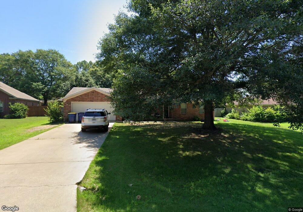
This home is located at 14 Michael Dr, Cabot, AR 72023 and is currently estimated at $198,931, approximately $128 per square foot. 14 Michael Dr is a home located in Lonoke County with nearby schools including Southside Elementary School, Cabot Junior High South, and Cabot Middle School South.
Ownership History
Date
Name
Owned For
Owner Type
Purchase Details
Closed on
Jul 31, 2023
Sold by
Gu Yuyuan and Chen Dandan
Bought by
Nj Rocktown Llc
Current Estimated Value
Purchase Details
Closed on
May 28, 2021
Sold by
Kirkland Richard B and Kirkland Jodie
Bought by
Gu Yuyuan and Chen Dandan
Purchase Details
Closed on
Jun 1, 2004
Bought by
Kirkland
Purchase Details
Closed on
May 28, 2004
Bought by
Kirkland
Purchase Details
Closed on
Feb 13, 1992
Bought by
Kirkland and Wife Karla
Create a Home Valuation Report for This Property
The Home Valuation Report is an in-depth analysis detailing your home's value as well as a comparison with similar homes in the area
Purchase History
| Date | Buyer | Sale Price | Title Company |
|---|---|---|---|
| Nj Rocktown Llc | -- | None Listed On Document | |
| Gu Yuyuan | $134,000 | Commerce Ttl & Closing Svcs | |
| Gu Yuyuan | $134,000 | Commerce Title | |
| Kirkland | -- | -- | |
| Kirkland | -- | -- | |
| Kirkland | $10,000 | -- | |
| Kirkland | $10,000 | -- |
Source: Public Records
Tax History
| Year | Tax Paid | Tax Assessment Tax Assessment Total Assessment is a certain percentage of the fair market value that is determined by local assessors to be the total taxable value of land and additions on the property. | Land | Improvement |
|---|---|---|---|---|
| 2025 | $1,220 | $23,970 | $3,600 | $20,370 |
| 2024 | $1,220 | $23,970 | $3,600 | $20,370 |
| 2023 | $1,220 | $23,970 | $3,600 | $20,370 |
| 2022 | $1,220 | $23,970 | $3,600 | $20,370 |
| 2021 | $1,220 | $23,970 | $3,600 | $20,370 |
| 2020 | $1,219 | $23,950 | $3,600 | $20,350 |
| 2019 | $1,219 | $23,950 | $3,600 | $20,350 |
| 2018 | $1,183 | $23,950 | $3,600 | $20,350 |
| 2017 | $1,099 | $23,950 | $3,600 | $20,350 |
| 2016 | $1,183 | $23,950 | $3,600 | $20,350 |
| 2015 | $1,289 | $26,100 | $3,600 | $22,500 |
| 2014 | $1,289 | $26,100 | $3,600 | $22,500 |
Source: Public Records
Map
Nearby Homes
- 12 Michael Dr
- 507 Southhaven Ave
- 1 Bill Foster Memorial Hwy E
- 10 Bill Foster Memorial Hwy E
- 2702 Bill Foster Memorial Hwy E Unit Hwy 321
- 11 Dale Ct
- 15 Judith Ct
- Lot 107 Southhaven
- 12 Daytona
- 3215 Kerr Station Rd
- Lots 44 &45 Broadmoor Cir
- 105 Earnhardt Cir
- 19 Talladega Dr
- 35 Warren St
- 11 Warren St
- 1309 S Pine St
- 45 Winners Cir
- 61 Wolfsbridge Loop
- 60 Wolfsbridge Loop
- 54 Wolfsbridge Loop
Your Personal Tour Guide
Ask me questions while you tour the home.