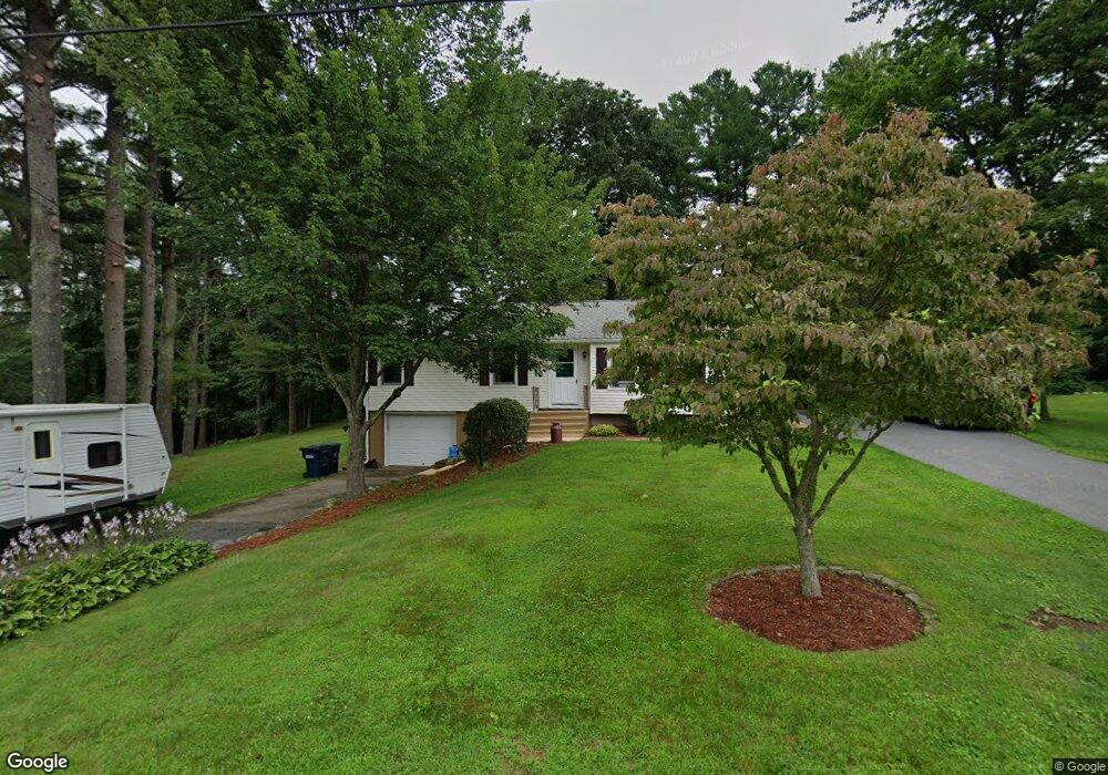
14 Miles Rd Rutland, MA 01543
Estimated Value: $431,000 - $435,646
3
Beds
1
Bath
1,036
Sq Ft
$419/Sq Ft
Est. Value
About This Home
This home is located at 14 Miles Rd, Rutland, MA 01543 and is currently estimated at $433,662, approximately $418 per square foot. 14 Miles Rd is a home located in Worcester County with nearby schools including Wachusett Regional High School.
Ownership History
Date
Name
Owned For
Owner Type
Purchase Details
Closed on
Oct 30, 2023
Sold by
Roy Donna P
Bought by
Roy Donna P and Roy Marc A
Current Estimated Value
Purchase Details
Closed on
Apr 23, 2020
Sold by
Macchi Joseph P and Macchi Patricia H
Bought by
Roy Donna M
Purchase Details
Closed on
May 15, 2009
Sold by
Cotton Daniel I and Lee Mark Twombly
Bought by
Macchi Patricia H and Macchi Joseph P
Purchase Details
Closed on
May 8, 2007
Sold by
North End Rt and Hadley
Bought by
Foster John J
Home Financials for this Owner
Home Financials are based on the most recent Mortgage that was taken out on this home.
Original Mortgage
$230,000
Interest Rate
6.23%
Mortgage Type
Purchase Money Mortgage
Purchase Details
Closed on
Aug 2, 2006
Sold by
Beard Charles R
Bought by
North End Rt
Create a Home Valuation Report for This Property
The Home Valuation Report is an in-depth analysis detailing your home's value as well as a comparison with similar homes in the area
Home Values in the Area
Average Home Value in this Area
Purchase History
| Date | Buyer | Sale Price | Title Company |
|---|---|---|---|
| Roy Donna P | -- | None Available | |
| Roy Donna M | -- | None Available | |
| Macchi Patricia H | $172,000 | -- | |
| Foster John J | $319,900 | -- | |
| North End Rt | -- | -- | |
| North End Rt | $50,000 | -- |
Source: Public Records
Mortgage History
| Date | Status | Borrower | Loan Amount |
|---|---|---|---|
| Previous Owner | Foster John J | $230,000 |
Source: Public Records
Tax History Compared to Growth
Tax History
| Year | Tax Paid | Tax Assessment Tax Assessment Total Assessment is a certain percentage of the fair market value that is determined by local assessors to be the total taxable value of land and additions on the property. | Land | Improvement |
|---|---|---|---|---|
| 2025 | $5,085 | $357,100 | $84,000 | $273,100 |
| 2024 | $4,832 | $325,800 | $80,300 | $245,500 |
| 2023 | $4,172 | $304,100 | $75,700 | $228,400 |
| 2022 | $4,053 | $256,700 | $63,900 | $192,800 |
| 2021 | $3,829 | $229,300 | $63,900 | $165,400 |
| 2020 | $3,754 | $213,200 | $60,400 | $152,800 |
| 2019 | $3,678 | $205,600 | $57,600 | $148,000 |
| 2018 | $3,454 | $190,500 | $57,600 | $132,900 |
| 2017 | $3,391 | $185,100 | $57,600 | $127,500 |
| 2016 | $3,107 | $178,900 | $58,600 | $120,300 |
| 2015 | $2,914 | $165,100 | $58,600 | $106,500 |
| 2014 | $2,825 | $165,100 | $58,600 | $106,500 |
Source: Public Records
Map
Nearby Homes
- 5 Miles Rd
- 55 Pommogussett Rd
- 32 Pommogussett Rd Unit 1
- 10 Soucy Dr
- 25 Watson Ln
- 16 Richards Ave
- 28 Forest Hill Dr
- 11 Lewis St
- 21 Lewis St
- 6 Lewis St
- 12 Lewis St
- 27 Lewis St
- 40 Brunelle Dr
- 47 Woodside Ave
- 2 Forest Hill Dr
- 51 Woodside Ave
- 10 Fidelity Dr Unit 5
- 12 Fidelity Dr Unit 6
- 132 Fidelity Dr Unit 61
- 85 Maple Ave Unit A
- 12 Miles Rd
- 16 Miles Rd
- 18 Miles Rd
- 17 Miles Rd
- 9 Miles Rd
- 19 Miles Rd
- 8 Miles Rd
- 15 Miles Rd
- 43 Pommogussett Rd
- Lot 1&3 Moulton Mill Rd
- 1 Moulton Mill Rd
- 3 Moulton Mill Rd
- 51 Pommogussett Rd
- 21 Miles Rd
- 46 Pommogussett Rd
- 48 Pommogussett Rd
- 50 Pommogussett Rd
- 5 Moulton Mill Rd
- Lot 1-S Maple Ave
- Lot 1 Maple Ave