Estimated Value: $645,820 - $701,000
2
Beds
2
Baths
1,078
Sq Ft
$615/Sq Ft
Est. Value
About This Home
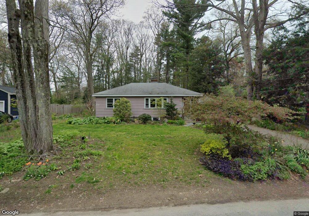
This home is located at 14 Mohegan Rd, Acton, MA 01720 and is currently estimated at $662,955, approximately $614 per square foot. 14 Mohegan Rd is a home located in Middlesex County with nearby schools including Acton-Boxborough Regional High School.
Ownership History
Date
Name
Owned For
Owner Type
Purchase Details
Closed on
May 4, 1998
Sold by
Grant Brooke A and Grant Edward W
Bought by
Strick Debra and Osgood Charles F
Current Estimated Value
Home Financials for this Owner
Home Financials are based on the most recent Mortgage that was taken out on this home.
Original Mortgage
$145,050
Interest Rate
7.04%
Mortgage Type
Purchase Money Mortgage
Purchase Details
Closed on
Jul 1, 1996
Sold by
Allred Burke
Bought by
Grant Edward W and Grant Brooke A
Home Financials for this Owner
Home Financials are based on the most recent Mortgage that was taken out on this home.
Original Mortgage
$120,000
Interest Rate
8.05%
Mortgage Type
Purchase Money Mortgage
Create a Home Valuation Report for This Property
The Home Valuation Report is an in-depth analysis detailing your home's value as well as a comparison with similar homes in the area
Home Values in the Area
Average Home Value in this Area
Purchase History
| Date | Buyer | Sale Price | Title Company |
|---|---|---|---|
| Strick Debra | $193,400 | -- | |
| Grant Edward W | $182,000 | -- |
Source: Public Records
Mortgage History
| Date | Status | Borrower | Loan Amount |
|---|---|---|---|
| Open | Grant Edward W | $143,000 | |
| Closed | Grant Edward W | $145,050 | |
| Previous Owner | Grant Edward W | $120,000 | |
| Previous Owner | Grant Edward W | $63,200 |
Source: Public Records
Tax History
| Year | Tax Paid | Tax Assessment Tax Assessment Total Assessment is a certain percentage of the fair market value that is determined by local assessors to be the total taxable value of land and additions on the property. | Land | Improvement |
|---|---|---|---|---|
| 2025 | $9,314 | $543,100 | $313,400 | $229,700 |
| 2024 | $8,882 | $532,800 | $313,400 | $219,400 |
| 2023 | $8,494 | $483,700 | $285,000 | $198,700 |
| 2022 | $8,414 | $432,600 | $247,800 | $184,800 |
| 2021 | $8,054 | $398,100 | $229,400 | $168,700 |
| 2020 | $7,675 | $398,900 | $229,400 | $169,500 |
| 2019 | $7,231 | $373,300 | $229,400 | $143,900 |
| 2018 | $6,845 | $353,200 | $229,400 | $123,800 |
| 2017 | $6,732 | $353,200 | $229,400 | $123,800 |
| 2016 | $6,450 | $335,400 | $229,400 | $106,000 |
| 2015 | $6,410 | $336,500 | $229,400 | $107,100 |
| 2014 | $6,457 | $332,000 | $229,400 | $102,600 |
Source: Public Records
Map
Nearby Homes
- 5 Perkins Ln
- 60 Nashoba Rd
- 79 Charter Rd
- 4 Littlefield Rd
- 20 Joseph Reed Ln
- 235 Arlington St
- 96 Newtown Rd
- 18 Hayward Rd
- 246 Main St Unit 2
- 11 Braebrook
- 7 Kelley Rd
- 4 Omega Way
- 92 Willow St Unit 3
- 92 Willow St Unit 2
- 90 Willow St Unit 1
- 33 Meadowbrook Rd
- 46 Taylor Rd
- 184 Main St Unit 3
- 491 Main St
- 25 Nylander Way
Your Personal Tour Guide
Ask me questions while you tour the home.