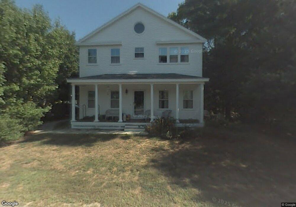
14 N Commons Unit B Lincoln, MA 01773
Estimated Value: $485,000 - $640,000
2
Beds
2
Baths
1,095
Sq Ft
$493/Sq Ft
Est. Value
About This Home
This home is located at 14 N Commons Unit B, Lincoln, MA 01773 and is currently estimated at $540,324, approximately $493 per square foot. 14 N Commons Unit B is a home located in Middlesex County with nearby schools including Lincoln-Sudbury Regional High School and Tremont School.
Ownership History
Date
Name
Owned For
Owner Type
Purchase Details
Closed on
May 12, 2022
Sold by
Krupsaw Brianne C
Bought by
B C Krupsaw Ret 2022
Current Estimated Value
Purchase Details
Closed on
Apr 24, 2019
Sold by
Swanson Kristin
Bought by
Krupsaw Brianne
Purchase Details
Closed on
Nov 20, 2006
Sold by
Monaghan Joanne
Bought by
Swanson Kristin
Purchase Details
Closed on
Apr 30, 1998
Sold by
Vernick Sheila K
Bought by
Mongahan Joanne
Home Financials for this Owner
Home Financials are based on the most recent Mortgage that was taken out on this home.
Original Mortgage
$160,000
Interest Rate
7.04%
Mortgage Type
Purchase Money Mortgage
Create a Home Valuation Report for This Property
The Home Valuation Report is an in-depth analysis detailing your home's value as well as a comparison with similar homes in the area
Home Values in the Area
Average Home Value in this Area
Purchase History
| Date | Buyer | Sale Price | Title Company |
|---|---|---|---|
| B C Krupsaw Ret 2022 | -- | None Available | |
| Krupsaw Brianne | $435,000 | -- | |
| Swanson Kristin | $365,500 | -- | |
| Mongahan Joanne | $209,000 | -- |
Source: Public Records
Mortgage History
| Date | Status | Borrower | Loan Amount |
|---|---|---|---|
| Previous Owner | Mongahan Joanne | $100,000 | |
| Previous Owner | Mongahan Joanne | $30,000 | |
| Previous Owner | Mongahan Joanne | $38,300 | |
| Previous Owner | Mongahan Joanne | $160,000 |
Source: Public Records
Tax History Compared to Growth
Tax History
| Year | Tax Paid | Tax Assessment Tax Assessment Total Assessment is a certain percentage of the fair market value that is determined by local assessors to be the total taxable value of land and additions on the property. | Land | Improvement |
|---|---|---|---|---|
| 2025 | $56 | $437,700 | $0 | $437,700 |
| 2024 | $5,278 | $409,500 | $0 | $409,500 |
| 2023 | $5,429 | $390,000 | $0 | $390,000 |
| 2022 | $5,699 | $381,700 | $0 | $381,700 |
| 2021 | $5,502 | $354,500 | $0 | $354,500 |
| 2020 | $5,041 | $328,200 | $0 | $328,200 |
| 2019 | $4,456 | $317,600 | $0 | $317,600 |
| 2018 | $4,319 | $317,600 | $0 | $317,600 |
| 2017 | $4,069 | $297,000 | $0 | $297,000 |
| 2016 | $4,119 | $294,400 | $0 | $294,400 |
| 2015 | $4,020 | $284,100 | $0 | $284,100 |
| 2014 | $3,871 | $268,600 | $0 | $268,600 |
Source: Public Records
Map
Nearby Homes
- 36 Indian Camp Ln Unit D
- 5 South Commons Unit D
- 29 S Commons Unit D
- 241 Shadyside Ave
- 16 Old Cambridge Turnpike
- 646 Cambridge Turnpike
- 10 Reiling Pond Rd
- 50 Summer St Unit A
- 52 Summer St Unit B
- 39 Neillian St Unit 39
- 16 Hatch Farm Ln
- 28 Hatch Farm Ln
- 10 Hatch Farm Ln
- 644 Old Bedford Rd
- 7 Blue Heron Way
- 9 Garland Rd
- 75 Westview St
- 84 Davison Dr
- 22 Selfridge Rd
- 86 Butternut Cir
- 14 N Commons Unit D
- 14 N Commons Unit C
- 14 N Commons Unit A
- 14 N Commons Unit 14C,14
- 14 N Commons Unit B
- 12 North Commons Unit L
- 12 N Commons Unit 12L
- 12 N Commons Unit R
- 12 N Commons Unit L
- 12L N Commons
- 12 N Commons Unit L,12
- 12 N Commons Unit 12 R
- 16 B North Commons Unit 16B
- 10 N Commons Unit D
- 10 N Commons Unit C
- 10 N Commons Unit B
- 10 N Commons Unit A
- 10 N Commons Unit 10C
- 10 North Commons Unit C
- 10 North Commons Unit D