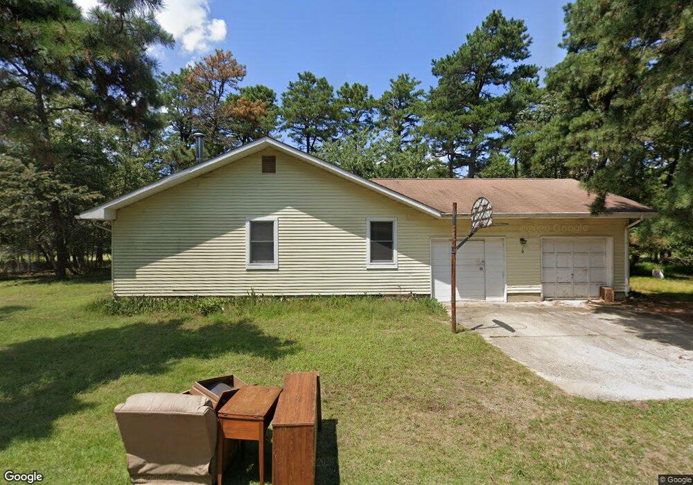
14 N Whites Bogs Rd Browns Mills, NJ 08015
Estimated Value: $383,928 - $439,000
--
Bed
--
Bath
1,528
Sq Ft
$271/Sq Ft
Est. Value
About This Home
This home is located at 14 N Whites Bogs Rd, Browns Mills, NJ 08015 and is currently estimated at $414,482, approximately $271 per square foot. 14 N Whites Bogs Rd is a home located in Burlington County.
Ownership History
Date
Name
Owned For
Owner Type
Purchase Details
Closed on
Feb 21, 2020
Sold by
Theander Joann
Bought by
Didonato Phillip N and Nunez Christina L
Current Estimated Value
Home Financials for this Owner
Home Financials are based on the most recent Mortgage that was taken out on this home.
Original Mortgage
$254,308
Outstanding Balance
$227,867
Interest Rate
4.25%
Mortgage Type
FHA
Estimated Equity
$186,615
Purchase Details
Closed on
Aug 15, 2019
Sold by
Whitby Helen A
Bought by
Theander Joann
Purchase Details
Closed on
Jul 5, 1984
Bought by
Whitby Carl R and Whitby Helen A
Create a Home Valuation Report for This Property
The Home Valuation Report is an in-depth analysis detailing your home's value as well as a comparison with similar homes in the area
Home Values in the Area
Average Home Value in this Area
Purchase History
| Date | Buyer | Sale Price | Title Company |
|---|---|---|---|
| Didonato Phillip N | $259,000 | National Integrity Llc | |
| Theander Joann | $78,553 | None Available | |
| Whitby Carl R | $55,100 | -- |
Source: Public Records
Mortgage History
| Date | Status | Borrower | Loan Amount |
|---|---|---|---|
| Open | Didonato Phillip N | $254,308 |
Source: Public Records
Tax History Compared to Growth
Tax History
| Year | Tax Paid | Tax Assessment Tax Assessment Total Assessment is a certain percentage of the fair market value that is determined by local assessors to be the total taxable value of land and additions on the property. | Land | Improvement |
|---|---|---|---|---|
| 2025 | $6,075 | $198,200 | $37,000 | $161,200 |
| 2024 | $5,700 | $198,200 | $37,000 | $161,200 |
| 2023 | $5,700 | $198,200 | $37,000 | $161,200 |
| 2022 | $5,276 | $198,200 | $37,000 | $161,200 |
| 2021 | $5,060 | $198,200 | $37,000 | $161,200 |
| 2020 | $3,929 | $159,900 | $37,000 | $122,900 |
| 2019 | $3,734 | $158,700 | $37,000 | $121,700 |
| 2018 | $3,607 | $158,700 | $37,000 | $121,700 |
| 2017 | $3,533 | $158,700 | $37,000 | $121,700 |
| 2016 | $3,473 | $92,900 | $16,000 | $76,900 |
| 2015 | $3,445 | $92,900 | $16,000 | $76,900 |
| 2014 | $3,293 | $92,900 | $16,000 | $76,900 |
Source: Public Records
Map
Nearby Homes
- 338 Ridge Rd
- 0 Margaret St
- 258 Ridge Rd
- 256 Ridge Rd
- 4101 N Lakeshore Dr
- 30 Marygold Ave
- 2 Kiowa Trail
- 0 Wheeler Trail
- 764 Lakehurst Rd
- 15 Vine St
- 6 Dahlia St
- 77 Sepulga Dr
- 22 Maricopa Trail
- 813 Hickory Ave
- 2800 S Lakeshore Dr
- 13 Muskogean Trail
- 37 Fern St
- L4 Wheeler Trail
- 0 Aster St & Elm
- 406 Cherokee Dr
- 14 N Whitesbog
- 12 N Whites Bogs Rd
- 139 Margaret St
- 23 N Whites Bogs Rd
- 11 N Whites Bogs Rd
- 24 N Whites Bogs Rd
- 4 N Whites Bogs Rd
- 7 N Whites Bogs Rd
- 27 N Whites Bogs Rd
- 5 N Whites Bogs Rd
- 203 Margaret St
- 205 Margaret St
- 133 Margaret St
- 15 N Whites Bogs Rd
- L:5 Margaret St
- 132 Margaret St
- L5 Margaret St
- 131 Margaret St
- 129 Margaret St
- 130 Margaret St