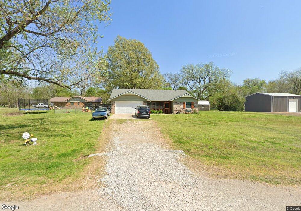
14 Pecan Ridge Shawnee, OK 74804
Estimated Value: $216,000 - $257,000
3
Beds
2
Baths
1,721
Sq Ft
$141/Sq Ft
Est. Value
About This Home
This home is located at 14 Pecan Ridge, Shawnee, OK 74804 and is currently estimated at $241,939, approximately $140 per square foot. 14 Pecan Ridge is a home located in Pottawatomie County with nearby schools including Family Of Faith Christian School.
Ownership History
Date
Name
Owned For
Owner Type
Purchase Details
Closed on
Nov 24, 2021
Sold by
Young Roger Phillip and Young Pamela Gay
Bought by
Minix Meagan Anne and Minix Ryan Douglas
Current Estimated Value
Purchase Details
Closed on
Nov 6, 2020
Sold by
Schiltz Patrick J and Schiltz Lora
Bought by
Young Roger Phillip and Young Pamela Gay
Purchase Details
Closed on
Nov 21, 2011
Sold by
Schiltz Faith
Bought by
Schiltz Patrick J
Home Financials for this Owner
Home Financials are based on the most recent Mortgage that was taken out on this home.
Original Mortgage
$26,085
Interest Rate
4.13%
Mortgage Type
Purchase Money Mortgage
Purchase Details
Closed on
Nov 10, 1997
Sold by
Johnson Wesley and Johnson Mary
Bought by
Schlitz Patrick and Schlitz Faith
Purchase Details
Closed on
Jul 5, 1991
Sold by
Hembree Nancy
Bought by
Johnson Wesley and Johnson Mary
Create a Home Valuation Report for This Property
The Home Valuation Report is an in-depth analysis detailing your home's value as well as a comparison with similar homes in the area
Home Values in the Area
Average Home Value in this Area
Purchase History
| Date | Buyer | Sale Price | Title Company |
|---|---|---|---|
| Minix Meagan Anne | -- | None Available | |
| Young Roger Phillip | $185,500 | None Available | |
| Schiltz Patrick J | $10,000 | Choice Title Insurance | |
| Schlitz Patrick | $78,500 | -- | |
| Johnson Wesley | $66,000 | -- |
Source: Public Records
Mortgage History
| Date | Status | Borrower | Loan Amount |
|---|---|---|---|
| Previous Owner | Schiltz Patrick J | $26,085 |
Source: Public Records
Tax History Compared to Growth
Tax History
| Year | Tax Paid | Tax Assessment Tax Assessment Total Assessment is a certain percentage of the fair market value that is determined by local assessors to be the total taxable value of land and additions on the property. | Land | Improvement |
|---|---|---|---|---|
| 2024 | $2,506 | $21,835 | $1,800 | $20,035 |
| 2023 | $2,506 | $21,835 | $1,800 | $20,035 |
| 2022 | $2,476 | $21,835 | $1,800 | $20,035 |
| 2021 | $2,551 | $21,835 | $1,800 | $20,035 |
| 2020 | $1,212 | $11,223 | $567 | $10,656 |
| 2019 | $1,165 | $10,896 | $530 | $10,366 |
| 2018 | $1,090 | $10,579 | $509 | $10,070 |
| 2017 | $1,058 | $10,272 | $477 | $9,795 |
| 2016 | $845 | $9,971 | $458 | $9,513 |
| 2015 | $816 | $9,682 | $493 | $9,189 |
| 2014 | $789 | $9,400 | $467 | $8,933 |
Source: Public Records
Map
Nearby Homes
- 10400 Bryan (40 Acres Tract #2) Rd
- 10400 Rd
- 9676 Bryan Rd
- 42072 Cadens Trail
- 10450 N Harrison
- 9429 Bryan Rd
- 0 Carmin Dr
- 000 N Hwy 18 - 14 59 Acres
- 43304 Moccasin Trail Rd
- 0 Steele St Unit 1153442
- 0 Steele St Unit 1153549
- 0 Steele St Unit 1153450
- 0 Steele St Unit 1153543
- 0 Steele St Unit 1153447
- 0 Steele St Unit 1153463
- 0 Steele St Unit 1153437
- 0 Steele St Unit 1153553
- 0 Steele St Unit 1153453
- 0 Steele St Unit 1153554
- 0 Steele St Unit 1153542