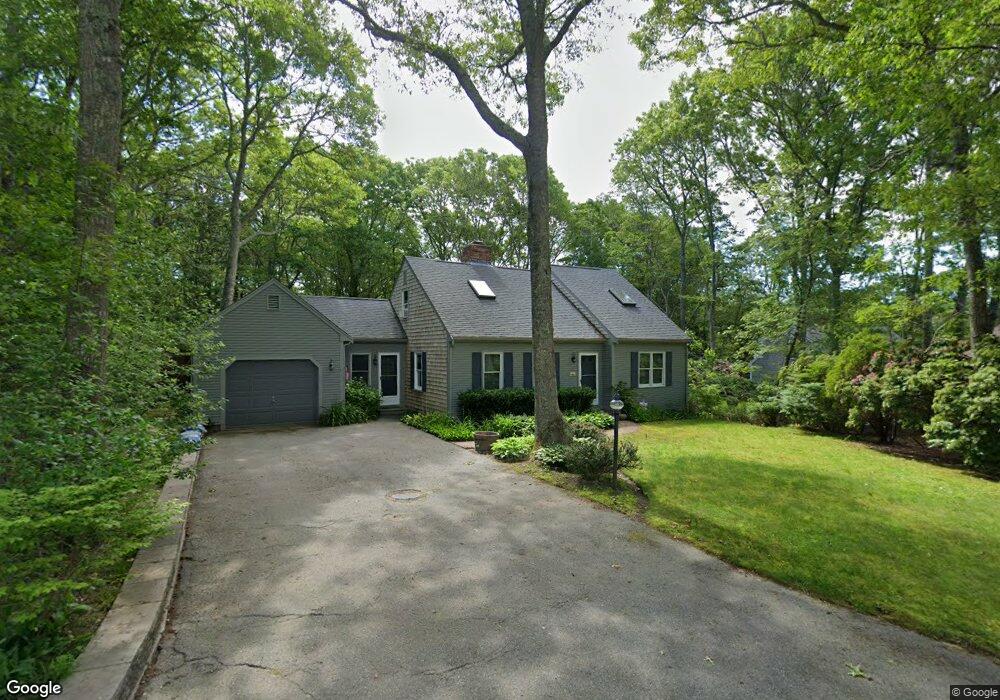
14 Peep Toad Rd Centerville, MA 02632
Centerville NeighborhoodEstimated Value: $704,000 - $905,000
4
Beds
3
Baths
1,801
Sq Ft
$424/Sq Ft
Est. Value
About This Home
This home is located at 14 Peep Toad Rd, Centerville, MA 02632 and is currently estimated at $762,907, approximately $423 per square foot. 14 Peep Toad Rd is a home located in Barnstable County with nearby schools including Barnstable United Elementary School, Centerville Elementary School, and Barnstable Intermediate School.
Ownership History
Date
Name
Owned For
Owner Type
Purchase Details
Closed on
Aug 19, 2019
Sold by
Kocaba Kathleen G
Bought by
Kathleen G Kocaba T 2019
Current Estimated Value
Purchase Details
Closed on
Aug 30, 2001
Sold by
Sennott Leslea J
Bought by
Kocaba Kathleen G
Create a Home Valuation Report for This Property
The Home Valuation Report is an in-depth analysis detailing your home's value as well as a comparison with similar homes in the area
Home Values in the Area
Average Home Value in this Area
Purchase History
| Date | Buyer | Sale Price | Title Company |
|---|---|---|---|
| Kathleen G Kocaba T 2019 | -- | -- | |
| Kocaba Kathleen G | $295,000 | -- |
Source: Public Records
Mortgage History
| Date | Status | Borrower | Loan Amount |
|---|---|---|---|
| Previous Owner | Kocaba Kathleen G | $50,000 | |
| Previous Owner | Kocaba Kathleen G | $45,000 | |
| Previous Owner | Kocaba Kathleen G | $85,000 |
Source: Public Records
Tax History
| Year | Tax Paid | Tax Assessment Tax Assessment Total Assessment is a certain percentage of the fair market value that is determined by local assessors to be the total taxable value of land and additions on the property. | Land | Improvement |
|---|---|---|---|---|
| 2025 | $5,265 | $650,800 | $152,600 | $498,200 |
| 2024 | $4,788 | $613,000 | $152,600 | $460,400 |
| 2023 | $4,564 | $547,200 | $138,700 | $408,500 |
| 2022 | $4,298 | $445,800 | $102,700 | $343,100 |
| 2021 | $4,186 | $399,000 | $102,700 | $296,300 |
| 2020 | $4,240 | $386,900 | $102,700 | $284,200 |
| 2019 | $4,055 | $359,500 | $102,700 | $256,800 |
| 2018 | $3,706 | $330,300 | $108,200 | $222,100 |
| 2017 | $3,449 | $320,500 | $108,200 | $212,300 |
| 2016 | $3,502 | $321,300 | $109,000 | $212,300 |
| 2015 | $3,475 | $320,300 | $105,700 | $214,600 |
Source: Public Records
Map
Nearby Homes
- 62 Three Ponds Dr
- 324 Patriot Way
- 900 Old Stage Rd
- 29 Appaloosa Way
- 66 Tern Ln
- 74 Saddler Ln
- 1028 Old Falmouth Rd
- 87 Foxglove Rd
- 296 Buckskin Path
- 169 Cedric Rd
- 315 Prince Hinckley Rd
- 352 Nye Rd
- 282 Parker Rd
- 80 Branch Terrace
- 82 Yacht Club Rd
- 159 Willow Run Dr
- 19 Marrick Ct
- 5 Chickadee Ln
- 481 Lakeside Dr W
- 585 Old Falmouth Rd
- 26 Peep Toad Rd
- 10 Peep Toad Rd
- 250 Capn Crosby Rd
- 11 Peep Toad Rd
- 21 Peep Toad Rd
- 258 Oak St
- 35 Peep Toad Rd
- 295 Patriot Way
- 295 Patriot Way Unit 295 B
- 305 Patriot Way
- 38 Peep Toad Rd
- 255 Capn Crosby Rd
- 255 Captain Crosby Rd
- 201 Oak St
- 241 Capn Crosby Rd
- 325 Patriot Way
- 230 Oak St
- 40 Peep Toad Rd
- 290 Patriot Way
- 308 Patriot Way Unit 308
Your Personal Tour Guide
Ask me questions while you tour the home.