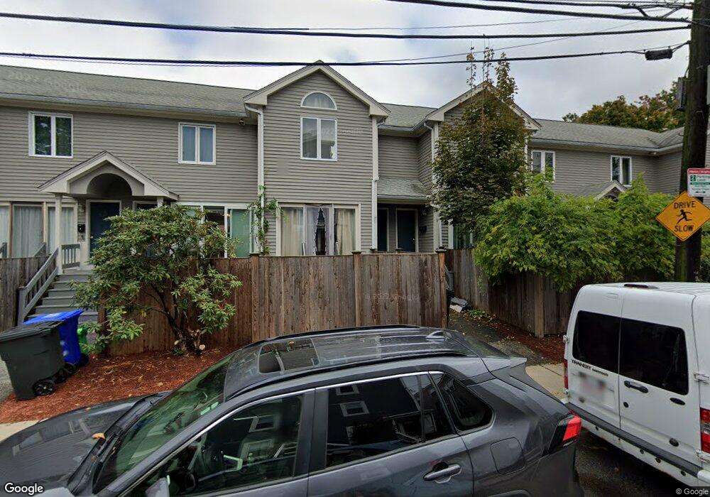
14 Portsmouth St Unit F Boston, MA 02135
Allston NeighborhoodEstimated Value: $580,000 - $696,000
1
Bed
1
Bath
1,165
Sq Ft
$535/Sq Ft
Est. Value
About This Home
This home is located at 14 Portsmouth St Unit F, Boston, MA 02135 and is currently estimated at $622,693, approximately $534 per square foot. 14 Portsmouth St Unit F is a home located in Suffolk County with nearby schools including Boston Green Academy Horace Mann Charter School, German International School Boston, and St Columbkille Partnership School.
Ownership History
Date
Name
Owned For
Owner Type
Purchase Details
Closed on
Jul 24, 2012
Sold by
Magee Jennifer and Aigen Joshua
Bought by
Wu Chunyao
Current Estimated Value
Purchase Details
Closed on
May 17, 1995
Sold by
Hoffman Phyllis
Bought by
Newsome David A
Home Financials for this Owner
Home Financials are based on the most recent Mortgage that was taken out on this home.
Original Mortgage
$107,800
Interest Rate
8.34%
Mortgage Type
Purchase Money Mortgage
Create a Home Valuation Report for This Property
The Home Valuation Report is an in-depth analysis detailing your home's value as well as a comparison with similar homes in the area
Home Values in the Area
Average Home Value in this Area
Purchase History
| Date | Buyer | Sale Price | Title Company |
|---|---|---|---|
| Wu Chunyao | $279,000 | -- | |
| Newsome David A | $113,500 | -- |
Source: Public Records
Mortgage History
| Date | Status | Borrower | Loan Amount |
|---|---|---|---|
| Previous Owner | Newsome David A | $107,800 |
Source: Public Records
Tax History Compared to Growth
Tax History
| Year | Tax Paid | Tax Assessment Tax Assessment Total Assessment is a certain percentage of the fair market value that is determined by local assessors to be the total taxable value of land and additions on the property. | Land | Improvement |
|---|---|---|---|---|
| 2025 | $6,440 | $556,100 | $0 | $556,100 |
| 2024 | $5,028 | $461,300 | $0 | $461,300 |
| 2023 | $4,630 | $431,100 | $0 | $431,100 |
| 2022 | $4,384 | $402,900 | $0 | $402,900 |
| 2021 | $4,299 | $402,900 | $0 | $402,900 |
| 2020 | $4,041 | $382,700 | $0 | $382,700 |
| 2019 | $3,600 | $341,600 | $0 | $341,600 |
| 2018 | $3,377 | $322,200 | $0 | $322,200 |
| 2017 | $3,160 | $298,400 | $0 | $298,400 |
| 2016 | $3,011 | $273,700 | $0 | $273,700 |
| 2015 | $3,362 | $277,600 | $0 | $277,600 |
| 2014 | $3,204 | $254,700 | $0 | $254,700 |
Source: Public Records
Map
Nearby Homes
- 26 Waverly St Unit 410
- 42 Waverly St Unit 1
- 42 Waverly St Unit 3
- 50 Leo M Birmingham Pkwy Unit 303
- 50 Leo M Birmingham Pkwy Unit 501
- 100 Lincoln St Unit 203
- 100 Lincoln St Unit 307
- 100 Lincoln St Unit 403
- 100 Lincoln St Unit 506
- 100 Lincoln St Unit 408
- 100 Lincoln St Unit 207
- 100 Lincoln St Unit 302
- 70 Leo Birmingham Pkwy Unit 307
- 78 Litchfield St
- 50 Hichborn St Unit 101
- 50 Hichborn St Unit 204
- 50 Hichborn St Unit 408
- 472-474 Western Ave
- 54-60 Holton St Unit 58
- 151 Coolidge Ave Unit 404
- 14 Portsmouth St Unit A
- 14 Portsmouth St Unit 1
- 14 Portsmouth St
- 14 Portsmouth St Unit D
- 14 Portsmouth St Unit A 14
- 14-16 Portsmouth St Unit F
- 14-16 Portsmouth St Unit G
- 14-16 Portsmouth St Unit E
- 14-16 Portsmouth St Unit A
- 14-16 Portsmouth St Unit C
- 16 Portsmouth St
- 16 Portsmouth St Unit "C",16-14
- 16 Portsmouth St Unit C
- 10 Portsmouth St
- 10 Portsmouth St
- 10 Portsmouth St Unit 1
- 24 Portsmouth St Unit 26
- 26 Portsmouth St Unit 2
- 26 Portsmouth St
- 26 Portsmouth St Unit 1