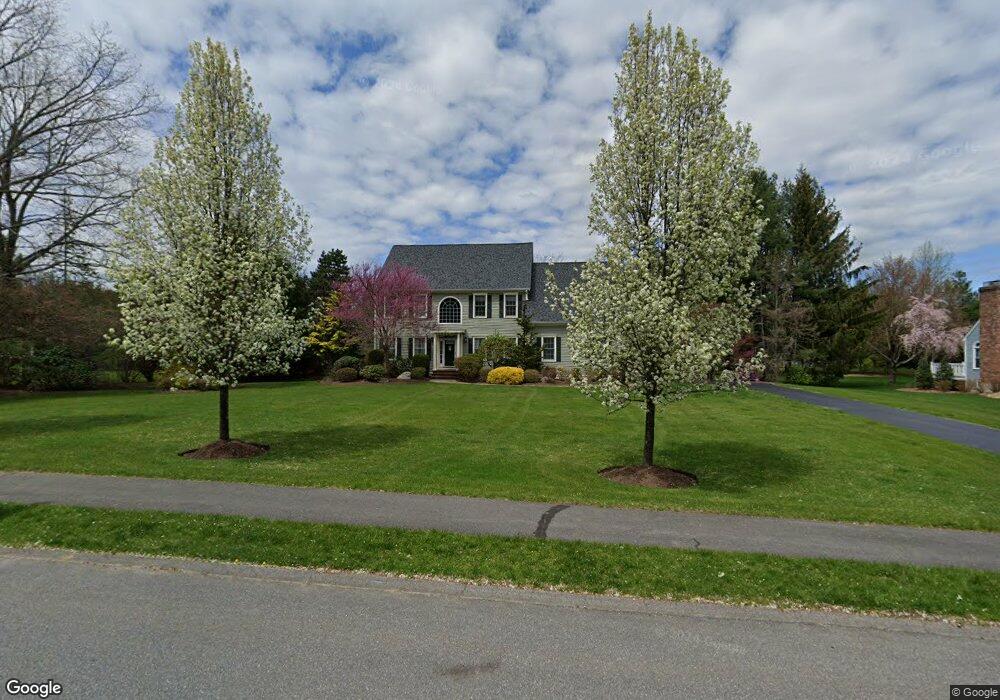
14 Read Rd Sudbury, MA 01776
Estimated Value: $1,455,000 - $1,924,000
4
Beds
4
Baths
3,000
Sq Ft
$546/Sq Ft
Est. Value
About This Home
This home is located at 14 Read Rd, Sudbury, MA 01776 and is currently estimated at $1,636,918, approximately $545 per square foot. 14 Read Rd is a home located in Middlesex County with nearby schools including Israel Loring Elementary School, Ephraim Curtis Middle School, and Lincoln-Sudbury Regional High School.
Ownership History
Date
Name
Owned For
Owner Type
Purchase Details
Closed on
Jan 12, 2006
Sold by
Yenke Ernest K and Yenke Katharine J
Bought by
Mulcahey Brian D and Hsu Lydia J
Current Estimated Value
Create a Home Valuation Report for This Property
The Home Valuation Report is an in-depth analysis detailing your home's value as well as a comparison with similar homes in the area
Home Values in the Area
Average Home Value in this Area
Purchase History
| Date | Buyer | Sale Price | Title Company |
|---|---|---|---|
| Mulcahey Brian D | $1,025,000 | -- | |
| Mulcahey Brian D | $1,025,000 | -- |
Source: Public Records
Mortgage History
| Date | Status | Borrower | Loan Amount |
|---|---|---|---|
| Open | Mulcahey Brian D | $321,000 | |
| Closed | Mulcahey Brian D | $335,000 | |
| Closed | Mulcahey Brian D | $340,000 |
Source: Public Records
Tax History Compared to Growth
Tax History
| Year | Tax Paid | Tax Assessment Tax Assessment Total Assessment is a certain percentage of the fair market value that is determined by local assessors to be the total taxable value of land and additions on the property. | Land | Improvement |
|---|---|---|---|---|
| 2025 | $22,437 | $1,532,600 | $624,400 | $908,200 |
| 2024 | $21,613 | $1,479,300 | $606,400 | $872,900 |
| 2023 | $20,498 | $1,299,800 | $566,800 | $733,000 |
| 2022 | $19,494 | $1,080,000 | $480,000 | $600,000 |
| 2021 | $18,892 | $1,003,300 | $480,000 | $523,300 |
| 2020 | $19,256 | $1,043,700 | $506,800 | $536,900 |
| 2019 | $18,693 | $1,043,700 | $506,800 | $536,900 |
| 2018 | $18,147 | $1,012,100 | $520,000 | $492,100 |
| 2017 | $17,238 | $971,700 | $484,000 | $487,700 |
| 2016 | $16,721 | $939,400 | $465,200 | $474,200 |
| 2015 | $15,101 | $858,000 | $392,800 | $465,200 |
| 2014 | $15,098 | $837,400 | $381,200 | $456,200 |
Source: Public Records
Map
Nearby Homes
- 0 Wagonwheel Rd
- 216 Landham Rd
- 63 Landham Rd
- 84 Hopestill Brown Rd
- 23 Cider Mill Rd
- 23 Massasoit Ave
- 36 Concord Rd
- 94 Goodmans Hill Rd
- 1011 Boston Post Rd
- 14 Eisenhower Rd
- 6 Old County Rd Unit 16
- 30 Edith Rd
- 91 Eaton Rd W
- 128 Nobscot Rd
- 19 Nob Hill Dr
- 32 Eaton Rd W
- 8 Clara Rd
- 27 Sloane Dr
- 14 Francine Rd
- 24 Pinewood Dr
- 19 Cutler Farm Rd
- 20 Read Rd
- 27 Cutler Farm Rd
- 49 Cutler Farm Rd
- 5 Read Rd
- 57 Cutler Farm Rd
- 15 Read Rd
- 79 Cutler Farm Rd
- 67 Cutler Farm Rd
- 41 Cutler Farm Rd
- 93 Cutler Farm Rd
- 18 Cutler Farm Rd
- 44 Woodside Rd
- 32 Woodside Rd
- 0 Lot 15 Cutler Farm Rd Unit 50255727
- 0 Lot 8 Cutler Farm Rd Unit 50272362
- 40 Woodside Rd
- 50 Cutler Farm Rd
- 0 Lot 6 Cutler Farm Rd Unit 50272308
- 88 Cutler Farm Rd