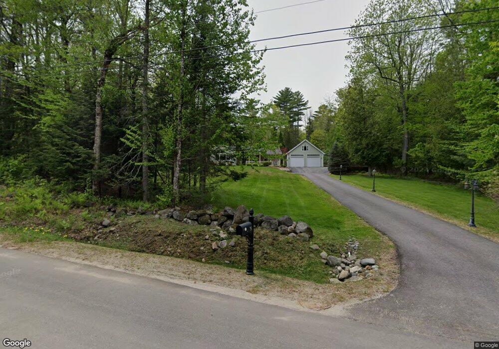
14 Robin Hood Dr Winthrop, ME 04364
Estimated Value: $349,000 - $393,000
2
Beds
1
Bath
1,488
Sq Ft
$248/Sq Ft
Est. Value
About This Home
This home is located at 14 Robin Hood Dr, Winthrop, ME 04364 and is currently estimated at $368,751, approximately $247 per square foot. 14 Robin Hood Dr is a home located in Kennebec County with nearby schools including Winthrop Grade School, Winthrop Middle School, and Winthrop High School.
Ownership History
Date
Name
Owned For
Owner Type
Purchase Details
Closed on
Oct 21, 2013
Sold by
Chesley Bruce D
Bought by
Gammon Mary P
Current Estimated Value
Home Financials for this Owner
Home Financials are based on the most recent Mortgage that was taken out on this home.
Original Mortgage
$165,000
Outstanding Balance
$123,629
Interest Rate
4.58%
Mortgage Type
Purchase Money Mortgage
Estimated Equity
$245,122
Purchase Details
Closed on
Mar 7, 2007
Sold by
Nadeau Melissa A and Nadeau Christopher M
Bought by
Chesley Bruce D and Clark Diana
Home Financials for this Owner
Home Financials are based on the most recent Mortgage that was taken out on this home.
Original Mortgage
$135,600
Interest Rate
6.3%
Mortgage Type
Purchase Money Mortgage
Create a Home Valuation Report for This Property
The Home Valuation Report is an in-depth analysis detailing your home's value as well as a comparison with similar homes in the area
Home Values in the Area
Average Home Value in this Area
Purchase History
| Date | Buyer | Sale Price | Title Company |
|---|---|---|---|
| Gammon Mary P | -- | -- | |
| Gammon Mary P | -- | -- | |
| Chesley Bruce D | -- | -- | |
| Chesley Bruce D | -- | -- |
Source: Public Records
Mortgage History
| Date | Status | Borrower | Loan Amount |
|---|---|---|---|
| Open | Gammon Mary P | $165,000 | |
| Closed | Chesley Bruce D | $135,600 | |
| Closed | Chesley Bruce D | $33,900 |
Source: Public Records
Tax History Compared to Growth
Tax History
| Year | Tax Paid | Tax Assessment Tax Assessment Total Assessment is a certain percentage of the fair market value that is determined by local assessors to be the total taxable value of land and additions on the property. | Land | Improvement |
|---|---|---|---|---|
| 2024 | $4,073 | $176,300 | $41,900 | $134,400 |
| 2022 | $3,838 | $176,300 | $41,900 | $134,400 |
| 2021 | $3,623 | $176,300 | $41,900 | $134,400 |
| 2020 | $3,641 | $176,300 | $41,900 | $134,400 |
| 2019 | $3,570 | $176,300 | $41,900 | $134,400 |
| 2018 | $3,228 | $176,300 | $41,900 | $134,400 |
| 2017 | $3,020 | $176,300 | $41,900 | $134,400 |
| 2016 | $2,793 | $176,300 | $41,900 | $134,400 |
| 2015 | $2,694 | $176,300 | $41,900 | $134,400 |
| 2014 | $2,694 | $176,300 | $41,900 | $134,400 |
Source: Public Records
Map
Nearby Homes
- 50 Robin Hood Dr
- M 8 Lot 5B Maranacook Rd
- 974 Sturtevant Hill Rd
- 60 Route 41
- 46 Squire Ct
- 31 Squire Ct
- 42 Squire Ct
- 795 Memorial Dr
- 882 Memorial Dr
- 2 Falling Pines Ln
- 90 Bearce Rd
- 29 Kents Hill Rd
- 192 Turkey Ln
- 336 Main St
- 333 Stanley Rd
- 8 Horseshoe Rd
- 1097 Main St
- 0 U S Highway 202
- 135 P Ridge Rd
- M 6, L 32 Main St
- 14 Robinhood Dr
- 18 Robin Hood Dr
- 18 Robinhood Dr
- 2 Robin Hood Dr
- 79 Nottingham Rd
- 19 Robin Hood Dr
- 95 Nottingham Rd
- 26 Robin Hood Dr
- 0 Robin Hood Dr
- 000 Sturtevant Hill Rd
- Lot 1 Sturtevant Hill Rd
- 40 Sherwood Forest Dr
- 38 Robin Hood Dr
- 30 Sherwood Forest Dr
- 67 Nottingham Rd
- Lot 4 Sturtevant Hill Rd
- Lot 5 Sturtevant Hill Rd
- Lot 3 Sturtevant Hill Rd
- Lot 6 Sturtevant Hill Rd
- 100 Nottingham Rd