Estimated Value: $192,000 - $196,000
Studio
2
Baths
1,359
Sq Ft
$143/Sq Ft
Est. Value
About This Home
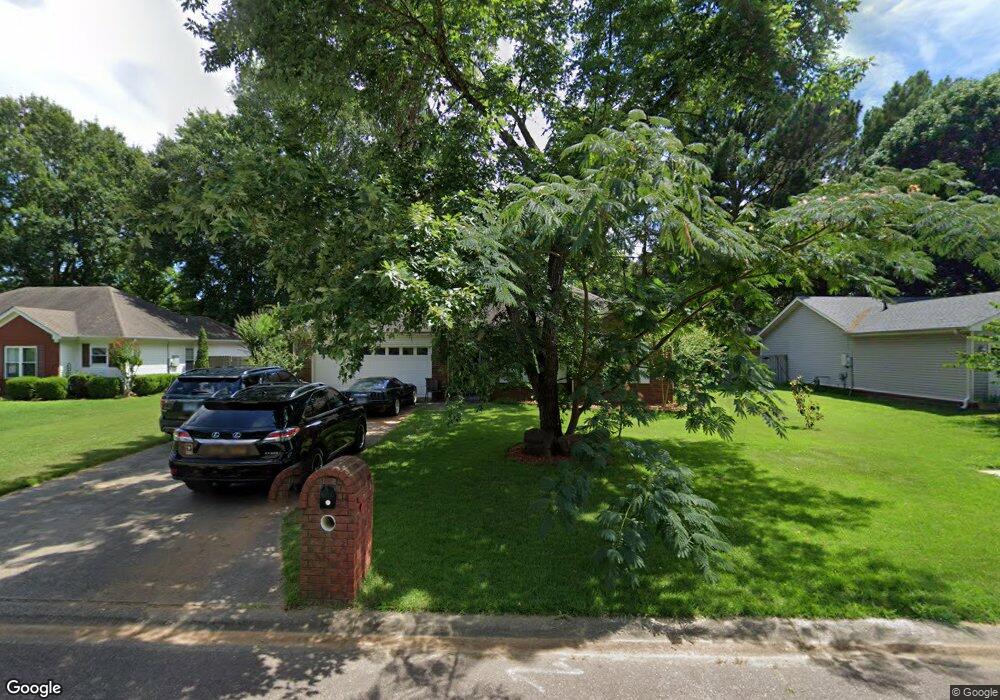
This home is located at 14 Robin Ln, Cabot, AR 72023 and is currently estimated at $194,022, approximately $142 per square foot. 14 Robin Ln is a home located in Lonoke County with nearby schools including Central Elementary School, Cabot Junior High South, and Cabot Middle School South.
Ownership History
Date
Name
Owned For
Owner Type
Purchase Details
Closed on
Jan 22, 2016
Sold by
Clancy John G and Clancy Marilyn E
Bought by
Clancy Trust
Current Estimated Value
Purchase Details
Closed on
Jan 2, 2016
Sold by
Clancy John G and Clancy Marilyn E
Bought by
Clancy John G and Clancy Marilyn E
Purchase Details
Closed on
Jan 31, 2006
Bought by
Clancy and Clancy Wf
Purchase Details
Closed on
Jan 24, 2006
Bought by
Clancy and Clancy Wf
Purchase Details
Closed on
Dec 21, 2005
Bought by
Chase
Purchase Details
Closed on
Aug 8, 2005
Bought by
Chase
Purchase Details
Closed on
Jul 26, 2005
Bought by
Chase
Purchase Details
Closed on
Jun 14, 2004
Bought by
Bynum
Purchase Details
Closed on
Jun 4, 2004
Bought by
Bynum
Purchase Details
Closed on
Dec 19, 1996
Bought by
Westbrook
Purchase Details
Closed on
Jul 11, 1995
Bought by
Cody Ward
Create a Home Valuation Report for This Property
The Home Valuation Report is an in-depth analysis detailing your home's value as well as a comparison with similar homes in the area
Purchase History
| Date | Buyer | Sale Price | Title Company |
|---|---|---|---|
| Clancy Trust | -- | Attorney | |
| Clancy John G | -- | First American Tittle | |
| Clancy | $105,000 | -- | |
| Clancy | $105,000 | -- | |
| Chase | $85,000 | -- | |
| Chase | $85,000 | -- | |
| Chase | $85,000 | -- | |
| Chase | $85,000 | -- | |
| Bynum | $106,000 | -- | |
| Bynum | $106,000 | -- | |
| Westbrook | $84,000 | -- | |
| Cody Ward | $12,000 | -- |
Source: Public Records
Tax History
| Year | Tax Paid | Tax Assessment Tax Assessment Total Assessment is a certain percentage of the fair market value that is determined by local assessors to be the total taxable value of land and additions on the property. | Land | Improvement |
|---|---|---|---|---|
| 2025 | $1,215 | $23,880 | $2,800 | $21,080 |
| 2024 | $1,215 | $23,880 | $2,800 | $21,080 |
| 2023 | $1,215 | $23,880 | $2,800 | $21,080 |
| 2022 | $1,215 | $23,880 | $2,800 | $21,080 |
| 2021 | $1,197 | $23,880 | $2,800 | $21,080 |
| 2020 | $1,088 | $21,370 | $2,800 | $18,570 |
| 2019 | $1,088 | $21,370 | $2,800 | $18,570 |
| 2018 | $1,056 | $21,370 | $2,800 | $18,570 |
| 2017 | $981 | $21,370 | $2,800 | $18,570 |
| 2016 | $1,056 | $21,370 | $2,800 | $18,570 |
| 2015 | $964 | $21,010 | $2,800 | $18,210 |
| 2014 | $1,038 | $21,010 | $2,800 | $18,210 |
Source: Public Records
Map
Nearby Homes
- 34 Bent Tree Dr
- 40 Bent Tree Dr
- 92 Sycamore Cir
- 00 Plaza Blvd
- 37 Pond St
- 49 Oak Meadows Dr
- 57 Meadowlark Dr
- 20 Paige Ave
- 51 Meadowlark Dr
- 35 Warren St
- 28 Pheasant Run Dr
- 19 Sycamore St
- 16 Meadowlark Dr
- 105 Earnhardt Cir
- 23 Robinson St
- 19 Talladega Dr
- Lots 44 &45 Broadmoor Cir
- 12 Daytona
- 11 Warren St
- 00 Kerr Station Rd
Your Personal Tour Guide
Ask me questions while you tour the home.