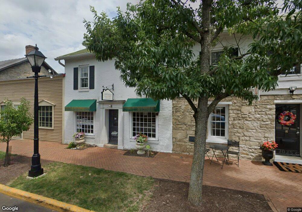
14 S High St Dublin, OH 43017
Estimated Value: $956,784
Studio
--
Bath
1,026
Sq Ft
$933/Sq Ft
Est. Value
About This Home
This home is located at 14 S High St, Dublin, OH 43017 and is currently estimated at $956,784, approximately $932 per square foot. 14 S High St is a home located in Franklin County with nearby schools including Indian Run Elementary School, John Sells Middle School, and Dublin Coffman High School.
Ownership History
Date
Name
Owned For
Owner Type
Purchase Details
Closed on
Jul 12, 2023
Sold by
37 Darby Company Ltd
Bought by
C & A Dublin Properties Llc
Current Estimated Value
Home Financials for this Owner
Home Financials are based on the most recent Mortgage that was taken out on this home.
Original Mortgage
$765,000
Outstanding Balance
$743,224
Interest Rate
6.67%
Mortgage Type
Credit Line Revolving
Estimated Equity
$213,560
Purchase Details
Closed on
Aug 1, 2007
Sold by
Guy Investment Co Ltd
Bought by
37 Darby Co Ltd
Purchase Details
Closed on
Feb 5, 1991
Bought by
Guy Investment Co
Create a Home Valuation Report for This Property
The Home Valuation Report is an in-depth analysis detailing your home's value as well as a comparison with similar homes in the area
Home Values in the Area
Average Home Value in this Area
Purchase History
| Date | Buyer | Sale Price | Title Company |
|---|---|---|---|
| C & A Dublin Properties Llc | $900,000 | Transcounty Title Agency | |
| 37 Darby Co Ltd | $450,000 | Hummel | |
| Guy Investment Co | -- | -- |
Source: Public Records
Mortgage History
| Date | Status | Borrower | Loan Amount |
|---|---|---|---|
| Open | C & A Dublin Properties Llc | $765,000 |
Source: Public Records
Tax History
| Year | Tax Paid | Tax Assessment Tax Assessment Total Assessment is a certain percentage of the fair market value that is determined by local assessors to be the total taxable value of land and additions on the property. | Land | Improvement |
|---|---|---|---|---|
| 2025 | $15,546 | $169,720 | $72,450 | $97,270 |
| 2024 | $15,546 | $169,720 | $72,450 | $97,270 |
| 2023 | $15,176 | $169,720 | $72,450 | $97,270 |
| 2022 | $14,522 | $158,310 | $70,250 | $88,060 |
| 2021 | $14,217 | $158,310 | $70,250 | $88,060 |
| 2020 | $14,217 | $158,310 | $70,250 | $88,060 |
| 2019 | $13,262 | $131,960 | $58,560 | $73,400 |
| 2018 | $12,910 | $131,960 | $58,560 | $73,400 |
| 2017 | $12,570 | $131,960 | $58,560 | $73,400 |
| 2016 | $12,564 | $124,610 | $58,560 | $66,050 |
| 2015 | $11,926 | $124,610 | $58,560 | $66,050 |
| 2014 | $12,545 | $124,610 | $58,560 | $66,050 |
| 2013 | $6,246 | $124,600 | $58,555 | $66,045 |
Source: Public Records
Map
Nearby Homes
- 6640 Mooney St Unit 404
- 105 Marion St
- 6350 Frantz Rd
- 410 Edinburgh Rd Unit 410
- 438 Edinburgh Rd Unit 438-452
- 0 Emerald Pkwy
- 4231 Troutbrook Dr
- 4214 Troutbrook Dr Unit 122
- 6812 Killilea Ct
- 4183 Tuller Rd Unit Lot 1104
- 4164 Mccune Ave Unit Lot 1402
- 4179 Tuller Rd Unit Lot 1103
- 4168 Mccune Ave Unit Lot 1401
- 4175 Tuller Rd Unit Lot 1102
- 6877 Seville St Unit Lot 1301
- 6841 Riverside Glen Ct
- 6889 Seville St Unit Lot 1304
- 4165 Tuller Rd Unit Lot 1206
- 6897 Seville St Unit Lot 1306
- 4149 Tuller Rd Unit Lot 1202
- 18 S High St
- 38 S High St Unit A
- 38 S High St
- 8 E Bridge St
- 9 E Bridge St
- 35 S High St
- 48-52 S High St
- 16 E Bridge St
- 16 N High St Unit 16
- 16 N High St Unit 16 & 22
- 16 N High St
- 48 S High St
- 25 S Riverview St
- 22 N High St
- 54 S High St
- 37 S Riverview St
- 19 S Riverview St
- 40 E Bridge St
- 315 N High St
- 40 N Blacksmith Ln
Your Personal Tour Guide
Ask me questions while you tour the home.