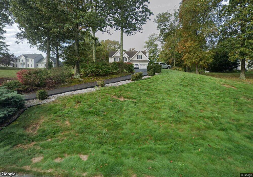
14 Sable Dr Ledyard, CT 06339
Estimated Value: $661,053 - $720,000
4
Beds
2
Baths
3,150
Sq Ft
$220/Sq Ft
Est. Value
About This Home
This home is located at 14 Sable Dr, Ledyard, CT 06339 and is currently estimated at $692,763, approximately $219 per square foot. 14 Sable Dr is a home located in New London County with nearby schools including Ledyard Middle School and Ledyard High School.
Ownership History
Date
Name
Owned For
Owner Type
Purchase Details
Closed on
Sep 29, 2008
Sold by
Lillge Robert E
Bought by
Stetson James R
Current Estimated Value
Home Financials for this Owner
Home Financials are based on the most recent Mortgage that was taken out on this home.
Original Mortgage
$100,000
Outstanding Balance
$65,577
Interest Rate
6.57%
Estimated Equity
$627,186
Purchase Details
Closed on
Sep 25, 2006
Sold by
Mount Kineo Bldrs Llc
Bought by
Lillge Robert E
Home Financials for this Owner
Home Financials are based on the most recent Mortgage that was taken out on this home.
Original Mortgage
$120,000
Interest Rate
6.49%
Purchase Details
Closed on
Feb 10, 2003
Sold by
Mt Kineo Bldrs Llc
Bought by
Lillge Roberts
Purchase Details
Closed on
Oct 4, 2000
Sold by
Mj Holdings Llc
Bought by
Medeiros Kevin and Medeiros Alana
Create a Home Valuation Report for This Property
The Home Valuation Report is an in-depth analysis detailing your home's value as well as a comparison with similar homes in the area
Home Values in the Area
Average Home Value in this Area
Purchase History
| Date | Buyer | Sale Price | Title Company |
|---|---|---|---|
| Stetson James R | $405,000 | -- | |
| Lillge Robert E | $441,500 | -- | |
| Lillge Roberts | $441,500 | -- | |
| M T Kineo Builders Ll | $81,000 | -- | |
| Medeiros Kevin | $68,000 | -- |
Source: Public Records
Mortgage History
| Date | Status | Borrower | Loan Amount |
|---|---|---|---|
| Open | Medeiros Kevin | $100,000 | |
| Previous Owner | Medeiros Kevin | $401,540 | |
| Previous Owner | Medeiros Kevin | $120,000 |
Source: Public Records
Tax History
| Year | Tax Paid | Tax Assessment Tax Assessment Total Assessment is a certain percentage of the fair market value that is determined by local assessors to be the total taxable value of land and additions on the property. | Land | Improvement |
|---|---|---|---|---|
| 2025 | $10,451 | $281,400 | $59,010 | $222,390 |
| 2024 | $9,874 | $280,420 | $59,010 | $221,410 |
| 2023 | $9,691 | $280,420 | $59,010 | $221,410 |
| 2022 | $9,484 | $280,420 | $59,010 | $221,410 |
| 2021 | $9,422 | $280,420 | $59,010 | $221,410 |
| 2020 | $9,402 | $268,870 | $63,770 | $205,100 |
| 2019 | $9,427 | $268,870 | $63,770 | $205,100 |
| 2018 | $9,220 | $268,870 | $63,770 | $205,100 |
| 2017 | $8,749 | $268,870 | $63,770 | $205,100 |
| 2016 | $8,577 | $268,870 | $63,770 | $205,100 |
| 2015 | $8,174 | $268,870 | $63,770 | $205,100 |
| 2014 | $8,646 | $282,730 | $68,460 | $214,270 |
Source: Public Records
Map
Nearby Homes
- 1866 Center Groton Rd
- 497 Colonel Ledyard Hwy
- 26 Quakertown Meadows
- 459 Colonel Ledyard Hwy
- 675 Colonel Ledyard Hwy
- 155 Lambtown Rd
- 14 Pennywise Ln
- 1661 Center Groton Rd
- 19 Chidley Way
- 27 Marty's Way
- 25 Marty's Way
- 18 Marty's Way
- 4 Amber Cir
- 4 Whalehead Rd
- 27 Highland Dr
- 69 Wendell Comrie Rd
- 777 Shewville Rd
- 115 Meeting House Ln
- 15 Country Club Dr
- 34 Country Club Dr
Your Personal Tour Guide
Ask me questions while you tour the home.