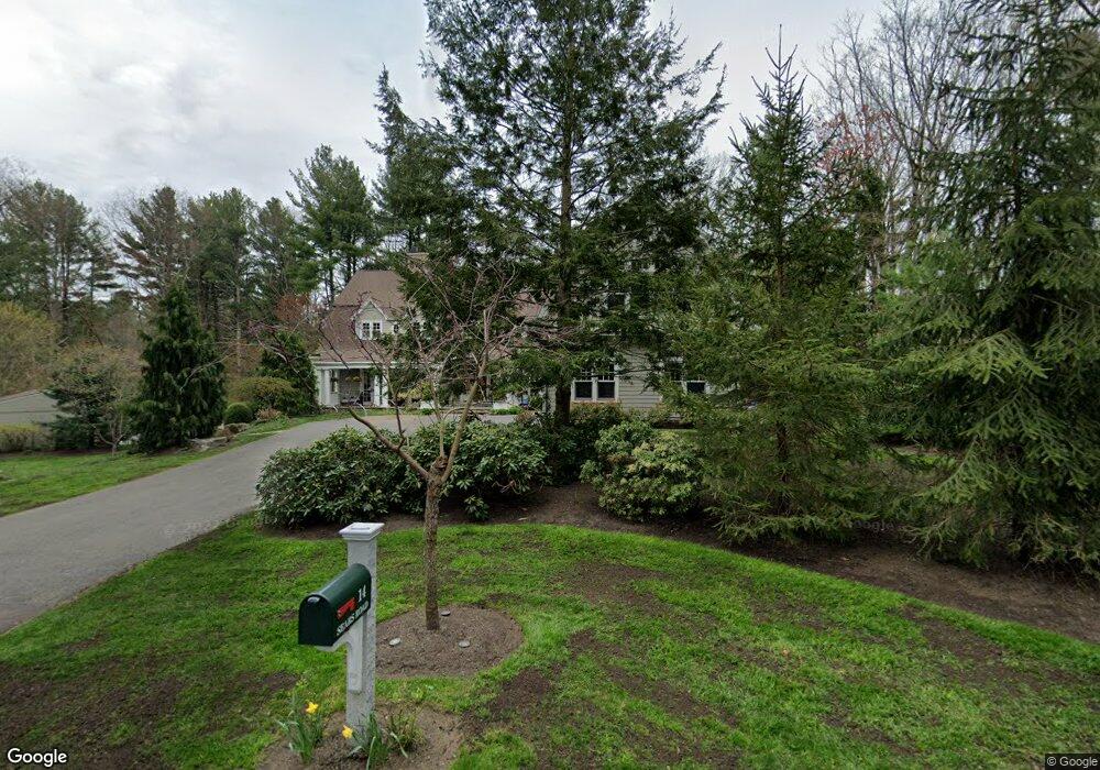
14 Sears Rd Wayland, MA 01778
Estimated Value: $1,681,000 - $3,803,000
5
Beds
6
Baths
6,845
Sq Ft
$441/Sq Ft
Est. Value
About This Home
This home is located at 14 Sears Rd, Wayland, MA 01778 and is currently estimated at $3,021,985, approximately $441 per square foot. 14 Sears Rd is a home located in Middlesex County with nearby schools including Wayland High School.
Ownership History
Date
Name
Owned For
Owner Type
Purchase Details
Closed on
Jun 10, 1997
Sold by
Allen Anthony S
Bought by
Murphy Kevin F and Murphy Lana J
Current Estimated Value
Purchase Details
Closed on
May 27, 1993
Sold by
Rutherford John D and Rutherford Cynthia J
Bought by
Allen Anthony S
Purchase Details
Closed on
Jan 15, 1992
Sold by
Steadman David R A and Steadman B
Bought by
Rutherford John D and Rutherford Cynthia
Create a Home Valuation Report for This Property
The Home Valuation Report is an in-depth analysis detailing your home's value as well as a comparison with similar homes in the area
Home Values in the Area
Average Home Value in this Area
Purchase History
| Date | Buyer | Sale Price | Title Company |
|---|---|---|---|
| Murphy Kevin F | $596,500 | -- | |
| Allen Anthony S | $532,500 | -- | |
| Rutherford John D | $525,000 | -- |
Source: Public Records
Mortgage History
| Date | Status | Borrower | Loan Amount |
|---|---|---|---|
| Open | Allen Anthony S | $1,612,000 | |
| Closed | Allen Anthony S | $1,614,000 | |
| Closed | Allen Anthony S | $407,000 |
Source: Public Records
Tax History
| Year | Tax Paid | Tax Assessment Tax Assessment Total Assessment is a certain percentage of the fair market value that is determined by local assessors to be the total taxable value of land and additions on the property. | Land | Improvement |
|---|---|---|---|---|
| 2025 | $49,652 | $3,176,700 | $698,300 | $2,478,400 |
| 2024 | $47,063 | $3,032,400 | $664,900 | $2,367,500 |
| 2023 | $43,332 | $2,602,500 | $604,800 | $1,997,700 |
| 2022 | $51,340 | $2,797,800 | $514,900 | $2,282,900 |
| 2021 | $51,110 | $2,759,700 | $476,800 | $2,282,900 |
| 2020 | $49,906 | $2,810,000 | $476,800 | $2,333,200 |
| 2019 | $7,457 | $2,628,600 | $454,400 | $2,174,200 |
| 2018 | $7,463 | $2,664,300 | $473,100 | $2,191,200 |
| 2017 | $46,885 | $2,584,600 | $450,300 | $2,134,300 |
| 2016 | $43,844 | $2,528,500 | $458,700 | $2,069,800 |
| 2015 | $44,642 | $2,427,500 | $458,700 | $1,968,800 |
Source: Public Records
Map
Nearby Homes
- 93 Draper Rd
- 32 Highland Cir
- 63 Sudbury Rd
- 156 Boston Post Rd
- 10 Hayward Rd
- 17 Glezen Ln
- 1 Winthrop Terrace
- 17 Hastings Way Unit 17
- 19 Old Connecticut Path
- 741 Boston Post Rd
- 291 Concord Rd
- 156 Cherry Brook Rd
- 93 Old Sudbury Rd
- 1 Pine Summit Cir
- 121 Cherry Brook Rd
- 21 Westerly Rd
- 70 Jericho Rd
- 9 Sanderson Ln
- 19 Jericho Rd
- 26 Jeffrey Rd