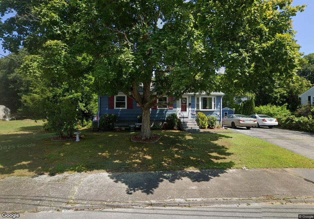
14 Shirley St Holbrook, MA 02343
Estimated Value: $479,426 - $558,000
3
Beds
1
Bath
880
Sq Ft
$576/Sq Ft
Est. Value
About This Home
This home is located at 14 Shirley St, Holbrook, MA 02343 and is currently estimated at $506,607, approximately $575 per square foot. 14 Shirley St is a home located in Norfolk County with nearby schools including John F. Kennedy Elementary School, Holbrook Middle High School, and Boston Higashi School.
Ownership History
Date
Name
Owned For
Owner Type
Purchase Details
Closed on
Nov 15, 2006
Sold by
Nee Paula-Marie and Mcfadden Paula-Marie
Bought by
Queenan Mark J and Queenan Sheri L
Current Estimated Value
Home Financials for this Owner
Home Financials are based on the most recent Mortgage that was taken out on this home.
Original Mortgage
$233,600
Outstanding Balance
$139,106
Interest Rate
6.33%
Mortgage Type
Purchase Money Mortgage
Estimated Equity
$367,501
Purchase Details
Closed on
Jul 14, 1995
Sold by
Aronson Philip H and Aronson Dorothea R
Bought by
Nee Paula-Marie
Home Financials for this Owner
Home Financials are based on the most recent Mortgage that was taken out on this home.
Original Mortgage
$90,400
Interest Rate
7.7%
Mortgage Type
Purchase Money Mortgage
Create a Home Valuation Report for This Property
The Home Valuation Report is an in-depth analysis detailing your home's value as well as a comparison with similar homes in the area
Home Values in the Area
Average Home Value in this Area
Purchase History
| Date | Buyer | Sale Price | Title Company |
|---|---|---|---|
| Queenan Mark J | $292,000 | -- | |
| Queenan Mark J | $292,000 | -- | |
| Queenan Mark J | $292,000 | -- | |
| Nee Paula-Marie | $113,000 | -- | |
| Nee Paula-Marie | $113,000 | -- |
Source: Public Records
Mortgage History
| Date | Status | Borrower | Loan Amount |
|---|---|---|---|
| Open | Queenan Mark J | $233,600 | |
| Closed | Queenan Mark J | $233,600 | |
| Previous Owner | Nee Paula-Marie | $90,400 |
Source: Public Records
Tax History
| Year | Tax Paid | Tax Assessment Tax Assessment Total Assessment is a certain percentage of the fair market value that is determined by local assessors to be the total taxable value of land and additions on the property. | Land | Improvement |
|---|---|---|---|---|
| 2025 | $52 | $392,800 | $217,700 | $175,100 |
| 2024 | $4,898 | $364,400 | $197,900 | $166,500 |
| 2023 | $5,178 | $336,700 | $179,900 | $156,800 |
| 2022 | $4,774 | $289,500 | $156,400 | $133,100 |
| 2021 | $4,679 | $271,700 | $146,200 | $125,500 |
| 2020 | $4,872 | $265,200 | $146,200 | $119,000 |
| 2019 | $4,916 | $252,600 | $139,200 | $113,400 |
| 2018 | $4,919 | $238,000 | $128,900 | $109,100 |
| 2017 | $4,642 | $222,100 | $117,300 | $104,800 |
| 2016 | $4,187 | $213,200 | $110,600 | $102,600 |
| 2015 | $3,873 | $203,000 | $105,800 | $97,200 |
| 2014 | $3,709 | $197,600 | $105,800 | $91,800 |
Source: Public Records
Map
Nearby Homes
- 610 S Franklin St Unit F102
- 37 Reeds Ln
- 660 S Franklin St
- 52 Quincy St
- 95 Rindone St
- 719 S Franklin St Unit C Block 1
- 375 S Franklin St Unit 1
- 36 Kalmia Rd
- 88 Roseen Rd
- 19 Overlook Rd
- 14 Leonard Ln
- 27 Valley Rd
- 181 S Franklin St Unit 102
- 181 S Franklin St Unit 206
- 152 S Franklin St
- 360 Plymouth St
- 12 Hamilton Way
- 14 Washington Cir
- 155 Union St
- 275 Jon Dr
Your Personal Tour Guide
Ask me questions while you tour the home.