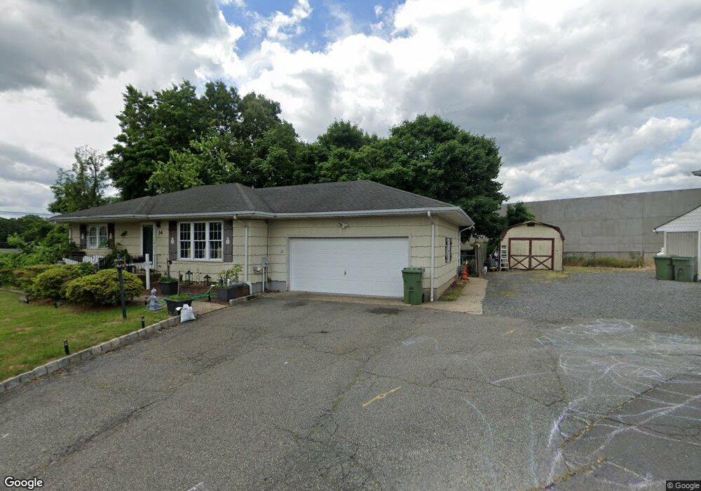
14 Singleton St South Amboy, NJ 08879
Estimated Value: $467,000 - $528,000
--
Bed
--
Bath
1,140
Sq Ft
$432/Sq Ft
Est. Value
About This Home
This home is located at 14 Singleton St, South Amboy, NJ 08879 and is currently estimated at $492,859, approximately $432 per square foot. 14 Singleton St is a home located in Middlesex County with nearby schools including Sayreville War Memorial High School, St. Mary Elementary School, and Cardinal Mccarrick High School.
Ownership History
Date
Name
Owned For
Owner Type
Purchase Details
Closed on
Jun 24, 2005
Sold by
George Patricia
Bought by
Rexinis Kosta
Current Estimated Value
Home Financials for this Owner
Home Financials are based on the most recent Mortgage that was taken out on this home.
Original Mortgage
$44,000
Outstanding Balance
$17,256
Interest Rate
1.9%
Mortgage Type
Adjustable Rate Mortgage/ARM
Estimated Equity
$475,603
Create a Home Valuation Report for This Property
The Home Valuation Report is an in-depth analysis detailing your home's value as well as a comparison with similar homes in the area
Home Values in the Area
Average Home Value in this Area
Purchase History
| Date | Buyer | Sale Price | Title Company |
|---|---|---|---|
| Rexinis Kosta | $305,000 | -- |
Source: Public Records
Mortgage History
| Date | Status | Borrower | Loan Amount |
|---|---|---|---|
| Open | Rexinis Kosta | $44,000 | |
| Open | Rexinis Kosta | $244,000 |
Source: Public Records
Tax History Compared to Growth
Tax History
| Year | Tax Paid | Tax Assessment Tax Assessment Total Assessment is a certain percentage of the fair market value that is determined by local assessors to be the total taxable value of land and additions on the property. | Land | Improvement |
|---|---|---|---|---|
| 2025 | $8,742 | $143,200 | $52,100 | $91,100 |
| 2024 | $8,500 | $143,200 | $52,100 | $91,100 |
| 2023 | $8,500 | $143,200 | $52,100 | $91,100 |
| 2022 | $7,940 | $143,200 | $52,100 | $91,100 |
| 2021 | $7,853 | $143,200 | $52,100 | $91,100 |
| 2020 | $7,654 | $143,200 | $52,100 | $91,100 |
| 2019 | $7,494 | $143,200 | $52,100 | $91,100 |
| 2018 | $7,359 | $143,200 | $52,100 | $91,100 |
| 2017 | $7,189 | $143,200 | $52,100 | $91,100 |
| 2016 | $6,997 | $143,200 | $52,100 | $91,100 |
| 2015 | $6,838 | $143,200 | $52,100 | $91,100 |
| 2014 | $6,655 | $143,200 | $52,100 | $91,100 |
Source: Public Records
Map
Nearby Homes
- 415 Brook Ave
- 434 S Pine Ave
- 466 Brook Ave
- 21 Luke St
- 164 Liberty St
- 191 Wessco St
- 158 Liberty St St
- 1200 Ernston Rd
- 158 Liberty St
- 503 Woodland Ave
- 179 Gabriel Terrace
- 21 Gordon Ave
- 18 Grand St
- 1511 Pebble Place
- 37 Hoffman Ave
- 161 Manor St
- 10 Dolan Ave
- 1202 Harbor Club Dr
- 3014 Lighthouse Ln
- 3015 Lighthouse Ln
- 12 Singleton St
- 9 Singleton St
- 256 Olsen St
- 424 Brook Ave
- 1980 State Route 35
- 1980 New Jersey 35
- 430 Brook Ave
- 420 Brook Ave
- 251 Kath St
- 1 Radford Ferry Rd
- 1 Radford Ferry Rd Unit 141
- 0 Brook Ave
- 436 Brook Ave
- 30 Brook Ave
- 423 Brook Ave
- 411 Brook Ave
- 252 Kath St
- 429 Brook Ave
- 442 Brook Ave
- 249 Kath St