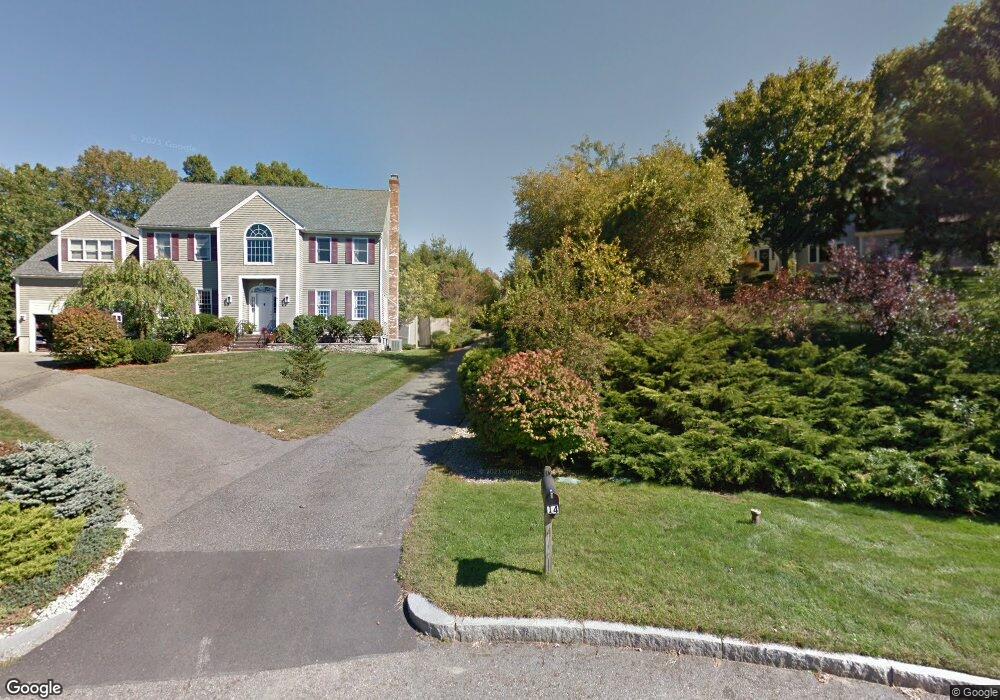
14 Skowhegan Way Natick, MA 01760
Estimated Value: $1,794,127 - $2,069,000
5
Beds
4
Baths
4,056
Sq Ft
$463/Sq Ft
Est. Value
About This Home
This home is located at 14 Skowhegan Way, Natick, MA 01760 and is currently estimated at $1,878,532, approximately $463 per square foot. 14 Skowhegan Way is a home located in Middlesex County with nearby schools including Natick High School, Lilja Elementary School, and Wilson Middle School.
Ownership History
Date
Name
Owned For
Owner Type
Purchase Details
Closed on
Dec 5, 2008
Sold by
Boyle Cynthia C and Boyle Terrence P
Bought by
Field Nora E and Geckle Richard P
Current Estimated Value
Home Financials for this Owner
Home Financials are based on the most recent Mortgage that was taken out on this home.
Original Mortgage
$450,000
Interest Rate
6.11%
Mortgage Type
Purchase Money Mortgage
Purchase Details
Closed on
Jul 14, 1994
Sold by
Bellamacina George S and Bellamacina Frances
Bought by
Boyle Terrence P and Boyle Cynthia
Create a Home Valuation Report for This Property
The Home Valuation Report is an in-depth analysis detailing your home's value as well as a comparison with similar homes in the area
Home Values in the Area
Average Home Value in this Area
Purchase History
| Date | Buyer | Sale Price | Title Company |
|---|---|---|---|
| Field Nora E | $872,800 | -- | |
| Boyle Terrence P | $530,000 | -- |
Source: Public Records
Mortgage History
| Date | Status | Borrower | Loan Amount |
|---|---|---|---|
| Open | Boyle Terrence P | $460,000 | |
| Closed | Field Nora E | $450,000 | |
| Previous Owner | Boyle Terrence P | $50,000 | |
| Previous Owner | Boyle Terrence P | $50,000 |
Source: Public Records
Tax History Compared to Growth
Tax History
| Year | Tax Paid | Tax Assessment Tax Assessment Total Assessment is a certain percentage of the fair market value that is determined by local assessors to be the total taxable value of land and additions on the property. | Land | Improvement |
|---|---|---|---|---|
| 2025 | $17,853 | $1,492,700 | $536,900 | $955,800 |
| 2024 | $17,278 | $1,409,300 | $508,500 | $900,800 |
| 2023 | $15,933 | $1,260,500 | $469,100 | $791,400 |
| 2022 | $15,664 | $1,174,200 | $419,500 | $754,700 |
| 2021 | $15,234 | $1,119,300 | $414,000 | $705,300 |
| 2020 | $15,008 | $1,102,700 | $397,400 | $705,300 |
| 2019 | $13,072 | $1,028,500 | $397,400 | $631,100 |
| 2018 | $12,212 | $935,800 | $383,600 | $552,200 |
| 2017 | $12,440 | $922,200 | $380,000 | $542,200 |
| 2016 | $12,446 | $917,200 | $380,000 | $537,200 |
| 2015 | $11,989 | $867,500 | $380,000 | $487,500 |
Source: Public Records
Map
Nearby Homes
- 15 Penobscot Rd
- 18 University Dr
- 191 E Central St
- 20 Marion St
- 10 Sundance Way
- 31 Marion St
- 67 E Central St & 5 Union St
- 192 Pond Rd
- 62 E Central St Unit 305
- 3 Vale St Unit B
- 11 Avon St
- 9 Arbor Cir
- 94 Woodland St
- 5 Wilson St Unit 5A
- 3 Wilson St Unit 3B
- 6B Lincoln St Unit 6B
- 4B Lincoln St Unit 4B
- 39 Davis Brook Dr
- 5 Oakridge Ave
- 200 Pond Rd
- 12 Skowhegan Way
- 7 Skowhegan Way
- 15 Woronoco Dr
- 16 Woronoco Dr
- 10 Skowhegan Way
- 18 Woronoco Dr
- 34 Algonquian Dr
- 5 Skowhegan Way
- 11 Woronoco Dr
- 8 Skowhegan Way
- 6 Skowhegan Way
- 36 Algonquian Dr
- 32 Algonquian Dr
- 6 Skowhegan Way
- 3 Skowhegan Way
- 38 Algonquian Dr
- 30 Algonquian Dr
- 9 Woronoco Dr
- 4 Skowhegan Way
- 1 Skowhegan Way