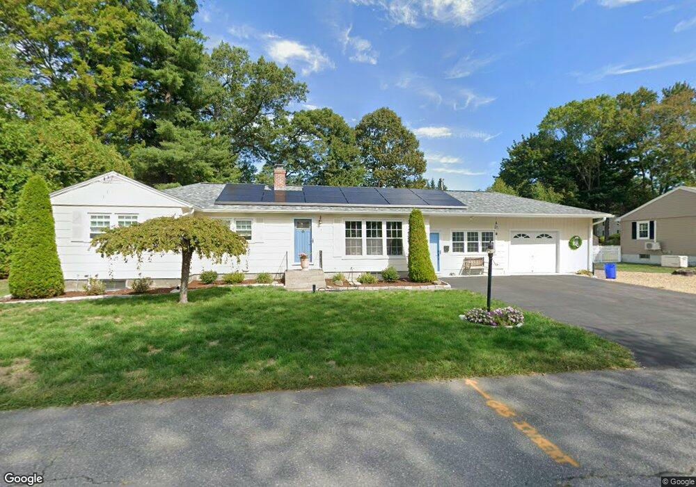
14 Stuart Ct Leominster, MA 01453
Estimated Value: $502,000 - $519,000
3
Beds
2
Baths
1,520
Sq Ft
$338/Sq Ft
Est. Value
About This Home
This home is located at 14 Stuart Ct, Leominster, MA 01453 and is currently estimated at $513,091, approximately $337 per square foot. 14 Stuart Ct is a home located in Worcester County with nearby schools including Leominster High School, St Bernards Elementary School, and St. Leo School.
Ownership History
Date
Name
Owned For
Owner Type
Purchase Details
Closed on
Aug 10, 2016
Sold by
Mckenna James E and Mckenna Joan R
Bought by
14 Stuart Court Rt
Current Estimated Value
Purchase Details
Closed on
Dec 4, 1998
Sold by
Lang James W and Lang Linda T
Bought by
Mckenna James E and Mckenna Joan R
Purchase Details
Closed on
Apr 18, 1996
Sold by
Putnam Barbara
Bought by
Lang James W and Lang Linda
Create a Home Valuation Report for This Property
The Home Valuation Report is an in-depth analysis detailing your home's value as well as a comparison with similar homes in the area
Home Values in the Area
Average Home Value in this Area
Purchase History
| Date | Buyer | Sale Price | Title Company |
|---|---|---|---|
| 14 Stuart Court Rt | -- | -- | |
| Mckenna James E | $147,900 | -- | |
| Lang James W | $114,500 | -- |
Source: Public Records
Mortgage History
| Date | Status | Borrower | Loan Amount |
|---|---|---|---|
| Previous Owner | Lang James W | $118,600 | |
| Previous Owner | Lang James W | $168,000 | |
| Previous Owner | Lang James W | $164,000 |
Source: Public Records
Tax History Compared to Growth
Tax History
| Year | Tax Paid | Tax Assessment Tax Assessment Total Assessment is a certain percentage of the fair market value that is determined by local assessors to be the total taxable value of land and additions on the property. | Land | Improvement |
|---|---|---|---|---|
| 2025 | $6,266 | $446,600 | $135,500 | $311,100 |
| 2024 | $6,036 | $416,000 | $129,100 | $286,900 |
| 2023 | $5,855 | $376,800 | $112,200 | $264,600 |
| 2022 | $5,629 | $339,900 | $97,600 | $242,300 |
| 2021 | $5,517 | $304,300 | $76,000 | $228,300 |
| 2020 | $5,318 | $295,800 | $76,000 | $219,800 |
| 2019 | $5,076 | $273,800 | $72,300 | $201,500 |
| 2018 | $4,985 | $257,900 | $70,300 | $187,600 |
| 2017 | $4,672 | $236,800 | $65,600 | $171,200 |
| 2016 | $4,474 | $228,500 | $65,600 | $162,900 |
| 2015 | $4,244 | $218,300 | $65,600 | $152,700 |
| 2014 | $3,952 | $209,200 | $70,300 | $138,900 |
Source: Public Records
Map
Nearby Homes
- 471 North St
- 121 Morningside St Unit 121
- 31 Park Ave
- 3 Chase Ave
- 1479 Main St
- 26 Otis St
- 44 Hamlin St
- 165 Summer St Unit Lot 2
- 1084 Main St
- 67 Bernice Ave
- 452 Hollis Rd
- 29 Lakeview Ave
- 51 Claflin St
- 195 Electric Ave
- 200-365 Hollis Rd
- 17 Fernwood Dr Unit G
- 51 Fox Meadow Rd Unit C
- 14 Fernwood Dr Unit D
- 40 Flaggler Rd
- 291 Joslin St