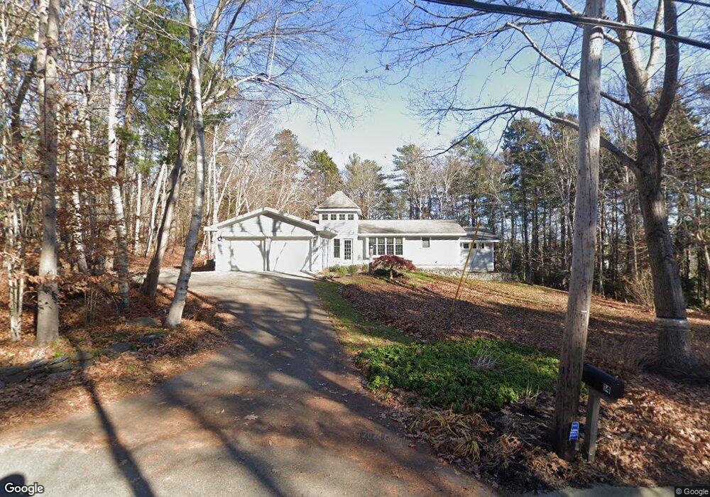
14 Talbot Rd Yarmouth, ME 04096
Cousins Island NeighborhoodEstimated Value: $722,000 - $1,108,000
3
Beds
2
Baths
2,000
Sq Ft
$436/Sq Ft
Est. Value
About This Home
This home is located at 14 Talbot Rd, Yarmouth, ME 04096 and is currently estimated at $872,096, approximately $436 per square foot. 14 Talbot Rd is a home located in Cumberland County with nearby schools including William H. Rowe School, Yarmouth Elementary School, and Frank H. Harrison Middle School.
Ownership History
Date
Name
Owned For
Owner Type
Purchase Details
Closed on
Jun 17, 2005
Sold by
Nadeau Marcel C and Nadeau Deborah J
Bought by
Crawford John G and Crawford Kathleen
Current Estimated Value
Home Financials for this Owner
Home Financials are based on the most recent Mortgage that was taken out on this home.
Original Mortgage
$270,000
Outstanding Balance
$134,002
Interest Rate
5%
Mortgage Type
Adjustable Rate Mortgage/ARM
Estimated Equity
$738,094
Create a Home Valuation Report for This Property
The Home Valuation Report is an in-depth analysis detailing your home's value as well as a comparison with similar homes in the area
Home Values in the Area
Average Home Value in this Area
Purchase History
| Date | Buyer | Sale Price | Title Company |
|---|---|---|---|
| Crawford John G | -- | -- |
Source: Public Records
Mortgage History
| Date | Status | Borrower | Loan Amount |
|---|---|---|---|
| Open | Crawford John G | $270,000 |
Source: Public Records
Tax History Compared to Growth
Tax History
| Year | Tax Paid | Tax Assessment Tax Assessment Total Assessment is a certain percentage of the fair market value that is determined by local assessors to be the total taxable value of land and additions on the property. | Land | Improvement |
|---|---|---|---|---|
| 2024 | $10,902 | $424,700 | $197,700 | $227,000 |
| 2023 | $9,997 | $424,700 | $197,700 | $227,000 |
| 2022 | $9,182 | $424,700 | $197,700 | $227,000 |
| 2021 | $8,409 | $424,700 | $197,700 | $227,000 |
| 2020 | $8,324 | $424,700 | $197,700 | $227,000 |
| 2019 | $8,010 | $424,700 | $197,700 | $227,000 |
| 2018 | $7,560 | $424,700 | $197,700 | $227,000 |
| 2017 | $7,288 | $424,700 | $197,700 | $227,000 |
| 2016 | $7,245 | $424,700 | $197,700 | $227,000 |
| 2015 | $7,574 | $351,300 | $128,900 | $222,400 |
| 2014 | $7,588 | $351,300 | $128,900 | $222,400 |
| 2013 | $7,729 | $351,300 | $0 | $0 |
Source: Public Records
Map
Nearby Homes
- 51 Oakland Ave
- 87 Wharf Rd
- 275 Littlejohn Rd
- 184 Spruce Point Rd
- 6 Daybreak Ln Unit 18
- Lot#8C North Rd
- Lot 2 Buxhill Blvd
- 48 Pond Rd
- 51 Meeting House Farms Rd
- 471 South Rd Unit A
- 471 South Rd Unit B
- 61 Sawyer Rd
- 258 Foreside Rd
- 24 York Ledge Dr
- 15 Sea Cove Rd
- 20 Blueberry Cove Rd Unit 20
- 52 Blueberry Cove Rd Unit 52
- 86 Pleasant St
- 186 Foreside Rd
- 24 Mast Ln
- 432 Cousins St
- 432 Cousins Rd
- 440 Cousins St
- 19 Talbot Rd
- 5 Maplewood Ave
- 9 Ashland Ave
- 452 Cousins St
- 12 Maplewood Ave
- 403 Cousins St
- 16 Ashland Ave
- 453 Cousins St
- 392 Cousins St
- 15 Ashland Ave
- 16 Birchwood Ave
- 13 Maplewood Ave
- 18 Ocean Reach
- 19 Ashland Ave
- 9 Elmwood Ave
- 389 Cousins St
- 466 Cousins St