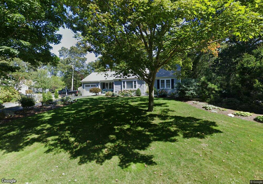
14 Tall Pines Dr Yarmouth Port, MA 02675
Yarmouth Port NeighborhoodEstimated Value: $654,514 - $703,000
2
Beds
3
Baths
1,248
Sq Ft
$550/Sq Ft
Est. Value
About This Home
This home is located at 14 Tall Pines Dr, Yarmouth Port, MA 02675 and is currently estimated at $686,879, approximately $550 per square foot. 14 Tall Pines Dr is a home located in Barnstable County with nearby schools including Dennis-Yarmouth Regional High School and St. Pius X. School.
Ownership History
Date
Name
Owned For
Owner Type
Purchase Details
Closed on
Mar 27, 2009
Sold by
Mcauliffe Joyce A
Bought by
Beane William E and Beane Barbara L
Current Estimated Value
Home Financials for this Owner
Home Financials are based on the most recent Mortgage that was taken out on this home.
Original Mortgage
$277,290
Interest Rate
5.14%
Mortgage Type
Purchase Money Mortgage
Purchase Details
Closed on
Dec 17, 2001
Sold by
Franco Samuel J and Franco Lois E
Bought by
Mcailiffe Joyce A
Home Financials for this Owner
Home Financials are based on the most recent Mortgage that was taken out on this home.
Original Mortgage
$199,500
Interest Rate
6.6%
Mortgage Type
Purchase Money Mortgage
Create a Home Valuation Report for This Property
The Home Valuation Report is an in-depth analysis detailing your home's value as well as a comparison with similar homes in the area
Home Values in the Area
Average Home Value in this Area
Purchase History
| Date | Buyer | Sale Price | Title Company |
|---|---|---|---|
| Beane William E | $300,000 | -- | |
| Mcailiffe Joyce A | $285,000 | -- |
Source: Public Records
Mortgage History
| Date | Status | Borrower | Loan Amount |
|---|---|---|---|
| Open | Mcailiffe Joyce A | $252,000 | |
| Closed | Beane William E | $277,290 | |
| Previous Owner | Mcailiffe Joyce A | $199,000 | |
| Previous Owner | Mcailiffe Joyce A | $199,500 |
Source: Public Records
Tax History Compared to Growth
Tax History
| Year | Tax Paid | Tax Assessment Tax Assessment Total Assessment is a certain percentage of the fair market value that is determined by local assessors to be the total taxable value of land and additions on the property. | Land | Improvement |
|---|---|---|---|---|
| 2025 | $4,657 | $657,700 | $236,100 | $421,600 |
| 2024 | $4,376 | $593,000 | $205,400 | $387,600 |
| 2023 | $4,204 | $518,400 | $173,300 | $345,100 |
| 2022 | $3,953 | $430,600 | $155,100 | $275,500 |
| 2021 | $3,721 | $389,200 | $155,100 | $234,100 |
| 2020 | $5,978 | $361,800 | $152,500 | $209,300 |
| 2019 | $5,709 | $332,000 | $152,500 | $179,500 |
| 2018 | $3,324 | $323,000 | $143,500 | $179,500 |
| 2017 | $3,236 | $323,000 | $143,500 | $179,500 |
| 2016 | $3,224 | $323,000 | $143,500 | $179,500 |
| 2015 | $3,102 | $309,000 | $143,500 | $165,500 |
Source: Public Records
Map
Nearby Homes
- 12 Tall Pines Dr
- 20 Tall Pines Dr
- 6 Tall Pines Dr
- 8 Tall Pines Dr
- 5 Many Oaks Cir
- 26 Tall Pines Dr
- 27 Tall Pines Dr
- 10 Tall Pines Dr
- 8 Many Oaks Cir
- 301 Weir Rd
- 11 Many Oaks Cir
- 300 Weir Rd
- 35 Tall Pines Dr
- 30 Tall Pines Dr
- 34 Tall Pines Dr
- 9 Many Oaks Cir
- 275 Weir Rd
- 7 Bent Bluff Ln
- 17 Bent Bluff Ln
- 37 Tall Pines Dr