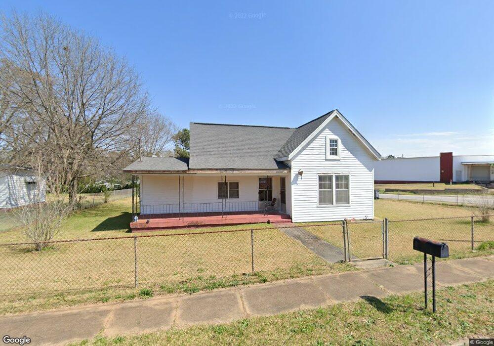
14 Thornton St Lagrange, GA 30241
Estimated Value: $130,000 - $178,000
3
Beds
2
Baths
1,808
Sq Ft
$83/Sq Ft
Est. Value
About This Home
This home is located at 14 Thornton St, Lagrange, GA 30241 and is currently estimated at $150,412, approximately $83 per square foot. 14 Thornton St is a home located in Troup County with nearby schools including Franklin Forest Elementary School, Hollis Hand Elementary School, and Ethel W. Kight Elementary School.
Ownership History
Date
Name
Owned For
Owner Type
Purchase Details
Closed on
Feb 5, 2025
Sold by
Bussey Charlotte T
Bought by
Tucker Rickey Lamar
Current Estimated Value
Purchase Details
Closed on
Aug 13, 1999
Sold by
Nonnie Williams
Bought by
Tucker Ricky L
Purchase Details
Closed on
Feb 15, 1999
Sold by
Barbara Williams
Bought by
Nonnie Williams
Purchase Details
Closed on
Jan 1, 1979
Sold by
Lashley
Bought by
Barbara Williams
Purchase Details
Closed on
Dec 1, 1971
Sold by
Lashley W J
Bought by
Lashley
Purchase Details
Closed on
Jul 1, 1970
Sold by
Frank Hinkle
Bought by
Lashley W J
Create a Home Valuation Report for This Property
The Home Valuation Report is an in-depth analysis detailing your home's value as well as a comparison with similar homes in the area
Home Values in the Area
Average Home Value in this Area
Purchase History
| Date | Buyer | Sale Price | Title Company |
|---|---|---|---|
| Tucker Rickey Lamar | -- | -- | |
| Tucker Ricky L | $58,000 | -- | |
| Nonnie Williams | -- | -- | |
| Barbara Williams | -- | -- | |
| Lashley | -- | -- | |
| Lashley W J | $7,500 | -- |
Source: Public Records
Tax History Compared to Growth
Tax History
| Year | Tax Paid | Tax Assessment Tax Assessment Total Assessment is a certain percentage of the fair market value that is determined by local assessors to be the total taxable value of land and additions on the property. | Land | Improvement |
|---|---|---|---|---|
| 2024 | $1,019 | $37,356 | $5,680 | $31,676 |
| 2023 | $912 | $33,436 | $5,680 | $27,756 |
| 2022 | $891 | $31,916 | $5,680 | $26,236 |
| 2021 | $669 | $24,160 | $3,160 | $21,000 |
| 2020 | $669 | $24,160 | $3,160 | $21,000 |
| 2019 | $630 | $22,876 | $3,160 | $19,716 |
| 2018 | $612 | $22,278 | $3,206 | $19,072 |
| 2017 | $612 | $22,278 | $3,206 | $19,072 |
| 2016 | $596 | $21,745 | $3,206 | $18,538 |
| 2015 | $598 | $21,758 | $3,220 | $18,538 |
| 2014 | $569 | $20,783 | $3,220 | $17,563 |
| 2013 | -- | $22,141 | $3,220 | $18,921 |
Source: Public Records
Map
Nearby Homes
- 5 Curran Ave
- 15 Fulton St
- 130 Clara Jean Ct
- 906 Georgia Ave
- 0 N Barnard Ave
- 0 E Render St
- 902 Georgia Ave
- Coleman Plan at Crossvine Village
- 0 Mill Creek Pkwy Unit PHASE 5 10313564
- Beckman Plan at Crossvine Village
- 0 Mill Creek Pkwy Unit PHASE 4 10313585
- Fairfield Plan at Crossvine Village
- Broadmoor Plan at Crossvine Village
- Dover Plan at Crossvine Village
- 113 Lenox Cir
- 128 Shenandoah Ln Unit A67
- 124 Shenandoah Ln
- 305 Lenox Cir
- 227 River Meadow Dr Unit H14
- 231 River Meadow Dr