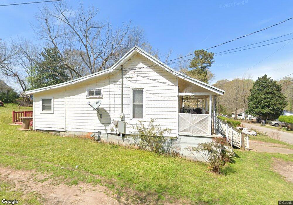
14 Timothy St Lagrange, GA 30240
Estimated Value: $53,000 - $80,000
1
Bed
1
Bath
930
Sq Ft
$73/Sq Ft
Est. Value
About This Home
This home is located at 14 Timothy St, Lagrange, GA 30240 and is currently estimated at $67,521, approximately $72 per square foot. 14 Timothy St is a home located in Troup County with nearby schools including Ethel W. Kight Elementary School, Hollis Hand Elementary School, and Franklin Forest Elementary School.
Ownership History
Date
Name
Owned For
Owner Type
Purchase Details
Closed on
May 9, 2016
Sold by
Williams Alma H
Bought by
Patterson Detrissa
Current Estimated Value
Home Financials for this Owner
Home Financials are based on the most recent Mortgage that was taken out on this home.
Original Mortgage
$50,000
Interest Rate
2.86%
Purchase Details
Closed on
Jan 10, 1996
Sold by
Isaac Hubbard
Bought by
Williams Alma H
Purchase Details
Closed on
Apr 1, 1952
Sold by
Hubbard Walter
Bought by
Isaac Hubbard
Create a Home Valuation Report for This Property
The Home Valuation Report is an in-depth analysis detailing your home's value as well as a comparison with similar homes in the area
Purchase History
| Date | Buyer | Sale Price | Title Company |
|---|---|---|---|
| Patterson Detrissa | $50,000 | -- | |
| Williams Alma H | -- | -- | |
| Isaac Hubbard | -- | -- |
Source: Public Records
Mortgage History
| Date | Status | Borrower | Loan Amount |
|---|---|---|---|
| Closed | Patterson Detrissa | $50,000 |
Source: Public Records
Tax History
| Year | Tax Paid | Tax Assessment Tax Assessment Total Assessment is a certain percentage of the fair market value that is determined by local assessors to be the total taxable value of land and additions on the property. | Land | Improvement |
|---|---|---|---|---|
| 2025 | $583 | $21,360 | $2,920 | $18,440 |
| 2024 | $561 | $20,560 | $2,920 | $17,640 |
| 2023 | $545 | $20,000 | $2,920 | $17,080 |
| 2022 | $529 | $18,960 | $2,920 | $16,040 |
| 2021 | $574 | $19,040 | $2,920 | $16,120 |
| 2020 | $574 | $19,040 | $2,920 | $16,120 |
| 2019 | $530 | $17,560 | $2,920 | $14,640 |
| 2018 | $530 | $17,560 | $2,920 | $14,640 |
| 2017 | $530 | $17,560 | $2,920 | $14,640 |
| 2016 | $405 | $13,438 | $2,968 | $10,470 |
| 2015 | $406 | $13,438 | $2,968 | $10,470 |
| 2014 | $390 | $12,887 | $2,968 | $9,919 |
| 2013 | -- | $13,609 | $2,968 | $10,641 |
Source: Public Records
Map
Nearby Homes
- 205 Grady St
- 149 Laurel Ridge Ave E
- 120 Laurel Ridge Ave E
- 134 Laurel Ridge Ave E
- 167 S Kight Dr
- 101 Crown St Unit LOT 5
- 102 Crown St Unit LOT 1
- 109 Garfield St
- 610 Wilburn Ave
- 608 Wilburn Ave
- 202 Parker Ln
- 1308 Forrest Ave
- 1304 Forrest Ave
- 1405 Forrest Ave
- 1402 Forrest Ave
- 107 Clark St
- 517 Jefferson St
- 1808 Murphy Ave
- 507 S Lee St
- 503 S Lee St
- 12 Timothy St
- 1 Ellis St
- 129 Grady St
- 10.5 Timothy St
- 10 Timothy St
- 10 Timothy St
- 127 Grady St
- 1 Timothy St
- 13 Timothy St
- 103 Timothy St
- 21 Grady St
- 11 Timothy St
- 106 Timothy St
- 123 Grady St
- 117 Ellis St
- 0 Grady St Unit 10239534
- 0 Grady St Unit 7322165
- 0 Grady St Unit 8918229
- 9 Timothy St
- 107 Timothy St
Your Personal Tour Guide
Ask me questions while you tour the home.