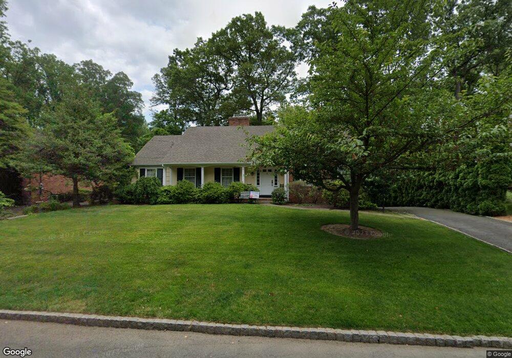
14 Tree Top Dr Springfield, NJ 07081
Estimated Value: $911,564 - $1,411,000
Studio
--
Bath
2,522
Sq Ft
$429/Sq Ft
Est. Value
About This Home
This home is located at 14 Tree Top Dr, Springfield, NJ 07081 and is currently estimated at $1,081,141, approximately $428 per square foot. 14 Tree Top Dr is a home located in Union County with nearby schools including Jonathan Dayton High School, St James The Apostle School, and Oak Knoll School of the Holy Child.
Ownership History
Date
Name
Owned For
Owner Type
Purchase Details
Closed on
Jun 11, 2004
Sold by
Sasso Stephanie
Bought by
Lieberman Paul
Current Estimated Value
Home Financials for this Owner
Home Financials are based on the most recent Mortgage that was taken out on this home.
Original Mortgage
$584,000
Outstanding Balance
$290,827
Interest Rate
6.28%
Estimated Equity
$790,314
Purchase Details
Closed on
Jun 29, 2000
Sold by
Vonderlinden Henry and Vonderlinden Arthur
Bought by
Sasso Frances A
Home Financials for this Owner
Home Financials are based on the most recent Mortgage that was taken out on this home.
Original Mortgage
$100,000
Interest Rate
8.55%
Mortgage Type
Purchase Money Mortgage
Create a Home Valuation Report for This Property
The Home Valuation Report is an in-depth analysis detailing your home's value as well as a comparison with similar homes in the area
Home Values in the Area
Average Home Value in this Area
Purchase History
| Date | Buyer | Sale Price | Title Company |
|---|---|---|---|
| Lieberman Paul | $730,000 | -- | |
| Sasso Frances A | $440,000 | Lawyers Title Insurance Corp |
Source: Public Records
Mortgage History
| Date | Status | Borrower | Loan Amount |
|---|---|---|---|
| Open | Lieberman Paul | $584,000 | |
| Previous Owner | Sasso Frances A | $100,000 |
Source: Public Records
Tax History
| Year | Tax Paid | Tax Assessment Tax Assessment Total Assessment is a certain percentage of the fair market value that is determined by local assessors to be the total taxable value of land and additions on the property. | Land | Improvement |
|---|---|---|---|---|
| 2025 | $17,953 | $755,900 | $279,000 | $476,900 |
| 2024 | $17,658 | $755,900 | $279,000 | $476,900 |
| 2023 | $17,658 | $755,900 | $279,000 | $476,900 |
| 2022 | $16,395 | $755,900 | $279,000 | $476,900 |
| 2021 | $18,002 | $241,800 | $96,700 | $145,100 |
| 2020 | $17,722 | $241,800 | $96,700 | $145,100 |
| 2019 | $17,482 | $241,800 | $96,700 | $145,100 |
| 2018 | $17,168 | $241,800 | $96,700 | $145,100 |
| 2017 | $16,696 | $241,800 | $96,700 | $145,100 |
| 2016 | $16,372 | $241,800 | $96,700 | $145,100 |
| 2015 | $16,181 | $241,800 | $96,700 | $145,100 |
| 2014 | $15,877 | $241,800 | $96,700 | $145,100 |
Source: Public Records
Map
Nearby Homes
- 14 Skylark Rd
- 1098 Sunny Slope Dr
- 34 Ascot Way
- 427 Summit Rd
- 423 Summit Rd
- 373 Upland Rd
- 701 Mountain Ave
- 29 Ashwood Ave
- 28 Shunpike Rd
- 62 Mountain Ave
- 105 Larned Rd
- 23 Diven St
- 4 Parkview Terrace
- 37-39 Edison Dr
- 2 S Audlen Terrace
- 28 Morris Ave Unit DD
- 28 Morris Ave Unit G4
- 300 Wilson Rd Unit 24D
- 3215 Park Place
- 272 Old Tote Rd
Your Personal Tour Guide
Ask me questions while you tour the home.